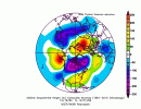
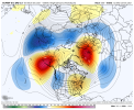
It worked beautifully!
-
Hello, please take a minute to check out our awesome content, contributed by the wonderful members of our community. We hope you'll add your own thoughts and opinions by making a free account!
You are using an out of date browser. It may not display this or other websites correctly.
You should upgrade or use an alternative browser.
You should upgrade or use an alternative browser.
Pattern December to Remember
- Thread starter SD
- Start date
After reading the past 3 pages, Ive booked tee times Dec 22 and 23rd. Gonna get all the golf in we can Christmas break, till the pattern flips. I Prefer pipe busting cold, snow.
That said the wisest move I made was allowing myself to get addicted to golf again. Now I win all winter ,no matter what.
That said the wisest move I made was allowing myself to get addicted to golf again. Now I win all winter ,no matter what.
Brent
Member
I cant help but notice our records threatened in the next week were set last year
Yeah... February happened after that ?
Yeah... February happened after that ?
Brent
Member
Obviously a little different but still I think winter will happen eventually. But I honestly don't want a repeat of February that was a tad much ?
Obviously a little different but still I think winter will happen eventually. But I honestly don't want a repeat of February that was a tad much ?
"That was a tad much."
^^^Biggest understatement of the year.
Brent
Member
"That was a tad much."
^^^Biggest understatement of the year.
It wouldn't have been so bad if the power stayed on ?
John1122
Member
Springs arrived . Saw this on Reddit , it’s a cherry tree that blooms during warm spells. Happened in December 2015 happening now .
Looks like a Japanese cherry, I have two in my yard. They bloom in spring and again in late November/Early December. Mine is partly bloomed now but some upper 10s in late November hurt the bloom and it didn't turn out as well as normal this year.
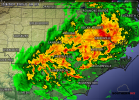
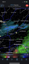
It’s been pouring off and on here for the last 90 minutes. Already .43 in gauge
D
Deleted member 1449
Guest
I think I can. I think I can. I think I can.

Thankfull to see it raining for the first time in weeks. Want add up to alot, but its a start. Interested to see if the weekend evnt fizzles as it comes across the Apps. That seems to be the theme / pattern rut we are in.
Wulfer
Member
Thank you for your efforts!
Cary_Snow95
Member
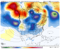
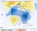
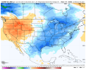
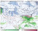
New CFS shows a big western cold dump the last week of the month. SER flares up in response. Cold eventually bleeds east and the first week of January the arctic flood gates open
NBAcentel
Member
Solid 0.5 of rain
Fountainguy97
Member
LukeBarrette
im north of 90% of people on here so yeah
Meteorology Student
Member
2024 Supporter
2017-2023 Supporter
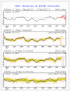
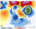
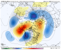
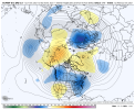
Checking over the teleconnections this morning FWIW, they are starting to also trend towards a pattern change in the long range. They had been consistently showing positive AO an NAO, but are now biting. Here is the NAO, the AO was similar with a drop to neutral and than a lot of spread. The PNA also was trending more neutral but has more ways to go. Of course, like the operationals, they can be too fast with the change, but I have also seen them change on a dime.
D
Deleted member 1449
Guest
0.00” in my rain gauge this morning.
.81 almost passed my November today
- Joined
- Jan 23, 2021
- Messages
- 4,603
- Reaction score
- 15,199
- Location
- Lebanon Township, Durham County NC
That would've been one hell of a storm. There was still single digit dewpoints feeding in.
- Joined
- Jan 23, 2021
- Messages
- 4,603
- Reaction score
- 15,199
- Location
- Lebanon Township, Durham County NC
0.07 this morning and it's already done.
Ward Cleaver
Member
0.00” in my rain gauge this morning.
Me, too. A big old 0.00” when I woke up. I’m on 25 straight days without any measurable rain.
Shaggy
Member
Been pouring all morning. Likely to overperform.
NBAcentel
Member
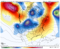
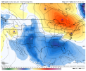
Feb 2014 ?Ridge is tall on the eps View attachment 97176
Nice! .06, if this had been a snow storm, while I would've been happy for you, I'd also been pretty salty about it Lol.81 almost passed my November today
L
Logan Is An Idiot 02
Guest
Was that a blowtorch ? I dint rememberFeb 2014 ?
NoSnowATL
Member
Nope. had 2 storms like 7 days apart.Was that a blowtorch ? I dint remember
Haha you would have had to ban me if this were snow and I was basically in the jackpot. I would be insufferable for everyoneNice! .06, if this had been a snow storm, while I would've been happy for you, I'd also been pretty salty about it Lol
I'm getting some feb 2015 vibes from it but really it's very similar to the epo ridge explosions that have been our main cold/snow driver the last 5-8 years. Have to wonder if we go warm for a period then a brief cool to cold shot leading into Christmas then another SER pump then the real cold dropsFeb 2014 ?
1.01" Very nice!

