Gfs little more realistic on this run for Texas. 
 Only 14 days away! Miller B garbage, lets reel it in! Happy Christmas! But Brent should approve!:weenie:
Welcome and great to have you!Hey guys first time poster and from the other forum. If you guys remember the last southeast storm over the weekend the FV3 has the system to far north until about 7 days out. It adjusted further south and stayed on its course. THE FV3 ruled on that storm so I wouldn’t discount the threat. Maybe we have something to chase. It looks like it slowly trending toward a Phase. Anyway thank you for letting me join the group!
Daniel R.
Sent from my iPhone using Tapatalk


Hey guys first time poster and from the other forum. If you guys remember the last southeast storm over the weekend the FV3 has the system to far north until about 7 days out. It adjusted further south and stayed on its course. THE FV3 ruled on that storm so I wouldn’t discount the threat. Maybe we have something to chase. It looks like it slowly trending toward a Phase. Anyway thank you for letting me join the group!
Daniel R.
Sent from my iPhone using Tapatalk
Welcome to the board ! The FV3 did do surprisingly well . Will be interesting to see if that continues this winter
Sent from my iPhone using Tapatalk
Hey guys first time poster and from the other forum. If you guys remember the last southeast storm over the weekend the FV3 has the system to far north until about 7 days out. It adjusted further south and stayed on its course. THE FV3 ruled on that storm so I wouldn’t discount the threat. Maybe we have something to chase. It looks like it slowly trending toward a Phase. Anyway thank you for letting me join the group!
Daniel R.
Sent from my iPhone using Tapatalk

Welcome to the board ! The FV3 did do surprisingly well . Will be interesting to see if that continues this winter
Sent from my iPhone using Tapatalk
That depends on where you live.Welcome to the board ! The FV3 did do surprisingly well . Will be interesting to see if that continues this winter
Sent from my iPhone using Tapatalk
 Only models that nailed this last storm for me were the GGEM and RGEM. Ask SD about it.
That depends on where you live.
Minus the ridiculous snow accumulation maps.
Sent from my iPhone using Tapatalk
I don't know man, this 48 hr FV3 map looks pretty darn good to me. You can't expect a global model to nail every transition zone down to the mile, and obviously it wasn't 100% perfect in the Mecklenburg and Wake County regions, but it consistently got the right idea of a very tight gradient and in the general right locations. It's up to the forecasters to take it from there and that's where I sucked it up - the FV3 gave all the right information to make a great forecast IMO.That depends on where you live.
Yeah, it's probably smart not to even expect anything but a cold rain when you are living on the fringe areas of a ridiculous clown map.I don't know man, this 48 hr FV3 map looks pretty darn good to me. You can't expect a global model to nail every transition zone down to the mile, and obviously it wasn't 100% perfect in the Mecklenburg and Wake County regions, but it consistently got the right idea of a very tight gradient and in the general right locations. It's up to the forecasters to take it from there and that's where I sucked it up - the FV3 gave all the right information to make a great forecast IMO.

The sooner this is accepted, the more appreciation you’ll have for 10 sleet pellets to start, while 10 miles N , gets a foot! Expect nothing but rain, and anything else is gravy!Yeah, it's probably smart not to even expect anything but a cold rain when you are living on the fringe areas of a ridiculous clown map.
 YET!
YET!I don't know man, this 48 hr FV3 map looks pretty darn good to me. You can't expect a global model to nail every transition zone down to the mile, and obviously it wasn't 100% perfect in the Mecklenburg and Wake County regions, but it consistently got the right idea of a very tight gradient and in the general right locations. It's up to the forecasters to take it from there and that's where I sucked it up - the FV3 gave all the right information to make a great forecast IMO.

Don’t worry, plenty more dissapointments coming this winter! The 2009/10 redux incoming!! Just wait till #SSWBESTWINTEREVER!

Yea I would be ticked if I was in the edge of that also.
Book that one! A NE/MA CrusherCome on baby. Sniff one more good en’ out before you are made obsolete View attachment 9080
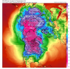
3 contoured cutoff on FV3 and still can't get snow down here.
getting closer for those to our west. Now has 30s in parts of Mississippi directly under the ull3 contoured cutoff on FV3 and still can't get snow down here.

Yeah. Upgrade. CJ made a big donation this morningBook that one! A NE/MA Crusher
Is the sight different!? On my phone, looks different
Basically too warm through the column, but if we had some cold air to work with that would be money...Great track on euro, but would assume way to warm at 2m
Have we ever had a SSW and what were the effects? I feel like it's a unicorn we chase every year....
Have we ever had a SSW and what were the effects? I feel like it's a unicorn we chase every year....


Yeah, I guess it was just too late to help us out last winter as it takes a while for us to feel the effects of it.We had one last February, March was fairly cold with blocking. I remember most of last spring was cold.
2010 had the most infamous one, occurred in mid-January and we know what happened rest of winter.
Cohens blog about this winter and SSW.
https://www.aer.com/science-research/climate-weather/arctic-oscillation/
View attachment 9084View attachment 9083
View attachment 9085