Lol I need to work on my central/east NC geography. I got WNC down pat (used to live in Boone)
-
Hello, please take a minute to check out our awesome content, contributed by the wonderful members of our community. We hope you'll add your own thoughts and opinions by making a free account!
You are using an out of date browser. It may not display this or other websites correctly.
You should upgrade or use an alternative browser.
You should upgrade or use an alternative browser.
Wintry December 4-7 Winter Precip Chance
- Thread starter SD
- Start date
Yep 36 all day and holding..... ughGeez I just looked at the temps across the state. Didn't know it was in the 30s for many north of 40... It's freaking 48 at the house
care to share?Yep 36 all day and holding..... ugh
Would love too... I hate 36 and raincare to share?
It's starting to drop here now down to 45.7. today looks like a classic winter day out the windowWould love too... I hate 36 and rain
smast16
Member
I'm watching. Getting thicker clouds and just feels like a flake or two could fall.
Moment of truth. Headed to Soco Gap now ?? Please be snowing
Webberweather53
Meteorologist
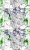
Lol sweet guess I’m gonna have to make a map for this oneI'm watching. Getting thicker clouds and just feels like a flake or two could fall. View attachment 56078
smast16
Member
I'm watching. Getting thicker clouds and just feels like a flake or two could fall. View attachment 56078
Update: very light mist / drizzle.
Yep, 39 at RDU as of noon!Geez I just looked at the temps across the state. Didn't know it was in the 30s for many north of 40... It's freaking 48 at the house
34 at Roxboro, they always win.
This band on the NAM is intriguing for RDU 
smast16
Member
Lol sweet guess I’m gonna have to make a map for this one
Its soo close. Just not quite there.

44.8/43.7, light mist.
RVD
Meteorology Student
What's your temp? I'm at 36 in Hillsborough, was hoping that maybe this could produce a few flakes if it made it here, but maybe not....
Fountainguy97
Member
35.6 here and just can’t quite get the mixing level down here into the valley.
but the cloud deck may be the lowest I’ve ever seen. Barely 500ft above my head
but the cloud deck may be the lowest I’ve ever seen. Barely 500ft above my head
FamouslyHot
Member

Finally seeing some more moisture headed my way. Before now you couldn’t see any returns NW of Gatlinburg
Sent from my iPhone using Tapatalk
BHS1975
Member
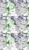
This band on the NAM is intriguing for RDU View attachment 56080
If the wind is just right moisture will sneak through the gap in the mountains. I've seen it once before.
Sent from my iPhone using Tapatalk
Yeah pretty much all the short range models depict some kind of band filtering through the RDU region later
Webberweather53
Meteorologist
Cmon gimme some graupel ?

What's your temp/DP?
Webberweather53
Meteorologist
50 over 47. ???What's your temp/DP?
D
Deleted member 1449
Guest
There were some flurries in Stokes county (one county north of here). I saw the video to confirm on Twitter. At least some in NC saw some flakes today.
Here are some of the individual members .. showing some solid back end precip .. would be interesting but idk long shot right?Wonder what the member showing 2" is seeing? Haha.
Attachments
Not bad for RAH:
.NEAR TERM /THROUGH TONIGHT/...
As of 1015 AM Monday...
Water vapor satellite showed the first of two troughs for today
exiting the area. Radar displayed most showers have also moved into
eastern NC, with patchy areas of drizzle lingering across the
region. The second upper trough is currently moving across eastern
TN, and will traverse across central NC this afternoon and evening.
Additional showers will develop this afternoon across the region as
the trough approaches the area, with the greatest coverage of
showers closer to the NC/SC border. Although today will be a quite
chilly day, with highs ranging from the upper 30s N to near 50 S,
precipitation through this afternoon will be liquid. However,
chances of frozen precip, or a mix of frozen and liquid, will
develop this evening as a weak surface cold front pushes across the
area. High-res models have been consistent with developing isolated
showers across portions of the Piedmont and southern Coastal Plain
this evening along the front, and model soundings look to be cold
enough for areas near and north of the Triangle to observe some
snowflakes (best chances near the VA border). Surface temps will be
right around freezing as precip is falling, therefore no frozen
accumulation is expected. Bridges may become a little icy overnight
where roads remain wet and temps fall into the 20s. Lingering
northwesterly winds behind the front may keep the atmosphere mixed
enough in some places to only lower temps to the low 30s overnight,
however sheltered areas should radiationally cool to the mid to
upper 20s as skies clear behind the front.
&&
D
Deleted member 1449
Guest
I just got back from a run and I thought I saw one renegade flake but since I only saw one it was probably something else. Dandruff ?
Temp down to 34 and is the radar deceiving me but looks like decent redevelopment just to my west
smast16
Member
What's your temp? I'm at 36 in Hillsborough, was hoping that maybe this could produce a few flakes if it made it here, but maybe not....
39 here. It did light spitting drizzle for a minute, and if you wished hard enough you could believe it was wet flakes.
Webberweather53
Meteorologist
Temp down to 34 and is the radar deceiving me but looks like decent redevelopment just to my west
Dang 34? yeah you're probably about to score
smast16
Member
I just got back from a run and I thought I saw one renegade flake but since I only saw one it was probably something else. Dandruff ?
Dust. Lol. I saw it too. Its Christmas time so I'm gonna #believeinmiracles
And dang Henderson is down to 32Dang 34? yeah you're probably about to score
Webberweather53
Meteorologist
Has to be snowing or had snowed there.And dang Henderson is down to 32
HAHAHA I actually relate to this so much sometimes you’re looking so hard that your Brian creates what you want to see ... happened too me many times before ... I think it’s the weenie membrane in the brain that kicks inI just got back from a run and I thought I saw one renegade flake but since I only saw one it was probably something else. Dandruff ?
Yeah you would think so but haven't seen any reports of any just yetHas to be snowing or had snowed there.
Down to 37 here in Raleigh near the PNC arena ... I’m licking my lips for that band models are showing .. I know it’s just a fantasy .. but one can hope
NBAcentel
Member
Has to be snowing around here, reflectivity has smoothed out and picked up 
Correlation coefficients seem to show what you're talking about .. definitely seems to be some sort of mischief up thereHas to be snowing around here, reflectivity has smoothed out and picked up View attachment 56088

Webberweather53
Meteorologist
Has to be snowing around here, reflectivity has smoothed out and picked up View attachment 56088
Widespread surface temp readings in the low-mid 30s up there, given the setup, sfc temps, & radar I also strongly suspect that it's actually snowing &/or at least a rain/snow mix in parts of Vance, Warren, & Halifax counties rn
I have got to schedule my work from home days better....
Webberweather53
Meteorologist
We're gonna have to rely almost solely on @metwannabe if we want ground truth out of that band, still not even a single mPING report
Problem...... where I'm at and where I wish I wasWe're gonna have to rely almost solely on @metwannabe if we want ground truth out of that band, still not even a single mPING report