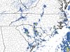
Rates will overcome all. modernweenieYeah these soundings won’t cut it View attachment 55859
-
Hello, please take a minute to check out our awesome content, contributed by the wonderful members of our community. We hope you'll add your own thoughts and opinions by making a free account!
You are using an out of date browser. It may not display this or other websites correctly.
You should upgrade or use an alternative browser.
You should upgrade or use an alternative browser.
Wintry December 4-7 Winter Precip Chance
- Thread starter SD
- Start date
Ok so now we root for that NS energy to hang back even more, strengthening the upper level low on the backside?
NBAcentel
Member
Yes, that gives us a chance at getting some backside precip goingOk so now we root for that NS energy to hang back even more, strengthening the upper level low on the backside?
Want to see how the 0z runs handle the wave interactions. The rgem and icon handle the northern mid atlantic energy differently than the gfs nam euro
NBAcentel
Member
Hopefully they keep keeping going that way, puts more people in play, the better UL energy, the more expansive the precip sheild would be and by that time 850s are already -2 to -6 across NC, rates can take care of the rest, but ATM NE NC stands the best chance at some snowflakesWant to see how the 0z runs handle the wave interactions. The rgem and icon handle the northern mid atlantic energy differently than the gfs nam euro
NBAcentel
Member
Like I been saying it’s sort a good thing models have been all over the place due to known and unknown causes, it gives more room for trends
NBAcentel
Member
Even if this does fail it’s been fun tracking this tho, helps you learn more
NBAcentel
Member
VA system on euro, but it changed quite a bit compared to 12z in which now is the right direction 


NBAcentel
Member
EPS looked good for VA and even tried throwing a bone for NC 


NBAcentel
Member
I guess we have to get back to this look
Yesterday’s 18z
 tonight’s 00z

We have to get back a stronger and more closed off upper level trough/low again, it’s been improving but I don’t know if we have enough time
Yesterday’s 18z
tonight’s 00zWe have to get back a stronger and more closed off upper level trough/low again, it’s been improving but I don’t know if we have enough time
NBAcentel
Member
Nam 3km is also doing the same by trying to strengthen the 3rd northern stream piece again, but it’s a bit to Far East for my liking 

L
Logan Is An Idiot 02
Guest
We need a West trend!Nam 3km is also doing the same by trying to strengthen the 3rd northern stream piece again, but it’s a bit to Far East for my liking View attachment 55914View attachment 55915
Sent from my Pixel 3 using Tapatalk
NBAcentel
Member
as much as I hate to say it, this one is beginning to go on life support if your outside of VA
Nomanslandva
Member
ICON rained up here...Not good. But no sun angle at 4 AM so maybe white rain can stick.as much as I hate to say it, this one is beginning to go on life support if your outside of VA
NBAcentel
Member
If your outside VA or the NC mountains and maybe NE NC, this one is probably over, however in WNC/the piedmont into SC, there may be some showers in the afternoon/evening that fire under the cold pocket aloft with maybe some small hail/graupel/snow pellets, melting layer under these cells is around 900-925 mb so it would be difficult to get snow to make it to the surface 

Wow this turned around quickly!

Stormsfury
Member
If your outside VA or the NC mountains and maybe NE NC, this one is probably over, however in WNC/the piedmont into SC, there may be some showers in the afternoon/evening that fire under the cold pocket aloft with maybe some small hail/graupel/snow pellets, melting layer under these cells is around 900-925 mb so it would be difficult to get snow to make it to the surface View attachment 55938View attachment 55939
Yeah...KCHS mentioned that H500 temps will be as low as -25C Monday Afternoon with the upper low passage which could spark graupel..
HRRR run there showing some crazy connective elements...with this new upgrade, it'll be interesting to see how this upgrade pans out...
JJr
Member
I was hoping this system would at least give most east of the mountains a few novelty flakes.If your outside VA or the NC mountains and maybe NE NC, this one is probably over, however in WNC/the piedmont into SC, there may be some showers in the afternoon/evening that fire under the cold pocket aloft with maybe some small hail/graupel/snow pellets, melting layer under these cells is around 900-925 mb so it would be difficult to get snow to make it to the surface View attachment 55938View attachment 55939
Thanks for all the PBP analysis you others do
NBAcentel
Member
@metwannabe special ?! 
So close yet so far.png")
NBAcentel
Member
Sucks it’s getting better when we’re basically almost out of time, sighSo close yet so farView attachment 55948

Short bus special@metwannabe special ?! View attachment 55947
Nailed itI'll guarantee you that precip shield ends up NW of current modeling but it'll be light white rain

set up isn’t completely the same, but if we had more cold air at the surface, those convective in nature bands moving through parts of SC give off Feb 2013 vibes. I chased that to Rock Hill. One of the coolest smaller events that I have ever experienced. Thundersnow was awesome in that.
NBAcentel
Member
Given the freezing level around 925-900mb tomorrow, Could definitely see some graupel/snow pellets mixed with rain with these showers tomorrow, especially the stronger ones that drag down more precipitation on top of the weak Dewpoint spreads, better than nothing, right ?


Attachments
Webberweather53
Meteorologist
Given the freezing level around 925-900mb tomorrow, Could definitely see some graupel/snow pellets mixed with rain with these showers tomorrow, especially the stronger ones that drag down more precipitation on top of the weak Dewpoint spreads, better than nothing, right ?
View attachment 55954View attachment 55955
At the rate we're going, this might be the highlight of the entire winter
NBAcentel
Member
At the rate we're going, this might be the highlight of the entire winter
Fab feb shall save
The new Euro seasonal FWIW agrees:At the rate we're going, this might be the highlight of the entire winter


Webberweather53
Meteorologist
The new Euro seasonal FWIW agrees:
View attachment 55956
View attachment 55957
View attachment 55958
My golf game is gonna be real good after this winter

NBAcentel
Member
The new Euro seasonal FWIW agrees:
View attachment 55956
View attachment 55957
View attachment 55958
Please start dumping those troughs out in the west by April please ?
I took a look at the LR GEFS for giggles, and even though there’s a SER, The trough over the north central US looks to be propagating eastward.

Webberweather53
Meteorologist
Please start dumping those troughs out in the west by April please ?
April? Shoot why wait for wedges when you could get them right now? If you're gonna torch might as well have some fun!
The ridge gets stronger, although I’m sure that ridge over the Atlantic could do you good.Please start dumping those troughs out in the west by April please ?

NBAcentel
Member
Am I crazy or does it seem like hail events are more frequent in the SE with La Ninas in the spring/early summer ?April? Shoot why wait for wedges when you could get them right now? If you're gonna torch might as well have some fun!
LOL!
NBAcentel
Member
Dewpoint Dan
Member
Don't get too excited unless you are in or near the mountains.
I wish the weather channel for go back to everything old that the used to have, it was so much better
NBAcentel
Member
Wow the icon brought the storm back
Lengthy discussion from GSP about tonight and tomorrowOtherwise, a complex split-flow upper lvl pattern will gradually
evolve thru the near-term period. By the end of the period early
Monday, the southernmost upper low/trof will phase with a more
northern trof and move across our area. At the surface, broad and
relatively weak high pressure will linger over the Southeast for
most of today/tonight with a complex sfc low developing over the
Carolinas as the period ends early Monday. As this occurs, a broad
region of deeper moisture will spread over the CWFA from the west
and south, yet the more favorable upper-lvl forcing/support will
remain to our southeast. As for the sensible fcst, cloud cover will
gradually increase from the SW later this aftn and evening. With the
weak forcing, QPF amounts should be minimal with the bulk of it
expected during the last 6 hrs or so of the period early Monday.
Based on the latest temperature profiles, only the higher terrain is
expected to be cold enough to see any appreciable snow, with accums
less than an inch anticipated for most locations. The Foothills
could see some rain/snow mix during the last few hours of the period
as their temperatures cool, but it`s doubtful that wetbulb temps
will be cold enough to support all snow there. Otherwise, the rest
of the CWFA will just see light rain showers.
For the Piedmont, most of the guidance sources now show precip
developing in the late morning to mid-afternoon timeframe. This
appears to result initially from the dynamic forcing, but a small
amount of instability (most likely well below 100 J/kg) is expected,
owing to strong midlevel lapse rates. This could keep precip going
for a time after the shortwave axis passes. With the downsloping,
precip is expected to taper off during the morning in the foothills
and portions of the NW NC Piedmont, though a small chance remains
warranted most of the remainder of the day in the still-lower
elevations, including the I-85 corridor. Temps look likely to break
into the 50s despite cloud cover. Most if not all of this light
precip thus should be rain. However, the low levels are expected to
be pretty dry, making wet-bulb temp profiles supportive of low snow
levels--if the precip does not evaporate/sublimate entirely above the
surface. This forecaster would be willing to bet that we get at least
a few reports of flakes mixing in with light rain, especially if
precip hangs on until later in the afternoon when the CAA sets in.
It`s a tricky situation; model soundings and p-type output suggest
the rain likely will end just as low-level temps become supportive of
snow. Some decent wind gusts (perhaps 20-30 mph) could occur at high
elevations in the NW flow, but also in the vicinity of any convective
showers Monday afternoon.