Ahhh that had to suck for you all.. I would of been so upset lolWas on southeastern side, saw flakes fall that quickly melted. did not experience the lush 10" snow that everyone NW of me got.
At least bunch of folks in LA, MS and AL got a lot of snow who rarely ever see it. SC is due, as is south/east Atlanta and Athens.
-
Hello, please take a minute to check out our awesome content, contributed by the wonderful members of our community. We hope you'll add your own thoughts and opinions by making a free account!
You are using an out of date browser. It may not display this or other websites correctly.
You should upgrade or use an alternative browser.
You should upgrade or use an alternative browser.
Nam may try to pull a rabbit out of the hat here
Sent from my SM-G955U using Tapatalk
Sent from my SM-G955U using Tapatalk
Yes sir, baby steps but can see differences at 51Nam may try to pull a rabbit out of the hat here
Sent from my SM-G955U using Tapatalk
Probably still going to crush it but the central us trough was deeper and there was more of a moisture response across the south in the pwatsYes sir, baby steps but can see differences at 51
Sent from my SM-G955U using Tapatalk
ForsythSnow
Moderator
Here starts the NW trend I believe. Let's watch all this misery undo itself, hopefully. Unless that is putting us into the misery of an inch of ice then never mind.
Surface precip further N at 57. Into Atl Metro.

BPATL
Member
I almost got 11 inches in my part of Atlanta it was stunning....
Hail Mary with the nam as Shane said, there is more moisture this run
Big change at 57 more consolidated wave stronger trough. Winds at h7 and h85 trying to get a more south component
Sent from my SM-G955U using Tapatalk
Sent from my SM-G955U using Tapatalk
Big improvements. Looks like the second wave is trying to take shape back in Gulf based of surface re flexion? 1022SLP with precip trying to break out into C and N AL/ N Ga.Hail Mary with the nam as Shane said, there is more moisture this run
Let it go man! LolBig change at 57 more consolidated wave stronger trough. Winds at h7 and h85 trying to get a more south component
Sent from my SM-G955U using Tapatalk
It's like rooting for NC State in basketball!
But seriously, the NAM run now shows it warmer? There's only a little mix near Macon, does it do well with surface temps? Can anyone post a map of this last run , with this run?
It's amazing what happens when you don't channel vorticity under the NE low.

Sent from my SM-G955U using Tapatalk

Sent from my SM-G955U using Tapatalk
Well that would be a pretty nasty ice event. Lol let's see if it has any other support from other models first
ForsythSnow
Moderator
Lol the NAM has a weak low off the coast. Let's get the GFS, CMC, and Euro with this trend and we'll be back in business.
Most models do have a weak sfc low off the coast, but will other models support it
Blue_Ridge_Escarpment
Member
Climo typically always wins. I’d say this thing is no where near done coming stronger and NW as a result.
.png")
That's a big hit for Larry. 1/2" or more of ZR. I bet we continue to changes in amounts and and locations especially once the wave gets fully sampled like others have said. Lets see what rest of 12z suite says.
Would temps be cold enough near the coast to support that much ZR ? Savannah isnt forecast to get below 34 through Sat so im guessing this would be a very marginal situation ?
SimeonNC
Member
Apparently there's no CAD at all in this run? Wth?
Stormsfury
Member
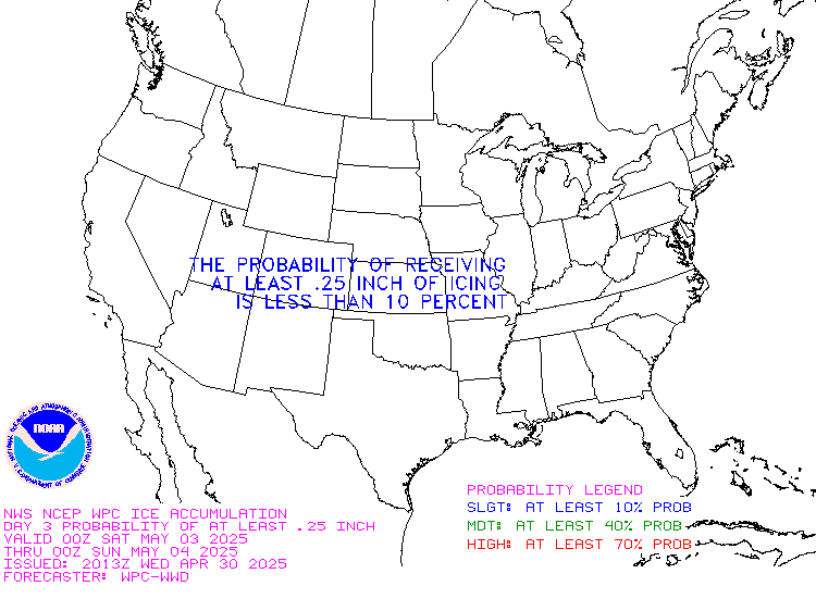
Significant uptick in ZR since the 00z and 06z cycles. WPC already has a Day 3 hatched risk area of ZR exceeding .25" in their graphic.
There is CAD
Oh dang. Pic?Significant uptick in ZR since the 00z and 06z cycles. WPC already has a Day 3 hatched risk area of ZR exceeding .25" in their graphic.
carolinachaos
Member
I'm so confused, some people saying there is no CAD, we have others saying there is. I'm in Florence, SC and I don't know what to expect.
Sent from my SM-N950U using Tapatalk
Sent from my SM-N950U using Tapatalk
Very good point, the cat does the dirty work before the actual precipitation, if there is any. LOLCAD may look weaker in GA because there's actually precipitation this run lol.

SimeonNC
Member
Oh, I see it now, I was looking at the 2m temps and saw that it warms up a lot on Friday.There is CAD
Well I am preparing for winter weather in Lavonia regardless of what these cray cray models say. A few years ago the radio met was saying we dodged a bullet as ice was starting to form and end result looked like a war zone
SimeonNC
Member
Disregard my post, I saw someone say it on the other board and checked the NAM and it appeared that way.I'm so confused, some people saying there is no CAD, we have others saying there is. I'm in Florence, SC and I don't know what to expect.
Sent from my SM-N950U using Tapatalk
carolinachaos
Member
I saw the same thing in the other board as well, that is what I was alluding too.Disregard my post, I saw someone say it on the other board and checked the NAM and it appeared that way.
Sent from my SM-N950U using Tapatalk
B
Brick Tamland
Guest
I guess we're hoping for a NW trend...AGAIN.
IF this (near 0.50" ZR) were to be close to verifying, I want to check one other event to make sure but I do believe this would be the worst widespread ZR for upper coastal counties of GA to far S SC since Jan of 1922. It almost certainly would be worst for right in the city of SAV since then and by what I think would be some margin. So, a truly historic (96 years) hit is a real possibility there. It is crucial that ZR amounts don't rise above here because that's when the damage and outages would rapidly increase. The JMA and ICON qpf's would cause massive damage. Hopefully they're both overdoing their 1.25" (which would be near the severe hit of 1922) as often is the case with the JMA. As it is at this near 1/2" level, it would already cause quite a number of problems for sure, including many outages and slippery driving/walking in certain areas, especially if it gets down to 30. We've got numerous very large oaks in and near the city that would be a big concern with just the 0.50" of ZR.
The comparison to the surface wx maps of the massive Jan 1922 ZR is eerily similar.
Keeping in mind the Irma hit, there have been other instances of a big tropical hit in the area followed by a sig wintry hit somewhere within the CHS-SAV corridor the following winter: 1894/1895, 1898/1899, 1989, 1979/1980 come to mind.
Last edited:
gfs w a nw jump in precip for tomorrow night
Annnnd the GFS puts a damper on everything
GFS = suppression depression. This ones on life support, and we're about to have a power failure! 
Webberweather53
Meteorologist
IF this (near 0.50" ZR) were to be close to verifying, I want to check one other event to make sure but I do believe this would be the worst widespread ZR for upper coastal counties of GA to far S SC since Jan of 1922. It almost certainly would be worst for right in the city of SAV since then and by what I think would be some margin. So, a truly historic (96 years) hit is a real possibility there. It is crucial that ZR amounts don't rise above here because that's when the damage and outages would rapidly increase. The JMA and ICON qpf's would cause massive damage. Hopefully they're both overdoing their 1.25" (which would be near the severe hit of 1922) as often is the case with the JMA. As it is at this near 1/2" level, it would already cause quite a number of problems for sure, including many outages and slippery driving/walking in certain areas, especially if it gets down to 30. We've got numerous very large oaks in and near the city that would be a big concern with just the 0.50" of ZR.
The comparison to the surface wx maps of the massive Jan 1922 ZR is eerily similar.
Keeping in mind the Irma hit, there have been other instances of a big tropical hit in the area followed by a sig wintry hit somewhere within the CHS-SAV corridor the following winter: 1894/1895, 1898/1899, 1989, 1979/1980 come to mind.
Ahh yes the infamous January 1922 knickerbocker storm, which led to the collapse of the Knickerbocker theatre in Washington DC due to the weight of the snow and dropped about 24-36" of snow in Roxboro, Oxford, & Henderson, NC gave you an insane ice storm. Very interesting to learn there were several sides to this insane storm and that the general setup is potentially similar to that. This doesn't mean by any stretch of the imagination the sensible impacts here in NC will be similar but interesting nonetheless...
Blue_Ridge_Escarpment
Member
GFS = suppression depression. This ones on life support, and we're about to have a power failure!
I think you mean the Gfs is on life support. It’s amazing how bad it is. Dreadful.
Stormsfury
Member

Webberweather53
Meteorologist
The combined precipitation totals of both the Wed and Thu-Fri event have shifted NW vs the 6z run... Let the NW trend begin.

Stormsfury
Member