• Hello, please take a minute to check out our awesome content, contributed by the wonderful members of our community. We hope you'll add your own thoughts and opinions by making a free account!

Wintry Dec 8-10th Winter Storm

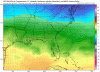
I see about 3" for the majority of Forsyth from that map, but even so; almost completely doubt any snow will fall here, nor sleet for that matter. Only thing we would get out of this is zr. That's my thinking anyway. We'll be too far S/W so our depth of cold air will be extremely shallow. I still think the wedge is being underestimated, however; happens quite often. 32F line will likely eclipse Forsyth completely and end up somewhere in Cherokee-N Fulton-Central Gwinnett. That's usually the zone where it stops.

Any snow would come from the back with temps in the mid 30s, no accumulations most likely. In my 30 years of tracking weather you are about right on with the freezing line during the wedge. The strongest CADs can make it to Alabama, but generally they never make it past the ridge in central Paulding County north through Carter, Cherokee, and back northeast.
 
Here is a realistic map from the 3km of pure snow.
It’s still dropping precip here but mostly ice for all of NC besides northern sections

As you can see it’s a far cry from some forecasts.

It’s wise to go with it. We are not in globals wheelhouse. This is the NAM territory now.

1138C431-B56D-4A9D-97ED-33BC3306976D.png
 
And here is 3km ice.

Notice how much less it is for Wake. That’s because surface is above freezing for many many areas. That with ground temps above freezing and rates will not promote ice accrual so hopefully we won’t see much ice accumulation.

B4757F0C-69D1-478F-9A4F-407A24BF1BC1.jpeg
 
Here is a realistic map from the 3km of pure snow.
It’s still dropping precip here but mostly ice for all of NC besides northern sections

As you can see it’s a far cry from some forecasts.

It’s wise to go with it. We are not in globals wheelhouse. This is the NAM territory now.

View attachment 8742
Seems very realistic for central NC. 1-2" at most probably prior to the changeover to sleet and then rain. If it was much colder I'd believe the clown maps on GFS, Euro and FV3. I do not trust them one bit in this case.
 
Here is a realistic map from the 3km of pure snow.
It’s still dropping precip here but mostly ice for all of NC besides northern sections

As you can see it’s a far cry from some forecasts.

It’s wise to go with it. We are not in globals wheelhouse. This is the NAM territory now.

View attachment 8742
People said to use that crap last year for the early December storm in GA and it busted horribly fwiw
 
And here is 3km ice.

Notice how much less it is for Wake. That’s because surface is above freezing for many many areas. That with ground temps above freezing and rates will not promote ice accrual so hopefully we won’t see much ice accumulation.

View attachment 8744
Agreed. With these runs I’d prob call Wake, south and east, done for. Temps just aren’t there. Swing and a miss. Good luck to everyone in WNC
 
The WRF-NMM suppressed further south. Nashville and Knoxville literally shut out of precip. Everything moving due east end of the run, as well
wrf-nmm_apcpn_seus_47.png


wrf-nmm_ref_frzn_seus_48.png
 
I wonder how the hrrr will handle things, it handled the northeast surprise snow a few weeks back well and the IP/rain mix that happened in november here
 
Back
Top