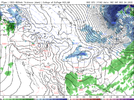
-
Hello, please take a minute to check out our awesome content, contributed by the wonderful members of our community. We hope you'll add your own thoughts and opinions by making a free account!
You are using an out of date browser. It may not display this or other websites correctly.
You should upgrade or use an alternative browser.
You should upgrade or use an alternative browser.
Pattern Dazzling December
- Thread starter Rain Cold
- Start date
Sidenote: Rolled through the CFS out through mid January for what its worth. Looked Fantastic. lots of blocking and BN for us.
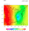
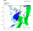
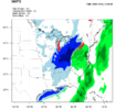
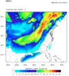
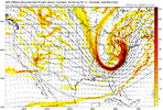
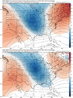
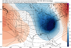
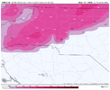
On this model it’s a crush job for the Great Lakes and Ohio Valley. Especially cities like Indianapolis Fort Wayne Cincinnati Dayton Toledo ClevelandMMFS seems to be holding steady with the majority of it's runs, with the exception being the 00z run last night. Some wrap around for those in Ga tho.
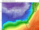
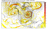
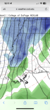
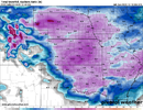
View attachment 127361View attachment 127363View attachment 127364
Last edited:
Might want to let the icon knowTonight’s the night where the models start looking great again. Buckle up!
SimeonNC
Member
The ICON is faster and colder than the GFS, which is weird knowing it's warm bias.
Looks like it got the memoMight want to let the icon know
The first storm is over with for most. The second storm maybe but the first it’s over.
The icon remains the same. A cutter well west. Not a lick of winter precip in the SE
Nothing says Carolinas winter storm like 995mb near indyLooks like it got the memo
SimeonNC
Member
ICON has single digit wind chills throughout most of the NC Piedmont Friday, damn.
Final post about the icon it would probably have some snow under the upper trough Thursday into Friday
Looking at the GFS, central AL has got to watch out of a very sneaky ZR threat with that first system. GFS has temps below freezing with dew points in the teens just before precip moves in. It reminds me a small ZR event back in 2013-2014 that caused major problems for BHM.
SimeonNC
Member
This is weird, looking at every other model available to me all of them has the front moving in way faster than the GFS except for the CMA which is laughable imo(has temps in the 60s for Friday in CLT).
Does the GFS have some sort of bias or something?
Does the GFS have some sort of bias or something?
0Z Gfs is once again strengthen western ridge and moving it further east. Even round hr 90 WOW!!
GFS has light rain breaking out here Thurs and 33 , should verify.
NBAcentel
Member
GFS bouta suck some people in lol
JLL1973
Member
Could be another good run for the midsouth area on gfs
buckinbronco
Member
GFS does look a tad better
SimeonNC
Member
The GFS seems to be taking a step towards the globals by having the cold further east sooner.
JLL1973
Member
LukeBarrette
im north of 90% of people on here so yeah
Meteorology Student
Member
2024 Supporter
2017-2023 Supporter
Not joking around if that model run came to fruition the mountain areas would get smoked with NW Flow/lake effect moisture enhancement. Would probably have some of that break thru the mountain containment and into the valleys as well
buckinbronco
Member
Looks like the snow made it a little further south but there is less of it overall
Storm5
Member
Thing is 1 inches in places like Mississippi with crashing temps in the low 20s can cause a hell of a problem
I'm confused; what about the 00z GFS was much different than the 18z?
Hmpfh.
Hmpfh.
Brent
Member
Nice upslope GFS. Hopefully he holds.
SimeonNC
Member
And this is what I was talking about this morning lol


LukeBarrette
im north of 90% of people on here so yeah
Meteorology Student
Member
2024 Supporter
2017-2023 Supporter

Possible incoming?? Lots of energy here.
- Joined
- Jan 23, 2021
- Messages
- 4,602
- Reaction score
- 15,197
- Location
- Lebanon Township, Durham County NC
LukeBarrette
im north of 90% of people on here so yeah
Meteorology Student
Member
2024 Supporter
2017-2023 Supporter

Ok, not too bad of a spot to be in right now
Bc the 500mb low is about 700 miles NNE of where we need itHow am I not getting snow from this? Any takers?View attachment 127375
NBAcentel
Member
CMC lead vortex goes way ahead, which is way different than the last few runs. It was weak but enough for some ice. Interesting but it’s just 1 run so meh. Still it’s getting closer in time so need to pay attention I guess

