-
Hello, please take a minute to check out our awesome content, contributed by the wonderful members of our community. We hope you'll add your own thoughts and opinions by making a free account!
You are using an out of date browser. It may not display this or other websites correctly.
You should upgrade or use an alternative browser.
You should upgrade or use an alternative browser.
Pattern Dazzling December
- Thread starter Rain Cold
- Start date
Every time I see someone say lots of energy incoming I go to look and everything fades away. If there’s so much energy where the heck is it going?
Possible incoming?? Lots of energy here.
Can Someone with more knowledge than me tell me why these keep fading out before they turn into something big?It tries. But washes out View attachment 127378
ForsythSnow
Moderator
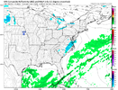
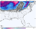
Cmc once more a totally different setup for the 26th time frame energy wise. That storm on the 23rd needs to be pinned down before we know what's going on with the 26th. However it also brings some nice backside snow showers for the 23rd like the gfs so that'll be watched.
mydoortotheworld
Member
Check out that ridge in eastern canada. Almost squashed in the new run.CMC looked better. View attachment 127374a few runs.
ForsythSnow
Moderator
CMC also pumping the western ridge way more on the 26th and that has implications. Almost trying to send another wave down after the one we are watching a day after.
- Joined
- Jan 23, 2021
- Messages
- 4,601
- Reaction score
- 15,196
- Location
- Lebanon Township, Durham County NC
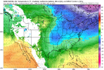
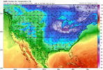
Canadian is by far the coldest and fastest with front progression. Temps would drop through the 20s on Friday with snow showers
Waves get sheared under the vortex exiting the NE. Trough axis stays too far E, no room for amplification, weak vorticity means mediocre to no reflection on the models. They do this every year and every year we get a big NW jump around day 4-5Every time I see someone say lots of energy incoming I go to look and everything fades away. If there’s so much energy where the heck is it going?
Can Someone with more knowledge than me tell me why these keep fading out before they turn into something big?
I know these past days of model runs have been depressing but I’ll tell you what.. I’m getting a bit intrigued by these waves of energy past our 22 storm. You don’t want the models showing u a storm right now you want them showing you the ingredients and ways small adjustments can give you that storm. I’m seeing the ingredients right now and I’m glad I’m not seeing the storm. I would like to see more ensembles jump on board to some snow. But I can easily see waves of flurries for that 25-28 ‘systems’ coming through the south. At this point if I can get flurries at any point Christmas week that is a huge W for me personally really a good Christmas feel there.
iGRXY
Member
See the storm on the 23rd as proof of big NW shifts and amplification lolWaves get sheared under the vortex exiting the NE. Trough axis stays too far E, no room for amplification, weak vorticity means mediocre to no reflection on the models. They do this every year and every year we get a big NW jump around day 4-5
LovingGulfLows
Member
- Joined
- Jan 5, 2017
- Messages
- 1,499
- Reaction score
- 4,100
Cmc once more a totally different setup for the 26th time frame energy wise. That storm on the 23rd needs to be pinned down before we know what's going on with the 26th. However it also brings some nice backside snow showers for the 23rd like the gfs so that'll be watched.
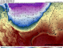
It's no wonder it's trended towards backend snow showers. Ridiculously low 850hPa temps. The DGZ will be very close to the ground.

CMC about to wallop some folks after day 10.
LukeBarrette
im north of 90% of people on here so yeah
Meteorology Student
Member
2024 Supporter
2017-2023 Supporter
That’s why I like to point it out now. Things like that typically uptrend.Waves get sheared under the vortex exiting the NE. Trough axis stays too far E, no room for amplification, weak vorticity means mediocre to no reflection on the models. They do this every year and every year we get a big NW jump around day 4-5
ForsythSnow
Moderator
Very similar to what I had posted about earlier. The DGZ could be hundreds of feet off the surface with Temps that bitter.It's no wonder it's trended towards backend snow showers. Ridiculously low 850hPa temps. The DGZ will be very close to the ground.

Storm5
Member
We are great at can kickingCMC about to wallop some folks after day 10.
ForsythSnow
Moderator
If we had a 280 hour run it'd have crushed GA through VA. Not a bad look but it'll likely change by 12Z tomorrowCMC about to wallop some folks after day 10.
Honestly, this is probably the time frame we should be watching; right as the pattern breaks down.If we had a 280 hour run it'd have crushed GA through VA. Not a bad look but it'll likely change by 12Z tomorrow
ForsythSnow
Moderator
Checking the soundings the air is not the most saturated so it wouldn't take much to immediately crash the column with the timing and influx of moisture into near freezing dry air.
Maybe at the start, but with only a small area above 0C in southern GA, I’d think that would cool as the 850mb low begins to crank.
Call me crazy, but I'm not ready to throw the towel in yet here for the 23rd. Five days out leaves plenty of time for us to pump the +PNA a little more favorably and dig that trough a little more.


Blue_Ridge_Escarpment
Member
What’s 300 miles among friends?UKMET joined the good trends. I wonder if the Euro will follow. View attachment 127384
UKMET joined the good trends. View attachment 127384
About 2 more of those and we will be good to go.
Well the Christmas storm just had it worst GEFS run soooo no sense looking.
Agree, the first wave dropping down after the Arctic blast cutter likely won't have enough room to breathe and amplify....the 2nd one dropping down should have the best chance, and tonight's CMC nails it. It needs a good ridge spike behind it of course to help it dig.Honestly, this is probably the time frame we should be watching; right as the pattern breaks down.


We should be sore from all of the can kicking and table setting, but this is our last shot before +EPO mild Pac air overruns the country. I think it will be a relatively brief respite though as we should go back into -EPO/+PNA stuff thereafter (I think -PNA is the least likely) as there are multiple reasons to think the jet won't retract back to the W Pac (more +EAMT coming, and tropical forcing should be favorable)....of course, who knows if any of that will do us any goodWe are great at can kicking
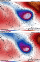
Looking at the 3 ensembles, can see here how the GEFS (1st image) doesn't have as good of a ridge spike out west at the key timeframe on Christmas Day. CMCE and EPS are more similar and have the better ridge spike (TPV over Western Canada has retrograded into AK on CMCE and EPS, but still lingering there on the GEFS).Agree, the first wave dropping down after the Arctic blast cutter likely won't have enough room to breathe and amplify....the 2nd one dropping down should have the best chance, and tonight's CMC nails it. It needs a good ridge spike behind it of course to help it dig.

Stormlover
Member
Is there not going to be a thread for the Thur/Fri threat?
For the Arctic Cutter storm, here is the trend loop on the last 4 runs of the UKMet as the big wave begins to dig thru the Rockies. Can see here how the UKMet has increased the low pressure anomaly just north of the Great Lakes, going in the direction of the GFS. This is pretty classic though in the sense that whenever there is a major disagreement among the models, they almost always move toward one another rather than one of them being the grand winner.


She’s sticking to her guns. Won’t budge.Euro is a miss for most on the first system. Big differences from the GFS particularly over the western areas (AL/MS/TN)View attachment 127388
Brent
Member
Snowman63
Member
I'm not familiar with this model. Is it a blend of multiple model data/Ensemble data? Is it similar to NBM that the NWS uses?00z MMFS is in and it remains consistent. The 3 runs Saturday (12z, 18z, 00z) were very consistent. Maybe a slight west nudge on this run.
View attachment 127394View attachment 127395
No, it’s a stand-alone model not a blend.I'm not familiar with this model. Is it a blend of multiple model data/Ensemble data? Is it similar to NBM that the NWS uses?
Isn’t that good look? We are trending to something look it?
It is, but we need some work. I am willing to bet that there is more moisture with this look than what models are showingIsn’t that good look? We are trending to something look it?
SimeonNC
Member
27.5 on my weather station
SimeonNC
Member
Wind forecasts for the area seem to be rising, all models have decent sustained winds with gusts up to 30-40mph. There should be a wicked NW flow event up in the mountains.

