000
FXUS62 KFFC 172014
AFDFFC
Area Forecast Discussion
National Weather Service Peachtree City GA
314 PM EST
Sat Dec 17 2022
.LONG TERM...
(Monday morning through next Friday)
Issued at 306 PM EST
Sat Dec 17 2022
Active period of weather ahead for north and central Georgia is a
bit of an understatement. Monday will be a quite day before a quick
moving
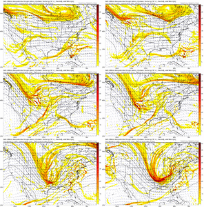
shortwave within the southern branch of the
jet will move
into the
CWA Monday Night into Tuesday, bringing with it some precip
chances. Best overall chances look to be across central Georgia.
Where we could see showers and some periods of steady rain overnight
and through part of Tuesday. Questions remain on just how far north
precip will extend. Overnight temps, and more specifically, wet bulb
temps, may be cold enough to support some light mixed precip
(rain/snow) on Tuesday morning, but precip may not be far enough
north or strong enough to overcome
evaporation to actually realize
anything. Have continued the trend of having some mixed precip in
the grids, but want to emphasize that it is very possible that we
don`t see it.
Going forward, Tuesday night into Wednesday looks to be precip free
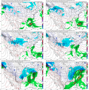
before the real show moves in. Models continue to show a very
dynamic and powerful
trough digging into the eastern US starting
early Thursday that punches through the
CWA by Friday.
Ensembles
show several potential waves of precip. Wednesday night could see
sfc low form near Atlantic coast that wraps some precip into the
area Wednesday night. Temps don`t look to be low enough with this
first wave to be too concerned with winter precip at this time.
Bigger push comes with the main
trough Thursday night into Friday.
Wave of precip is
likely to be ahead of a very powerful cold
front pushing into the area. Overall timing on this, as well as
just exactly where the
sfc low will be that is driving the
front,
remains uncertain.
Ensembles can be divided into 2 groups with
timing, where the GEFS seems to be faster than its Euro and
Canadian counterparts.
Winter precip continues to look uncertain
as well. Cold air may be driving in fast enough to see a period of
changeover that lasts long enough for some light accumulations,
but these type of events in Georgia are rare and I won`t speak
with any confidence about seeing something like that happen. At
the very least we likely would see some light wintry precip being
wrapped around the deepening sfc low as it occludes to the north,
which will probably bring some winter weather to areas of far
north Georgia. Sorry to the winter weather fans - this AFD still
won`t provide you with any answers, as there is still too many
variables that can change 5-6 days out.
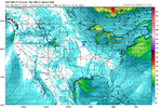
What is increasingly certain is that we will see a powerful push of
arctic air into the
CWA Thursday night into Friday. Expect
temperatures to be well below climatological norms, sinking into
teens and 20s Thursday night. Friday will see highs that may not
break 30 in many locations in north Georgia, including
metro
Atlanta. Friday night has the potential to be very cold with teens
extending well into central Georgia and the possibility of seeing
single digit temps in parts of north Georgia. There is some
uncertainty on seeing air as cold as above, but now is the time to
start thinking of any preparations needed for homes, animals, etc.,
as folks here in Georgia don`t see temperatures like that very
often. Temps will remain chilly, but look to slowly warm after
this.
Lusk

forecast.weather.gov
EDIT: TWC has me in the mid 20s with am snow showers Fri and a high in the upper 20s (coldest forecast so far) on Christmas Eve.


