• Hello, please take a minute to check out our awesome content, contributed by the wonderful members of our community. We hope you'll add your own thoughts and opinions by making a free account!

Pattern Dazzling December

It definitely appears (to me) as though we are trending towards a step-down, slower progression into a colder pattern. It does look like a lot of the ensembles and ops are beginning to more consistently show an evolution towards what some of those extended Euro runs were showing, but if we can hold the block I do think by the last week of December there could be an opportunity depending on how the undercutting energy evolves and manifests under the block and also what happens with the AK ridging (or lack thereof).

Overall, it's definitely a less-optimal version of what initially appeared with part of the TPV sliding under the block, but the Greenland blocking is a constant and is already trending stronger as we move forward in time (not unexpected), so future trends could continue to be positive towards a gradually 7-10 day step down into a southern Mid-Atlantic / northern southeast wintry threat closer to Christmas or just after.
@Isohume from American.... is that you???
 
Something that would change things in a hurry would be to see a low pressure get wound up strongly up under the block tracking thru the Ohio Valley and off the NE coast....not implausible in this setup

This is definitely true and with an active Pacific jet, there are opportunities for things to escalate down the road.

gfs_z500_vort_namer_fh120-240 (1).gif

@Isohume from American.... is that you???

Unfortunately I am not - sorry to disappoint! :)
 
I thought the EPS run last night was the best I've seen to date. Can see the Pac jet extending here. Ideally, this would extend west to east to a point just north of Hawaii (the GEFS wants to run the jet more poleward and send energy / low pressure into AK).

DEKfD1P.gif


Can see it better here on the Control run. I know some hate the Control run, but I like to see it as it is going to show more detail, and you can always compare it with the ensemble mean. This builds low pressure moreso into the Aleutians rather than into AK. It's not a traditional El Nino Aleutian Low, but it's not way off, and it helps with the western ridging pump

7MUkQza.gif


LahuQAX.gif
Griteater, always good analysis, especially the post from last night about mjo. Like u alluded to, hopefully the mjo can get moving and not stall or get stuck where we don't want it. The pattern really if u think about it, minus a -ao/nao is somewhat similar to last December with troughing out west and Aleutian ridge. I've always believed with a -ao/nao we get pretty cold east of the rockies, but not in this pattern currently. I think most got excited when models trended towards a big -nao since we haven't seen something this substantial in a while, probably since 2010. Hopefully the models will work things out, but convection in different locations isn't helping imo. Also, Anthony masiello, who is very smart, if he gets the prediction right from Nov 17th, he deserves the biggest cookie ever??
 
Also good to note with that Webber product I showed earlier in a post. There is much lower confidence in modeling about what’s going to happen in the pacific and west coast regions. This means we could still see huge swings in potential model outputs over the next several runs. They haven’t nailed down exactly what could go on over there. I guess meaning there’s still a shot we could see more ridging that currently modeled out west. And even if it’s just a quick shot it would help dislodge more cold air and give us a chance at something.
 
Griteater, always good analysis, especially the post from last night about mjo. Like u alluded to, hopefully the mjo can get moving and not stall or get stuck where we don't want it. The pattern really if u think about it, minus a -ao/nao is somewhat similar to last December with troughing out west and Aleutian ridge. I've always believed with a -ao/nao we get pretty cold east of the rockies, but not in this pattern currently. I think most got excited when models trended towards a big -nao since we haven't seen something this substantial in a while, probably since 2010. Hopefully the models will work things out, but convection in different locations isn't helping imo. Also, Anthony masiello, who is very smart, if he gets the prediction right from Nov 17th, he deserves the biggest cookie ever??
Thank you! Anthony’s not perfect, no one is, but I’ve seen him make successful long range calls time and time again
 
I thought the EPS run last night was the best I've seen to date. Can see the Pac jet extending here. Ideally, this would extend west to east to a point just north of Hawaii (the GEFS wants to run the jet more poleward and send energy / low pressure into AK).

DEKfD1P.gif


Can see it better here on the Control run. I know some hate the Control run, but I like to see it as it is going to show more detail, and you can always compare it with the ensemble mean. This builds low pressure moreso into the Aleutians rather than into AK. It's not a traditional El Nino Aleutian Low, but it's not way off, and it helps with the western ridging pump

7MUkQza.gif


LahuQAX.gif

This difference between the EPS & GEFS is something I talked about w/ one of the forecasters at the WPC this morning. Likely emanates from how the 2 model suites are handling the upstream tropical forcing over the Warm Pool. Here's the EPS vs GEFS VP200a means valid about 5 days from now.

ezgif-2-749f0073ca.gif


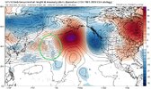
Notice the GEFS holds the forcing back into the Indian Ocean more, whereas the EPS kicks it out into the West Pacific. That difference is subtle, but it's enough to dramatically alter the downstream storm track over the N Pacific. The GEFS holding this back into the Indian Ocean allows more of a suppressed Aleutian ridge/+EPO look, whereas the EPS pushes it into the West Pacific, encouraging the storm track to amplify & push the Aleutian ridge more into Alaska (-EPO ish).


Screen Shot 2022-12-04 at 6.35.54 AM.png

gfs-ens_z500a_npac_40.png


Screen Shot 2022-12-04 at 6.36.05 AM.png


eps_z500a_npac_41.png


We've actually been trending to the GEFS the last several days, with convection/irrotational outflow from it lagging behind more into the Indian Ocean & especially Bay of Bengal

eps_chi200Mean_global_fh240_trend.gif


This little critter that's developing in the South Andaman Sea is probably to blame for that.


Himawari_1km_ir_202212041435_-7.50_27.25_-294.00_-242.00_ir1_ltnggw_hgwy_warn_weathernerds.png


Likely will develop into a tropical cyclone, as soon as tomorrow perhaps.

gfs_ir_india_fh13-67.gif


Link to Paul Roundy's RMM regression plots:

https://www.atmos.albany.edu/facstaff/roundy/waves/rmmcyc/index200reg.html
 
Also good to note with that Webber product I showed earlier in a post. There is much lower confidence in modeling about what’s going to happen in the pacific and west coast regions. This means we could still see huge swings in potential model outputs over the next several runs. They haven’t nailed down exactly what could go on over there. I guess meaning there’s still a shot we could see more ridging that currently modeled out west. And even if it’s just a quick shot it would help dislodge more cold air and give us a chance at something.

Mike did a great job w/ this plot idea we talked about yesterday. We have a few other ones potentially coming down the pipe at some pt and we're working to also include the EPS in this multi-suite super ensemble plot.

The combination of uncertainty from Warm Pool tropical forcing (noted above) to go along with uncertainty immediately upstream of the Greenland-Baffin Bay blocking ridge, where waves tend to slow down, amplify, & cyclonically break off from the mean flow, is why you see the big grey blob of high noise vs signal off the US west coast into the CONUS next week.


Eric, I have one question if you don't mind answering. If the gefs ultimately is correct with the holding back of forcing in IO, will that delay a pattern shift that you and others have been alluding to or is this just a blip in the road, perhaps after this system develops and moves on?
 
This difference between the EPS & GEFS is something I talked about w/ one of the forecasters at the WPC this morning. Likely emanates from how the 2 model suites are handling the upstream tropical forcing over the Warm Pool. Here's the EPS vs GEFS VP200a means valid about 5 days from now.
I can see it now Eric, you are going to work your way on to the Winter Weather Desk at WPC. Give us some love down south when that happens!

Yeah that's a good point about the cyclone forming in the Indian Ocean etc. That is kind of 'comforting' in a way in my mind as that would seem to give credence to the idea that the MJO pause in that region is more of a temporary blip
 
Great stuff guys. To me again say mid month on is the period we want to see this taking shape. Delayed or what have you with the convection and all from the point of the GEFS and the EPS I think will get worked out hopefully by the end of this coming week but climo is much more favorable towards the end of the month so that fits greatly with the pattern change going forward. Again great stuff from all above.
 
Griteater, always good analysis, especially the post from last night about mjo. Like u alluded to, hopefully the mjo can get moving and not stall or get stuck where we don't want it. The pattern really if u think about it, minus a -ao/nao is somewhat similar to last December with troughing out west and Aleutian ridge. I've always believed with a -ao/nao we get pretty cold east of the rockies, but not in this pattern currently. I think most got excited when models trended towards a big -nao since we haven't seen something this substantial in a while, probably since 2010. Hopefully the models will work things out, but convection in different locations isn't helping imo. Also, Anthony masiello, who is very smart, if he gets the prediction right from Nov 17th, he deserves the biggest cookie ever??
Something to keep in mind when we’re talking about the -NAO/AO is that both just went negative on Friday which means the block is still in the development phase. There is typically about a 2 week lag time for things to really show in the overall pattern. This is why I really think it’s smart to look at the time around the 16th before we see a favorable pattern
 
Eric, I have one question if you don't mind answering. If the gefs ultimately is correct with the holding back of forcing in IO, will that delay a pattern shift that you and others have been alluding to or is this just a blip in the road, perhaps after this system develops and moves on?

It sounds like forcing mechanisms are in place to extend the jet and give us the pacific we need eventually. However even at the very end of the GEFS, the jet is not ideal, the pacific is not great, and there's lower heights in AK. EPS looks great, but it sounds like it's probably wrong. I guess a wait and see approach is needed.

"Indian Ocean Convection" is becoming just as annoying as "western trough".

gfs-ens_z500a_nhem_65.png
Hopefully we aren't chasing unicorns all winter but we definitely have a ways to go. Eps will trend towards gefs if that IO is going to be a real problem for us?
 
There are some years with a -NAO in Dec that were warm in the east. And those didn't seem to feature an endless trough in the west with below average temps there. Instead looked more zonal at least according to these composites created by the legend himself. So you would think the trough in the west will disappear soon or either we're going to create a new way to fail.

 
Back
Top