-
Hello, please take a minute to check out our awesome content, contributed by the wonderful members of our community. We hope you'll add your own thoughts and opinions by making a free account!
You are using an out of date browser. It may not display this or other websites correctly.
You should upgrade or use an alternative browser.
You should upgrade or use an alternative browser.
Pattern Dazzling December
- Thread starter Rain Cold
- Start date
packfan98
Moderator
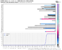
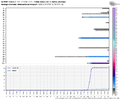
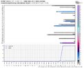
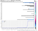
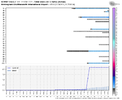
Anyone with access to the weather bell maps want to post a couple of the city EPS meteogram charts? Based off the control run, I’m curious to see if there’s more support for a Christmas miracle. Selfishly, I’d like to see Greensboro.
JHS
Member
At this rate on the GFS we may just stay dry next week with no big pattern changing event at all. Many of us have gone from 2+ of rain down to .25 or so The low just goes towards the lake and dies.
Webberweather53
Meteorologist
Anyone with access to the weather bell maps want to post a couple of the city EPS meteogram charts? Based off the control run, I’m curious to see if there’s more support for a Christmas miracle. Selfishly, I’d like to see Greensboro.
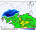
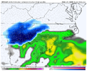
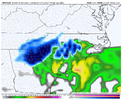
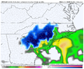
There's a couple monsters in this suite.

The Canadian ensemble also has a couple takers right before Christmas

LukeBarrette
im north of 90% of people on here so yeah
Meteorology Student
Member
2024 Supporter
2017-2023 Supporter
It’s clear the op models have no idea what they are doing after this next system
The rain can take a hike regardless of a pattern change. I've gotten nearly 7" in 8 days and my creek has been out it's banks the whole time. All the ponds are filled again.At this rate on the GFS we may just stay dry next week with no big pattern changing event at all. Many of us have gone from 2+ of rain down to .25 or so The low just goes towards the lake and dies.
iGRXY
Member
Yeah we are on a surplus from a rain standpoint and all these CAD days are keeping things damp. If it hasn’t been raining It’s been heavy misting with fog nonstop for the last week outside of a few hours on sunlight yesterday morning. And that doesn’t look to be ending whatsoever
bigstick10
Member
It has been and still is raining in ATL< over 2,6 inches so far today since midnight.At this rate on the GFS we may just stay dry next week with no big pattern changing event at all. Many of us have gone from 2+ of rain down to .25 or so The low just goes towards the lake and dies.
L
Logan Is An Idiot 02
Guest
Nothing on the 18z GEFS?
Sent from my iPhone using Tapatalk
Sent from my iPhone using Tapatalk
It's only through 216 hours.Nothing on the 18z GEFS?
Sent from my iPhone using Tapatalk
Until the euro starts supporting gfs types of solutions I’m disregarding it and it’s gefs members. I mean why should we trust it at all?
Itryatgolf
Member
What's interesting is the gefs was on the cold weather train and since departed it lol. Now the euro switched places. Is the gfs and gefs really that bad or is euro and eps that bad? ??Yeah and mods feel free to move this to banter but the worst part was the Georgia Governor and Atlanta Mayor trying to deflect all the blame on the NWS despite their forecast ending up correct.
L
Logan Is An Idiot 02
Guest
What's interesting is the gefs was on the cold weather train and since departed it lol. Now the euro switched places. Is the gfs and gefs really that bad or is euro and eps that bad?
The GEFS doesn’t even look that warm to me lol. It just warms up a bit around the 20th then quickly goes back to cold. At least that was 12z
Sent from my iPhone using Tapatalk
Met1985
Member
The 18z ensembles still brings the cold front blasting through the area. Looks nothing like the OP. Looks good to me still. In general the GEFS has been pretty rock steady other than a few runs here and there...
Itryatgolf
Member
Euro and eps was real cold, which supports the +EAMT spike, if correct, should unlock the arctic flood gates.The GEFS doesn’t even look that warm to me lol. It just warms up a bit around the 20th then quickly goes back to cold. At least that was 12z
Sent from my iPhone using Tapatalk
L
Logan Is An Idiot 02
Guest
Definitely a warming trend around the 20th on the GEFS.

Sent from my iPhone using Tapatalk

Sent from my iPhone using Tapatalk
ForsythSnow
Moderator
I'd hardly call 2 data sets a "trend". This doesn't even mention how the skill of the GFS at this range right now doesn't seem very consistent. If you have an eye out at H5 or even that big blob of cold air you'd know there's at least consistency in a cold air push which should be the focus, not 6 degrees of cooling hours 11 days out.Definitely a warming trend around the 20th on the GEFS.
Sent from my iPhone using Tapatalk
AJ1013
Member
73F here at 8pm. Really getting me in the Christmas Spirit! ?????
tennessee storm
Member
Must be nice , save on heating73F here at 8pm. Really getting me in the Christmas Spirit! ?????
Bills lol
AJ1013
Member
What about my AC bill lolMust be nice , save on heating
Bills lol
Itryatgolf
Member
Itryatgolf
Member
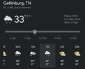
Terrible check back in October to see if next winter is betterJust got in to the hotel at Gatlinburg. Haven’t checked the model runs all day but it’s quiet on here. Were they bad?
NoJust got in to the hotel at Gatlinburg. Haven’t checked the model runs all day but it’s quiet on here. Were they bad?
I bet the fantasy storms are great for next October.Terrible check back in October to see if next winter is better
Met1985
Member
00z op gfs looks a lot like the 18z. No real push in cold air. It's delayed a bit and just kind of bleeds through. I wouldn't even call it a cold front but a zonal flow. Again the ensembles have not been supporting this. If the Euro is right with blowing the front through then something is very wrong with the gfs. The freaking update broke it....
NBAcentel
Member
iGRXY
Member
D
Deleted member 609
Guest
At first glance it looks not great but this is air that’s still plenty cold enough to support some winter weather with the suppressed storm track and blocking over top .. and the gfs is certainly playing with that idea right now .. cold enough for a thumping of snow with a dynamic system. Still gfs is a bad model so this is just eye candy but I won’t budge on believing anything it says until CMC but more importantly the euro agrees with it00z op gfs looks a lot like the 18z. No real push in cold air. It's delayed a bit and just kind of bleeds through. I wouldn't even call it a cold front but a zonal flow. Again the ensembles have not been supporting this. If the Euro is right with blowing the front through then something is very wrong with the gfs. The freaking update broke it....
iGRXY
Member

