NBAcentel
Member
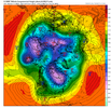
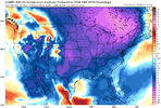
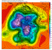
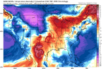
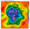
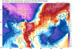

Definitely not Arctic.
Its smoothed out ensemble means at day 7-12…. Of course it’s not gonna be very very cold yet, low-mid 40s at this lead is pretty impressive. Sheesh the expectations are crazy. It’s the SE US. LmaoDefinitely not Arctic.
LOL< probably a high of 52 and a low of 35, break out the parkas.James Spann said get ready for a cold Christmas View attachment 125383
Per some of the posts I’ve seen this morning you cant even tell it’s getting colderJust for reference last Christmas eve. Maybe be thankful for 40s and cold rain. View attachment 125384
OK, a high of 48 and a low of 32...FrigidLOL< probably a high of 52 and a low of 35, break out the parkas.


Expectations like we live in the northern plains I guess, people complain either wayWe complaining about below normal now?
James Spann said get ready for a cold Christmas View attachment 125383
I mean if we are being honest with ourselves we have had what maybe 3-5 "cold" periods in the last decade.Expectations like we live in the northern plains I guess, people complain either way
It’s interesting. Last dec-jan the lower stratosphere (30-50mb) became unfavorable for blocking into late dec/January as we ended up getting the WPAC forcing regime to setup that gave us the -EPO/+PNA combo. Hudson Bay vortex setup but absolutely no blocking, fast flow and sheared waves, very timing reliant. Looks like this time that strat becomes less favorable but not as unfavorable as -NAM continues to show up especially the lower down you go, but I see lots of wave breaking on the smoothed Ensemble means. Really wanna try this pattern out with a block, considering fast flow was the problem last jan.Starting to get more bullish on a solid cold period east of the Rockies to the Deep South from just before Christmas into the 1st week of January. I think we'll see modeling improve with that as we go thru next week. Excellent sequence shown on the EPS for +EAsiaMtnTorq with strong high moving into SE Asia (1st loop). This should combine with the tropical convective signal emerging into the WPac next week (2nd loop) to move us into a --EPO / +PNA look. In addition, this sequence during La Nina favors a continuation of the current generally negative AO / NAO regime (3rd image).
See: https://blogs.reading.ac.uk/weather...-predict-north-atlantic-and-european-weather/
"...During La Niña years we also find the teleconnection from the MJO phases 6–8 makes the NAO– regime occur up to 2.5 times as often as the full climatology – this signal travels via the stratosphere, warming it and slowing the stratospheric polar vortex (Figure 4), with the total pathway taking around 20 days. There is a strong subseasonal link between the stratospheric polar vortex and the weather regimes throughout all winters [7], however, it is during La Niña years when there is the strongest subseasonal link between the MJO and the stratosphere [6]."


Starting to get more bullish on a solid cold period east of the Rockies to the Deep South from just before Christmas into the 1st week of January. I think we'll see modeling improve with that as we go thru next week. Excellent sequence shown on the EPS for +EAsiaMtnTorq with strong high moving into SE Asia (1st loop). This should combine with the tropical convective signal emerging into the WPac next week (2nd loop) to move us into a --EPO / +PNA look. In addition, this sequence during La Nina favors a continuation of the current generally negative AO / NAO regime (3rd image).
See: https://blogs.reading.ac.uk/weather...-predict-north-atlantic-and-european-weather/
"...During La Niña years we also find the teleconnection from the MJO phases 6–8 makes the NAO– regime occur up to 2.5 times as often as the full climatology – this signal travels via the stratosphere, warming it and slowing the stratospheric polar vortex (Figure 4), with the total pathway taking around 20 days. There is a strong subseasonal link between the stratospheric polar vortex and the weather regimes throughout all winters [7], however, it is during La Niña years when there is the strongest subseasonal link between the MJO and the stratosphere [6]."


Trough just east of HI backs up or the Aleutian low lifts, we get a ---- tilt/Nina esque NPAC ridge. That’s the scary partI'm nervous that we get the pacific ridge oriented incorrectly or off by like 2 degrees and we take an L here. That said all signs do point to go. I think even if we were to fail early it would be similar to last year where we would eventually get there
Yep it's the same fight we fight when this pac ridge goes up. We win big or we take a fat L there's not much middle ground. Like i said I think we are good this time but if you aren't sweating a little bit can you give me that confidenceTrough just east of HI backs up or the Aleutian low lifts, we get a ---- tilt/Nina esque NPAC ridge. That’s the scary part
We complaining about below normal now?
#MericaNice trend GFS View attachment 125334
Do you understand why that's happening? Have you looked at the plumes to see what's changing or are you just throwing out a post salad? I'm asking this honestly not trying to be a ----I wouldn’t call it complaining. I just think it’s worth pointing out that all major ensembles have a warming trend around the 21st through Christmas Eve. . It’s still around average but it’s been backing off each run. I just feel like that’s worth mentioning
Sent from my iPhone using Tapatalk
The D10 Euro shows how to do it the right way, but it's hard to put a lot of stock in one 10 day deterministic model run, particularly when the other two major suites show something different. Whatever the orientation of features at H5, we absolutely need the PV in eastern Canada, pressing the height field south. With the propensity for blocking this year, I'd give that pretty good odds of verifying at some point soon. Will there be any stability to it? That's a different question and harder to foresee.Yep it's the same fight we fight when this pac ridge goes up. We win big or we take a fat L there's not much middle ground. Like i said I think we are good this time but if you aren't sweating a little bit can you give me that confidence
Do you understand why that's happening? Have you looked at the plumes to see what's changing or are you just throwing out a post salad? I'm asking this honestly not trying to be a ----

Pretty Nice signal on the EPS, no big dawgs but lots of light members, rather have that then a few big
key word POTENTIALLY lolJames Spann said get ready for a cold Christmas View attachment 125383
Same here, this rots! I cant tell you the last time I saw the sun.CAD/Fog/Mist for 7th day in a row. 43 degrees
Can’t see above about 750-1000 ft on the mountains around here. If it isn’t raining, it’s been misting and down right chilly with fog.CAD/Fog/Mist for 7th day in a row. 43 degrees
If this went out past 180, we would’ve been cooking with grease here.
