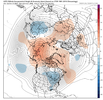
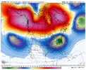
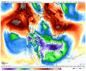
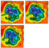
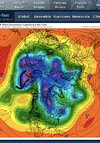
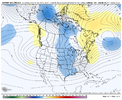
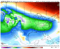
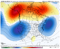
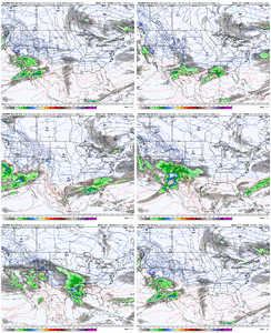
I like the fact that the ridge north of AK doesn't cut off. Hopefully it doesn't roll over. Anyway, looks good. Should have some energy to work with in the STJ with that look. Hopefully, it can remain suppressed.CMC Ens goes to this

-
Hello, please take a minute to check out our awesome content, contributed by the wonderful members of our community. We hope you'll add your own thoughts and opinions by making a free account!
You are using an out of date browser. It may not display this or other websites correctly.
You should upgrade or use an alternative browser.
You should upgrade or use an alternative browser.
Pattern Dazzling December
- Thread starter Rain Cold
- Start date
iGRXY
Member

Let’s not get too excited. Remember there’s a good reason our snow climo isn’t above but a few inches a year .. cause it’s just damn hard to get snow in the south. There’s always more fail routes then there are success routes. I certainly like where the trends are going though in terms of some sort of winter weather in an area in the south east or mid Atlantic.AT this point I think it's not a matter of if, but when we get a legit winter storm here in the south. Now granted nothing is guaranteed in life, but this basically house money at this point if the progression of the pattern continues like it is doing so far. We would have cold air to the west, confluence/CAD and cold air to the north. wave after wave of energy rolling through, blocking over top to shift the storm track south. I think this time next week (maybe sooner) we will have a storm to track. Now whether that's Ice or snow remains to be seen, but I think the odds are through the roof right now.
Id go as much to say that the south has an even better chance at seeing severe weather before we see a chance at the winter weather stuff. We will see
NBAcentel
Member
Agreed. As Webb noted earlier the pattern we are going into improves our odds, but there’s plenty of times where the perfect pattern doesn’t translate to winter stormsLet’s not get too excited. Remember there’s a good reason our snow climo isn’t above but a few inches a year .. cause it’s just damn hard to get snow in the south. There’s always more fail routes then there are success routes. I certainly like where the trends are going though in terms of some sort of winter weather in an area in the south east or mid Atlantic.
iGRXY
Member
Difference is whether or not the perfect pattern has any type of staying power. As of today and again this is as of today it looks like it does. You keep this pattern for 3-4 weeks and somebody will score. It may not be us in the Carolinas, could very easily be mid south, the deep south and Mississippi valley, heck you get too much blocking and drop too much cold air and the gulf coast or coastal regions of the SE will score. Right now I think the odds are somebody, not everybody, will see some type of winter storm within the next 3-4 weeks. Just not sure on who and we won't know that until there's something to actually track. That's really my point. Not guaranteeing snow for everybody lol.Agreed. As Webb noted earlier the pattern we are going into improves our odds, but there’s plenty of times where the perfect pattern doesn’t translate to winter storms
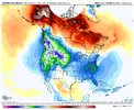
12z Euro: 850mb temp anomaly change from previous run for day 8-9


L
Logan Is An Idiot 02
Guest
12z EURO much better with the cold shot
NBAcentel
Member
Met1985
Member
12z Euro looked really good from about hour 168 onwards and you can see at the end of the run much colder air working down from Canada. Again im taking the mid to long range op runs with a grain of salt but the recent ensemble runs support this.
L
Logan Is An Idiot 02
Guest
What do y’all think of this?

Sent from my iPhone using Tapatalk

Sent from my iPhone using Tapatalk
NBAcentel
Member
That doesn’t look like a west based -NAO, did he have a 500mb map ?What do y’all think of this?
Sent from my iPhone using Tapatalk
Trends today nudged in the direction of less SE ridging, but it's always lurking in La Nina....small differences in the height pattern go a long way and there will be plenty of back and forth moves going forward with the model runsWhat do y’all think of this?
I would be curious to see how that would look if you throw the very -AO into the mix. A number of those dates were at time when the AO was positive to neutral. Right now the AO is almost to -3 and looks to stay below -1.5 for the foreseeable future. Also one would have to throw the MJO into the mix. It’s going into a mode that favors muted SERWhat do y’all think of this?
Sent from my iPhone using Tapatalk
Does the monster low in the Plains early next week, shuffle up the pattern and make it more favorable?? Looks like a storm of that caliber, may have been what the models were missing and or making for the wild run to run swings?
You need a little ridge to take suppression off the table for a good storm in the SE. It’s a razor fine line!Trends today nudged in the direction of less SE ridging, but it's always lurking in La Nina....small differences in the height pattern go a long way and there will be plenty of back and forth moves going forward with the model runs
It is the tablesetter that starts up the pattern change.Does the monster low in the Plains early next week, shuffle up the pattern and make it more favorable?? Looks like a storm of that caliber, may have been what the models were missing and or making for the wild run to run swings?
I believe it is. It cuts across the Plains and through the Ohio Valley and then helps to set up the 50/50 lowDoes the monster low in the Plains early next week, shuffle up the pattern and make it more favorable?? Looks like a storm of that caliber, may have been what the models were missing and or making for the wild run to run swings?
NBAcentel
Member
I don't even have the word 'suppression' in my vocabulary. You could have lows tracking from Mexico City to Havana, and it wouldn't bother me a bit. Give me all the cold you got. We'll find some moisture in that GulfYou need a little ridge to take suppression off the table for a good storm in the SE. It’s a razor fine line!
NBAcentel
Member
I week from midnight tonight. Its happening
east based -nao and SER will do that for you.Coldest EPS run yet around day 8-9 View attachment 125140
In all seriousness the upcoming pattern might not hold for a long duration but it's got money printing potential as far cold and/snow
NBAcentel
Member
If you play your cards right here you send energy out of the SW shear it while bringing secondary energy out of the arctic and you can theoretically get a similar result to Dec 2010This H5 look is up there with some big ice events across CAD regions View attachment 125141View attachment 125142
AJ1013
Member
12z Euro has 2” of snow in downtown Tucson on Monday!
whatalife
Moderator
NBAcentel
Member
The Shane method as he statedI know it’s the surface map and the euro control gives you two systems. View attachment 125143
That high over the eastern Great Lakes pumping down cold from what should be a decent snowpack, weak low along the Gulf Coast.. can you say overrunning?I know it’s the surface map and the euro control gives you two systems. View attachment 125143
JHS
Member
This kind of reminds me of the big pattern changing storms of November of 1989 and again in 2010. Both had lots of rain and the 1989 event was a major severe outbreak. Next week should have severe with it too but not in the CAD areas.I believe it is. It cuts across the Plains and through the Ohio Valley and then helps to set up the 50/50 low
If this pattern gets established the south has the best chance it could probably ever have at getting an actual white Christmas. Or maybe an icy oneI know it’s the surface map and the euro control gives you two systems. View attachment 125143
Those are both years that I’ve seen similarities in the models to those patterns.This kind of reminds me of the big pattern changing storms of November of 1989 and again in 2010. Both had lots of rain and the 1989 event was a major severe outbreak. Next week should have severe with it too but not in the CAD areas.
JHS
Member
It's possible I guess that we get the latter of Dec to be a lot like 1989 too. That big storm right before Christmas though would leave most of us if we got another low to take that same track. Wilmington got down to 0 one morning after that big storm. Only cirrus cloud cover kept many other places going that low.If you play your cards right here you send energy out of the SW shear it while bringing secondary energy out of the arctic and you can theoretically get a similar result to Dec 2010
For those interested & mentioning 1989..
Synoptic Overview
Synoptic Overview
Last edited:
Hypsometric
Member
For sure. ?If you play your cards right here you send energy out of the SW shear it while bringing secondary energy out of the arctic and you can theoretically get a similar result to Dec 2010
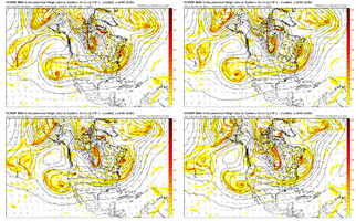
If we are staring at this potential in another 4-5 days, it's five-alarm time. Heck, we'll probably have already witnessed some of those epic Dec. 2010 euro runs by that time....
Last edited:
Gotta love the trend colder every run.Coldest EPS run yet around day 8-9 View attachment 125140

