• Hello, please take a minute to check out our awesome content, contributed by the wonderful members of our community. We hope you'll add your own thoughts and opinions by making a free account!

Arctic April

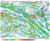
Also I know this is the LR GFS, but Still we’re getting to a time where average 500mb heights are rising to around 570-585dm, troughs arent so cold nomore, even with cold looking possible in the Medium range, average heights are increasing, only a month before we start heating up B7071220-8B82-4260-BC03-80FA4915974F.png5B9ADB2A-4D1C-4D9D-8796-4753EEC42F72.png
also the strat PV is going through its final warming, reason why I like spring for the transition A40BE1CE-5646-417E-828E-FFAC404FE39A.png
 
On the NAM, it’s forms a almost MCS like feature on Monday from energy embedded in NW flow, lee troughing helps out as well, solid little setup for severe storms given the dew-point depressions, and low freezing levels with present 0-6km shear, these little setups can produce decent storms 6A9106B8-0003-4E91-BFC0-80201A2DD01A.png14D0ABF9-2E2D-493C-BA5E-BFA107E8878A.png47E370E7-0823-4A5D-99F5-195E6763FDEE.pngB3AD4579-9DE6-4306-8798-9ECE4B93EC4C.png
 

Attachments

  • 13760DBD-6E21-414C-9318-063230BB6B89.png
    13760DBD-6E21-414C-9318-063230BB6B89.png
    245.3 KB · Views: 15
On the NAM, it’s forms a almost MCS like feature on Monday from energy embedded in NW flow, lee troughing helps out as well, solid little setup for severe storms given the dew-point depressions, and low freezing levels with present 0-6km shear, these little setups can produce decent storms
Post theif. Seriously though I think we have a set up here where if storms can overcome the inhibiting factors there is a reasonably high ceiling for hail/wind on an isolated basis. Im watching for more moisture pooling on the warm side of the backdoor front to see if we can start getting up into the 60s. These quasi backdoor/true backdoor events have been hit or miss in the past but right off the top of my head I remember a couple of decent hailers in the last decade
 
Post theif. Seriously though I think we have a set up here where if storms can overcome the inhibiting factors there is a reasonably high ceiling for hail/wind on an isolated basis. Im watching for more moisture pooling on the warm side of the backdoor front to see if we can start getting up into the 60s. These quasi backdoor/true backdoor events have been hit or miss in the past but right off the top of my head I remember a couple of decent hailers in the last decade

NAM has slowly been on a uptick with dew points, we’ll see what happens, but there’s already gonna be decent 5-11km SR winds supportive of hail so that’s with SHIPS are around 0.5-1.5, if dewpoints stay the same as they look, some damaging winds could be a issue given the fact that dry subcloud layers cuase evaporative cooling and gusty winds
 
@SD that hail threat looks like it’s increasing a bit, soundings are more supportive of hail on both NAMs, soundings also supportive of isolated microbursts, weird the 3km keeps showing a cape maximum around my county which increases hail chances, but both NAMs had better SBcape across NC 14D5125C-86B7-4B29-9434-C4EF23885F31.pngA1339361-67FF-418C-B2F8-5145E92027D6.png7C13D60C-E28F-4F3A-A476-45B8092F1652.png49065DC4-3CD9-4392-9E19-5978474C14F1.png
 
High only 47 here if we don't get another degree(we are at the high right now) we'll break a record from 1920 for record lowest maximum

Where was this in the winter...

Also Wednesdays forecast high is 87
It was 76 here, and SUNNY. A delightful Saturday.
 
Just noticed on the Euro that it looks like it’s trying to bring back the severe weather threat for the weekend. Could be something to watch.
 
Just noticed on the Euro that it looks like it’s trying to bring back the severe weather threat for the weekend. Could be something to watch.

Yep, the threat it showed a few days ago has come back. The environment verbatim is excellent, nearly 40 knots of 0-1 shear and 300-400 01-km SRH coupled with CAPE anywhere from 500 j/kg further north near the low center to nearly 2000 j/kg on the Gulf coast. This is a sounding near Mobile, AL

1586081187216.png
 
Despite the lack of internal consistency in the models right now, one thing is basically set in stone already, any synoptic-scale low pressure system and warm sector convection that comes along will be fueled an the left exit region (which enhances upper level divergence & forces ascent) of an exceptionally strong jet streak within the subtropical jet.

A 135-140 knot jet streak in the subtropical jet is very unusual at any time of the year really, much less in mid April when the polar jet usually starts moving north & weakens, not to mention this is happening when many of us are approaching our peak severe and tornado climo.

We really need to keep a very close eye on this the next few days.

1586082768052.png
 
This one is near Charlotte a few frames later. Just your casual 600 0-1 SRH and 50 knots of low level shear coupled with nearly 1000 j/kg CAPE.

View attachment 38385
Geez and I thought that setup in February that produced tornadoes around CLT looked bad, this is sum else, also that’s impressive CAPE For the morning time, just one run of the euro but this one has the highest ceiling of any threat we’ve seen this year atm...
 
Also back to that little Monday threat, NAM3km still shows it, mixed out BLs/dry subcloud layers and low freezing levels along with 30kts+ of 0-6KM shear May allow some decent storms
Dcapes up near 1000 too. Models have a very modest bit of energy at h5 cresting the ridge and moving in. That may help organize things tomorrow afternoon instead of a hodgepodge of intermittent storms along outflows and convergent boundaries moving SE.
 
NAM 3KM has solid profiles on Tuesday, could be a few scattered storms on tuesday aswell 1586100972554.png
 
geez even Wednesday south of CLT, im loving this pattern lol, can see nice EML advection with that sounding supportive of large hail
1586101242469.png
 
Despite the lack of internal consistency in the models right now, one thing is basically set in stone already, any synoptic-scale low pressure system and warm sector convection that comes along will be fueled an the left exit region (which enhances upper level divergence & forces ascent) of an exceptionally strong jet streak within the subtropical jet.

A 135-140 knot jet streak in the subtropical jet is very unusual at any time of the year really, much less in mid April when the polar jet usually starts moving north & weakens, not to mention this is happening when many of us are approaching our peak severe and tornado climo.

We really need to keep a very close eye on this the next few days.

View attachment 38387

To put into perspective how unusual this is, based on a sounding climo out of New Orleans, LA, a 135-140 knot jet streak on the Gulf coast would be record breaking at certain points in the heart of the winter, & it's 15-20 knots higher than the previous record of 120 knots at this time of the year. We're meeting or exceeding the boundaries of the "typical" outbreak parameter space in some aspects, but synoptic & mesoscale details will determine if this massive ceiling is realized.

Screen Shot 2020-04-05 at 11.50.54 AM.png
 
gfs_mslp_pcpn_frzn_us_40.png
Nice pattern
 
The difference between a severe outbreak and nothing next week pretty much hinges on how much stream separation we get in the medium range between the SW US s/w and the big vortex over the Lakes (sounds familiar lol?). More stream separation & stronger/slower SW US shortwave increases the chances of a severe &/or tornado outbreak by keeping the parent s/w & QG forcing for ascent more in-tact, allowing the s/w to tilt more neutrally/less positive and shifting the eventual surface low further NW >>> more of the SE US in a more robust warm sector of a stronger mid-latitude cyclone.

1586107046857.png


1586107478701.png
 
The difference between a severe outbreak and nothing next week pretty much hinges on how much stream separation we get in the medium range between the SW US s/w and the big vortex over the Lakes (sounds familiar lol?). More stream separation & stronger/slower SW US shortwave increases the chances of a severe &/or tornado outbreak by keeping the parent s/w & QG forcing for ascent more in-tact, allowing the s/w to tilt more neutrally/less positive and shifting the eventual surface low further NW >>> more of the SE US in a more robust warm sector of a stronger mid-latitude cyclone.

View attachment 38400


View attachment 38401

Model trends are well on their way towards it being a nothingburger locally.
 
Back
Top