• Hello, please take a minute to check out our awesome content, contributed by the wonderful members of our community. We hope you'll add your own thoughts and opinions by making a free account!

4/19/20-4/20/20 Severe Weather

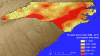
Really pulling for the wedge to win this time like it has in other cases...but I'll tell you who really needs it, and I'm doubtful it makes it all the way there. Areas southeast of me into southern SC. Maybe I wasn't looking too hard for a day or so, but on the 18z short range, some sketchy parameters for the same areas that got blasted last Sunday over there looked back to me. It actually looks like about the same timeperiod too. :rolleyes:

Screw nighttime tornado threats. If it ends up similar to last week, tomorrow's short range models are going to be very interesting. As I kept seeing some high parameters in southern SC.
 
More and likely a pds watch will be issued for south alabama tommorow if things go as planned. ?
 
Such a sharp cutoff on the northern fringe. It’ll be fun to watch how far north the higher dew points and warm front make it. Seems to be some fairly large disagreements on that part of the forecast amongst the models

View attachment 39756

That sharp cutoff will create a nasty mesoscale boundary and really raise helicity around it.
 
This one has a sneaky feel too it. Either the warm front doesn’t come as far north or this one could raise some hell. Parameters actually look more favorable around here vs last Sunday. Cape is at or above 1800-3000 (some model runs) and shear is more than enough.
 
This one has a sneaky feel too it. Either the warm front doesn’t come as far north or this one could raise some hell. Parameters actually look more favorable around here vs last Sunday. Cape is at or above 1800-3000 (some model runs) and shear is more than enough.
Yes Sir!! I m worried about !) Cells in the MCS running the Warm Boundary and then Any Discrete that comes with "Round 2" (South of US 80 or so.) Late Night.
 
18z NAM made another shift northward. Close to being pretty ominous for the South ATL Metro.

There's been a very noticeable slowing/amping trend on the NAM with our s/w over the lower Tennessee Valley. All else considered, this definitely favors the warm sector coming further north & west and potentially creeping up on areas like Atlanta, however mesoscale variability can make up the difference and then some.

namconus_z500_vort_eus_fh36_trend.gif
 
There's been a very noticeable slowing/amping trend on the NAM with our s/w over the lower Tennessee Valley. All else considered, this definitely favors the warm sector coming further north & west and potentially creeping up on areas like Atlanta, however mesoscale variability can make up the difference and then some.

View attachment 39760

What concerns me a little is 40-50 south of me has a tornado sounding and I've crept up into severe soundings from a previous nothingburger sounding. I'm wondering if the nam is onto something and in may have to watch this east of I-95 if some better instability works in.
 
How close is this thing to shifting just 20-30 miles north?


Sent from my iPhone using Tapatalk
 
What concerns me a little is 40-50 south of me has a tornado sounding and I've crept up into severe soundings from a previous nothingburger sounding. I'm wondering if the nam is onto something and in may have to watch this east of I-95 if some better instability works in.

Yeah I favor elevated convection solution for the moment, but this is one of those cases where we definitely need to keep an eye on how far north the warm front advances tomorrow over the lower MS valley
 
The baron model that Fox6 has been showing for us here in Bham has trended a little further north with areas of rotation than its previous runs.

6D9889A4-F6B0-43F2-9CBF-A9A0E26F5D48.jpeg
 
RAP is quite close CBA43B04-4A19-4FCC-A348-D447760F9747.png
Sounding near Rock hill SC
69DA5FB8-4A69-4BE1-A545-FC8C9E9BAA0E.pngSounding near CLT 8E32BAC7-E81D-4BDB-89A3-847B2838ADE6.png
These soundings are still elevated with terrible low level lapse rates but it’s getting close, this at least supports organized elevated storms, again tho this is the LR RAP....
 
We are considered to be in a more tornado-prone area compared to NC as a whole. These setups can bite us in the ass, especially we break from the wedge and storms ride that boundary. It sorta happened last Sunday in the Upstate.
 

Attachments

  • small.allen.nc.tornado.density.png
    small.allen.nc.tornado.density.png
    192.7 KB · Views: 35
We are considered to be in a more tornado-prone area compared to NC as a whole. These setups can bite us in the ass, especially we break from the wedge and storms ride that boundary. It sorta happened last Sunday in the Upstate.

Thankfully, we won't have anywhere near the amount of CAPE we had last weekend
 
That big MCS really suppresses the warm sector, nowhere close to getting up into the Carolinas save maybe Charleston or Beaufort and even then, they're barely in it

Hrrr does make sense, often times trailing stratiform associated with MCSs trend more and more over time and are often undermodeled
 
Boy would the 0z runs be a big sigh of relief if it turned out to be what we see tomorrow. If there's going to be another major event soon for some areas that were hard hit, let's at least wait a little longer than a week.

Edit: Spoke too soon because the 0z NAM put some areas that had major problems last time back in play still although it was a major trend south.
 
Last edited:
Wow! Nam drenches Montgomery with more then 9 inches of rain tomorrow into Monday morning. Don’t know where yet but I would not be surprised to see some isolated 8+ inch rain reports from somewhere along the warm front tomorrow. Those that end up along it are going to have an absolute mess tomorrow. Severe storms and inches and inches of rain.292BD95C-63AD-472D-972A-180E6BBED4E7.png
 
Wow! Nam drenches Montgomery with more then 9 inches of rain tomorrow into Monday morning. Don’t know where yet but I would not be surprised to see some isolated 8+ inch rain reports from somewhere along the warm front tomorrow. Those that end up along it are going to have an absolute mess tomorrow. Severe storms and inches and inches of rain.View attachment 39772
Nearly 10" near Montgomery and 0.20" not far away in Dothan ? Thats a sharp cutoff. From 10" to nothing in like 50 miles.
 
If this is anywhere close to verifying, the warm sector is gonna have a real tough time getting anywhere near the I-20 corridor in GA. Wouldn't feel confident in the warm sector getting much further north of Jackson-Montgomery-Macon atm

View attachment 39767
I would think that is the "best" bet right now. I noticed even the NAM and 3KM NAM had a hard time making it even to MCN. 00z run
 
Wow! Nam drenches Montgomery with more then 9 inches of rain tomorrow into Monday morning. Don’t know where yet but I would not be surprised to see some isolated 8+ inch rain reports from somewhere along the warm front tomorrow. Those that end up along it are going to have an absolute mess tomorrow. Severe storms and inches and inches of rain.View attachment 39772
Much of Middle TN gets almost nothing in the rain gauge if that verifies.
 
Back
Top