Henry2326
Member
Seeing the tropical threats die down warms my heart. I think the US is good and doesn't need anymore hurricanes.
you post globals but not ens?

And NHC agrees with them all.
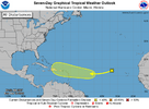
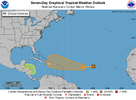
View attachment 153217
NWS National Hurricane Center Miami FL
800 AM EDT Sun Oct 13 2024
For the North Atlantic...Caribbean Sea and the Gulf of Mexico:
1. Eastern Tropical Atlantic (AL94):
Showers and thunderstorms have diminished again in associated with
an area of low pressure located a few hundred miles west of the Cabo
Verde Islands. While the system is currently embedded in an
environment that is not favorable for development over the next
couple of days, the system is forecast to move generally westward to
west-southwestward across the tropical Atlantic, where environmental
conditions could become more favorable for gradual development in
the central Tropical Atlantic by the mid to latter part of this
week.
* Formation chance through 48 hours...low...10 percent.
* Formation chance through 7 days...low...30 percent.
Appears to be the year of first in a very long time.It is this nondevelopment well east that’s actually making it potentially more dangerous to land area in the W basin. The only way this late in the year something moving through the MDR has on record (back to 1851) hit land in the W basin is nondevelopment until near the longitude of the Lesser Antilles or further W.
Appears to be the year of first in a very long time.

Another exceptionally unusual thing is that many models have this system tracking WSW to one degree or another from near the Lesser Antilles to near the SE or Central American coast. Unusual at any time of year much less this deep into October!It is this nondevelopment well east that’s actually making it potentially more dangerous to land area in the W basin. The only way this late in the year something moving through the MDR has on record (back to 1851) hit land in the W basin is nondevelopment until near the longitude of the Lesser Antilles or further W.
If a ridge of high pressure ends up off the east coast in that time-frame, a system will not recurve and a good chance getting in the gulf, unfortunately. However, a trough coming down could change that since we are in mid October imoIt is this nondevelopment well east that’s actually making it potentially more dangerous to land area in the W basin. The only way this late in the year something moving through the MDR has on record (back to 1851) hit land in the W basin is nondevelopment until near the longitude of the Lesser Antilles or further W.
Another exceptionally unusual thing is that many models have this system tracking WSW to one degree or another from near the Lesser Antilles to near the SE or Central American coast. Unusual at any time of year much less this deep into October!
good ole Jb says watch 25th thru nov 13th time frame for hurricanesLC:
After the recent tragedies regarding major hurricanes, it can be surmised that many want to believe newfound media and Internet comments suggesting that hurricane season is over. Now while we are seeing a largely quiet pattern across North America, with manageable temperatures and abundant sunshine, it seems probable that the tropics are going to throw a few more punches at the. I suspect the threat is growing for at least one more major hurricane strike into the eastern third of the USA, with another risk probable in the countries that rim the Caribbean Sea. We will see how things work out as far as the predictions, but 18 named storms, 11 hurricanes, and 6 major cyclones may just work out before the westerly flow aloft and colder, drier air masses end the season for good on November 30.
The hurricane forecast has some importance here, since we have a danger of interaction between baroclinic systems, as well as cold and dry air masses against the warm/humid tropical regimes. If you consider why Milton was such an awful event, the storm was starting to convert to an extratropical structure due to upper air influence. Increased vorticity against a three air mass convergence created maxi-tornadoes, which killed more people than the wind core and heavy rains which ripped up the Interstate 4 corridor. Now imagine such an amalgam hitting the Eastern Seaboard. I think it unwise to bring up an analog, but there are two standout Halloween storms that are not far from your memory, to be sure.

It’s too early for a nor’easterGiven the last few weeks, that's a concerning look to say the least. All eyes will be on the Atlantic in the days ahead.

