Brent
Member
Invest tomorrowCode Red
A broad area of low pressure located over the southwestern Gulf of
Mexico is producing disorganized showers and thunderstorms.
Gradual development of this system is expected, and a tropical or
subtropical depression or storm is likely to form late this weekend
or early next week while the system moves eastward or northeastward
across the Gulf of Mexico. Interests in the Florida Peninsula and
the Florida Keys should monitor the progress of this system.
Regardless of tropical or subtropical development, locally heavy
rains could occur over portions of Mexico during the next day or
two, and over much of Florida late this weekend through the middle
of next week.
* Formation chance through 48 hours...low...30 percent.
* Formation chance through 7 days...high...
70 percent.
Invest tomorrow
Dang....I'm goodOr now apparently
``AL, 92, 2024100500, , BEST, 0, 220N, 955W, 25, 0, DB, 0, , 0, 0, 0, 0, 1011, 180, 60, 0, 0, L, 0, , 0, 0, GENESIS028, , 0, , 0, 0, 0, 0, genesis-num, 028, SPAWNINVEST, al712024 to al922024,``
Dang....I'm good
You ever see a name like this? On Tropical tidbits....
92L GENESIS028
6z still has itGo back to my post for both set of ensembles on Friday. Oct 17 was a big day on the GFS ensemble. So not really surprised that the operational has something then. Ensembles are a bit delayed from the operational now, but its there.
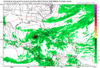
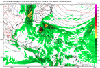
This is the third run of the GPS with a third storm.
View attachment 152671
View attachment 152672


Yep....let's keep up with how many runs in a row. So 4 now.
Well the second storm crossing Florida then bringing hurricane conditions up pretty much the entire east coast would be the icing on the cake and make this the most destructive cane year ever. Would bankrupt insurance companies for sure....
Rip rodanthe homes
Holy smokes. How would this steer Milton, if at all?Per model consensus, there’s a chance for a short-lived TC to form just E of FL from an area of convection currently in the E GOM ahead of Milton that would then move well OTS. Is anyone else watching this? For example, the 12Z UKMET has a TC from this:
NEW TROPICAL CYCLONE FORECAST TO DEVELOP AFTER 48 HOURS
FORECAST POSITION AT T+ 48 : 27.6N 78.8W
LEAD CENTRAL MAXIMUM WIND
VERIFYING TIME TIME POSITION PRESSURE (MB) SPEED (KNOTS)
-------------- ---- -------- ------------- -------------
1200UTC 08.10.2024 48 27.6N 78.8W 1003 23
0000UTC 09.10.2024 60 28.6N 75.5W 1002 28
1200UTC 09.10.2024 72 30.0N 71.9W 1003 30
0000UTC 10.10.2024 84 32.3N 66.5W 1004 30
1200UTC 10.10.2024 96 35.3N 60.5W 1003 33
0000UTC 11.10.2024 108 38.9N 54.6W 999 37
1200UTC 11.10.2024 120 CEASED TRACKING
Good catch. I would presume if this developed, it would influence a little further south Milton landfall through Fujiwara interaction (strong enough to matter?) and a weakness in the SE Atlantic UL ridge. Interesting.Per model consensus, there’s a chance for a short-lived TC to form just E of FL from an area of convection currently in the E GOM ahead of Milton that would then move well OTS. Is anyone else watching this? For example, the 12Z UKMET has a TC from this:
NEW TROPICAL CYCLONE FORECAST TO DEVELOP AFTER 48 HOURS
FORECAST POSITION AT T+ 48 : 27.6N 78.8W
LEAD CENTRAL MAXIMUM WIND
VERIFYING TIME TIME POSITION PRESSURE (MB) SPEED (KNOTS)
-------------- ---- -------- ------------- -------------
1200UTC 08.10.2024 48 27.6N 78.8W 1003 23
0000UTC 09.10.2024 60 28.6N 75.5W 1002 28
1200UTC 09.10.2024 72 30.0N 71.9W 1003 30
0000UTC 10.10.2024 84 32.3N 66.5W 1004 30
1200UTC 10.10.2024 96 35.3N 60.5W 1003 33
0000UTC 11.10.2024 108 38.9N 54.6W 999 37
1200UTC 11.10.2024 120 CEASED TRACKING
I believe there will be alot of troughing coming down mid Oct that nothing will hit anywhere except maybe Florida moving forward imoPer model consensus, there’s a chance for a short-lived TC to form just E of FL from an area of convection currently in the E GOM ahead of Milton that would then move well OTS. Is anyone else watching this? For example, the 12Z UKMET has a TC from this:
NEW TROPICAL CYCLONE FORECAST TO DEVELOP AFTER 48 HOURS
FORECAST POSITION AT T+ 48 : 27.6N 78.8W
LEAD CENTRAL MAXIMUM WIND
VERIFYING TIME TIME POSITION PRESSURE (MB) SPEED (KNOTS)
-------------- ---- -------- ------------- -------------
1200UTC 08.10.2024 48 27.6N 78.8W 1003 23
0000UTC 09.10.2024 60 28.6N 75.5W 1002 28
1200UTC 09.10.2024 72 30.0N 71.9W 1003 30
0000UTC 10.10.2024 84 32.3N 66.5W 1004 30
1200UTC 10.10.2024 96 35.3N 60.5W 1003 33
0000UTC 11.10.2024 108 38.9N 54.6W 999 37
1200UTC 11.10.2024 120 CEASED TRACKING
If something does form in the NW Caribbean, with these powerful troughs dropping down, there is also the risk of a rocketship inland to the southeastern states if things line up badly.I believe there will be alot of troughing coming down mid Oct that nothing will hit anywhere except maybe Florida moving forward imo
It also drops lows into the 50's here. The ideal storm.
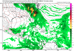
Back on the GFSI think we are on the 8th run in a row with operational.
Ensemble is bullish...
View attachment 152749

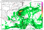
Isn’t that a rather unusual track for Late October ?But much worse.....mother nature determined to destroy whatever is left of FL.View attachment 152848
