• Hello, please take a minute to check out our awesome content, contributed by the wonderful members of our community. We hope you'll add your own thoughts and opinions by making a free account!

Tropical 2024 Tropical Thread Reboot

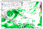
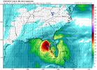
A surface low appears to be developing in the NW Gulf. If this were to turn into a TD+, the ICON will have nailed it very well since it has had numerous runs over the last week or so suggesting this. No other model has consistently shown this with most never showing a closed sfc low. Several UKMET runs also have shown this to a lesser extent.
 
Last edited:
A surface low appears to be developing in the NW Gulf. If this were to turn into a TD+, the ICON will have nailed it very well since it has had numerous runs over the last week or so suggesting this. No other model has consistently shown this with most never showing a closed sfc low. Several UKMET runs also have shown this to a lesser extent.
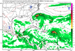
It looks like the storm on the ICON comes from the carib disturbance


1725554365466.png
 
It looks like the storm on the ICON comes from the carib disturbance


View attachment 150714

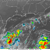
It appears to me to be a combination of energy from both as the NW Gulf low moves SSE toward the Bay of Campeche and meets up with the Caribbean disturbance moving WNW to the same area.

Meanwhile, here’s the new UKMET (12Z) regarding the NW Gulf:

Latest UKMET (12Z) now has TCG at hour 6, much sooner than the hour 60 of the 0Z run. It then drifts S through the weekend:

NEW TROPICAL CYCLONE FORECAST TO DEVELOP AFTER 6 HOURS
FORECAST POSITION AT T+ 6 : 27.9N 95.1W

LEAD CENTRAL MAXIMUM WIND
VERIFYING TIME TIME POSITION PRESSURE (MB) SPEED (KNOTS)
-------------- ---- -------- ------------- -------------
0000UTC 06.09.2024 12 28.1N 94.9W 1008 23
1200UTC 06.09.2024 24 28.3N 94.3W 1006 27
0000UTC 07.09.2024 36 27.7N 94.3W 1005 34
1200UTC 07.09.2024 48 25.3N 94.5W 1004 32
0000UTC 08.09.2024 60 24.2N 93.9W 1003 35
1200UTC 08.09.2024 72 CEASED TRACKING
 
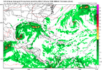
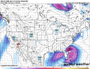
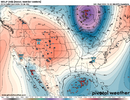
ATL is a mish-mosh of weak lows along the trof from the central ATL to Texas and the 2 weak waves.


1725556198280.png
 
GFS is weak and meandering ending up dissipating.

Regarding the NW GOM, the GFS has been far behind the curve. Before this run it had virtually nothing on every run. So, I’d take its weak solution with a huge grain and favor the ICON/UKMET.
 
Last edited:
Regarding the NE GOM, the GFS has been far behind the curve. Before this run it had virtually nothing on every run. So, I’d take its weak solution with a huge grain and favor the ICON/UKMET.
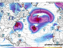
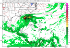
GFS sure ends with a bang and says, "JB, I will make your revised forecast come true". Has a developing cane in the gom and a possible major south of Bermuda moving wnw at the end.

Here is 354

1725556841956.png


384 it is motoring WNW


1725556886242.png
 
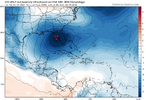
Euro continues to show the wave now east of the islands beginning to develop east of FLA. Also shows the storm the GFS has SW of Bermuda


1725562358931.png


1725562661301.png
 
Last edited:
A surface low appears to be developing in the NW Gulf. If this were to turn into a TD+, the ICON will have nailed it very well since it has had numerous runs over the last week or so suggesting this. No other model has consistently shown this with most never showing a closed sfc low. Several UKMET runs also have shown this to a lesser extent.

Invest up now for this

It is kind of amazing how it's still hanging around
 
For the first time like the GFS/CMC, the Euro (12Z) FINALLY has the current NW Gulf low (1011 mb now). It then drifts S (similarly to ICON/UK/others) while getting stronger. It doesn’t reach peak strength til Saturday, when it gets down to 1003 mb at 27N. Keep in mind that the Euro like the GFS/CMC is playing catch-up.

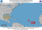
Rumor has it (i.e., unconfirmed) from an outside source is that this has just been designated Invest 90L. Although the ICON for days has been remarkable with this, I suspect that the 12Z Euro was the deciding factor (assuming this rumor is verified).

Edit: @Brent has confirmed this is in fact now Invest 90L.
I agree about ICON forecast in 7-10 day period.....
EURO AI caught on a day or so ago.

icon_mslp_wind_watl_fh168-168.gif
ec-aifs_mslp_wind_watl_fh162-162.gif
 
Back
Top