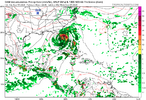
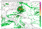
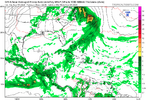
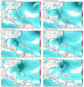
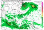
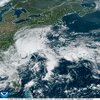
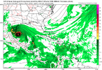
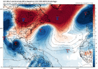
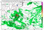
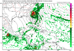
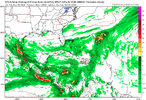
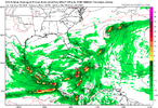
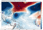
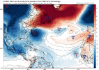
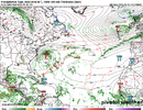
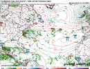
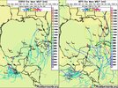
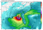
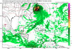
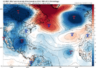
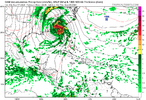
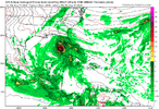
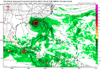
6 inch plus rains imo for Brunswick,New Hanover up to onslow, Carterett, Hyde,Dare
-
Hello, please take a minute to check out our awesome content, contributed by the wonderful members of our community. We hope you'll add your own thoughts and opinions by making a free account!
You are using an out of date browser. It may not display this or other websites correctly.
You should upgrade or use an alternative browser.
You should upgrade or use an alternative browser.
Tropical 2024 Tropical Thread Reboot
- Thread starter SD
- Start date
Shaggy
Member
IlM mentioning low end TS force gusts too. Might be enough to bring a few power outages as well6 inch plus rains imo for Brunswick,New Hanover up to onslow, Carterett, Hyde,Dare
lexxnchloe
Member
From LC
But then again, most -ENSO years are going to surprise you with cases of super-intense storms and widespread/numerous output of late season tropical cyclones. I will stand by my original call of 18 named storms, 10 hurricanes, and 6 major storms. The current roster of developed warm-core cyclonic circulations is 6 named, 4 hurricanes, and 1 major. I emphasize a long-lasting season with clustering between now and Halloween. There is still a threat for a high-impact system affecting the entire Eastern Seaboard between September 30 and October 15. Most schemes show a broad, but negative-tilt trough complex over the eastern half of North America, with a weakness across the eastern Gulf of Mexico and Florida Peninsula. This plays into the linear wave progression that has linked with the remnants of Francine and a disturbed area below South Carolina. I also should mention that the subtropical westerlies in the Pacific Basin have only advanced to just past the International Dateline; the earliest these winds could reach the middle of the equatorial Atlantic Basin would be in about a month. Lastly, La Nina is approaching the moderate strength range in sector 3.4, while the entire field of warm waters between the Americas and the Cape Verde Islands is much warmer than normal. All of this should tell you that the useful malaprop "It ain't over 'til it's over" applies here. Give it time, folks. But next time, I would advise not throwing "record numbers" out like candy.
But then again, most -ENSO years are going to surprise you with cases of super-intense storms and widespread/numerous output of late season tropical cyclones. I will stand by my original call of 18 named storms, 10 hurricanes, and 6 major storms. The current roster of developed warm-core cyclonic circulations is 6 named, 4 hurricanes, and 1 major. I emphasize a long-lasting season with clustering between now and Halloween. There is still a threat for a high-impact system affecting the entire Eastern Seaboard between September 30 and October 15. Most schemes show a broad, but negative-tilt trough complex over the eastern half of North America, with a weakness across the eastern Gulf of Mexico and Florida Peninsula. This plays into the linear wave progression that has linked with the remnants of Francine and a disturbed area below South Carolina. I also should mention that the subtropical westerlies in the Pacific Basin have only advanced to just past the International Dateline; the earliest these winds could reach the middle of the equatorial Atlantic Basin would be in about a month. Lastly, La Nina is approaching the moderate strength range in sector 3.4, while the entire field of warm waters between the Americas and the Cape Verde Islands is much warmer than normal. All of this should tell you that the useful malaprop "It ain't over 'til it's over" applies here. Give it time, folks. But next time, I would advise not throwing "record numbers" out like candy.
lexxnchloe
Member
lexxnchloe
Member
lexxnchloe
Member
6-8 new storms the next month and 3-5 to hit the US
lexxnchloe
Member
Henry2326
Member
I feel like I have seen this movie already this year.
lexxnchloe
Member
Henry2326
Member
Prior years too.....I feel like I have seen this movie already this year.
lexxnchloe
Member
Henry2326
Member
lexxnchloe
Member
Thanks. Normally I’d treat the Uncle at 240 with little significance. However, it has had this storm every run since the 12Z of 9/13. Plus it has good ensemble support.
Euro Weeklies in a general sense have been calling for something like this for several weeks.
lexxnchloe
Member
accu35
Member
I would definitely keep a close eye on the gulf again next week
lexxnchloe
Member
lexxnchloe
Member
This is more of a fwiw/mainly for entertainment run than the late portion of the 12Z CMC imo because unlike the CMC this Euro is very different from prior Euros. Interestingly, this isn’t at all from a tropical origin and is instead related to a combo of PTC-8’s vorticity going NE and the vorticity associated with that 32N, 70W circulation that I mentioned earlier going N. They combine and get stuck near NYC under a new Rex block. Then a new surface low forms Wed night, moves S, and then turns W (as you show).
lexxnchloe
Member
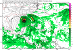
Yes, 3 very different scenarios. Cat4 into Mexico, Cat2 just off the SE coast, west moving low at 34NThis is more of a fwiw/mainly for entertainment run than the late portion of the 12Z CMC imo because unlike the CMC this Euro is very different from prior Euros. Interestingly, this isn’t at all from a tropical origin and is instead related to a combo of PTC-8’s vorticity going NE and the vorticity associated with that 32N, 70W circulation that I mentioned earlier going N. They combine and get stuck near NYC under a new Rex block. Then a new surface low forms Wed night, moves S, and then turns W (as you show).
Henry2326
Member
lexxnchloe
Member
Henry2326
Member
lexxnchloe
Member
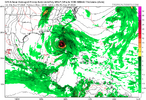
Signal instead of exact placement. Signal is getting stronger!View attachment 151165
Begins to head NE. Would rival Helene 1958 in pressure
View attachment 151166
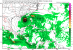
The 0Z GFS also has a similar storm that comes in a little later. Before that interestingly enough, it does something similar to the 12Z Euro forming a weak LLC SE of NYC at least partially from the remnants of PTC-8. It similarly moves S and gets down to 1001 mb. But instead of turning W to NC, it then turns SW and goes over C FL while opening up.
Meanwhile the GFS gives lexx what she craves so badly.
Meanwhile the GFS gives lexx what she craves so badly.
lexxnchloe
Member
The 0Z GFS also has a similar storm that comes in a little later. Before that interestingly enough, it does something similar to the 12Z Euro forming a weak LLC SE of NYC at least partially from the remnants of PTC-8. It similarly moves S and gets down to 1001 mb. But instead of turning W to NC, it then turns SW and goes over C FL while opening up.
Meanwhile the GFS gives lexx what she craves so badly.
lexxnchloe
Member
lexxnchloe
Member
lexxnchloe
Member
lexxnchloe
Member
lexxnchloe
Member
There sure is unusually strong agreement on hurricane formation in the NW Carribean/GOM in the 7-10-day range with Genesis on day 5 in the Wester Carribean from the Central American gyre.
NoSnowATL
Member
Big Bend is the new Hurricane hot spot.
Shaggy
Member
Yeah seems to be a hot spot. If they hold these solutions and they are right then another high impact event seems likely for Florida and up the east coastBig Bend is the new Hurricane hot spot.
NoSnowATL
Member
If a strong storm does happen the Big Bend area is the place. Like 9 people live there.Yeah seems to be a hot spot. If they hold these solutions and they are right then another high impact event seems likely for Florida and up the east coast

