• Hello, please take a minute to check out our awesome content, contributed by the wonderful members of our community. We hope you'll add your own thoughts and opinions by making a free account!

Tropical 2023 Tropical thread

Status
Not open for further replies.
Disturbance in the Gulf hitting us pretty good right now. 43MPH Gust reported at my station. Models weren't impressed by this line of convection, and NWS Miami only gave us a 10% chance of rain. I think the 18z GFS might have been on to something when it developed the caribbean system.

KAMX_loop.gif
 
GFS ensembles not really hitting on much, there is always that one ensemble though......looks like it crashes and burns after turning into NC after bombing off SC....this was 00Z I see.

gefs_2023-09-25-00Z_240_38.556_273.8_25.333_285.533_MSLP_Surface_tracks_lows.png
 
The offshore SE waters stay stormy for pretty much the entire run on most of the models.....shear seems to be able to keep it all shut down from becoming anything to worry about so far which is good as we really dont want another big rainmaker in eastern NC anytime soon.
 
The offshore SE waters stay stormy for pretty much the entire run on most of the models.....shear seems to be able to keep it all shut down from becoming anything to worry about so far which is good as we really dont want another big rainmaker in eastern NC anytime soon.
We're entering drought in NE GA and NW SC, so yeah, we need all the rain we can get here.
It's bone dry
 
The GFS gets the energy formally know as Philippe off the SE., coast where it sits and spins itself out....

gfs_mslp_pcpn_frzn_seus_41.png
We don't NEED any more precip" here in SENC, Nor "downeast" I suspect.. I still have 2 FEET of water in my ditchline..
 
This is the type of thing to watch for. At the end of the gefs it's forming something deep in the carribbean and moving it north. It's fantasy land but it's where our attention will need to shift to as we finish the season
 

Attachments

  • Screenshot_20230926_144622_Chrome.jpg
    Screenshot_20230926_144622_Chrome.jpg
    447.4 KB · Views: 13
This is the type of thing to watch for. At the end of the gefs it's forming something deep in the carribbean and moving it north. It's fantasy land but it's where our attention will need to shift to as we finish the season
It doesn’t have my attention in fantasy land
 
1954 was a weak el nino year. As we watch Caribbean. Probably the strongest Hurricane to ever hit NC, was October 1954. The forward speed really brought the wind damage inland.
To me the October storms whether fully tropical or hybird, are always fun from wx hobbiest standpoint.

Gonna be a stellar Fall/Winter for Noreasters at the least.
 
Looks like the GFS has some life down the line. Gotta watch that squally weather getting hung up there this time of year

gfs_mslp_pcpn_frzn_us_37.png
 
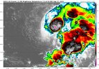
Philippe looks like he is putting up a fight so far tonight with at least sustained storms firing over the center as sheared as it is...

In fact as soon as the NHC said this

After the previous advisory, there was a convective burst with cloud
tops as cold as -80C that formed near the circulation center. More
recently, this burst has been waning in intensity, and it would not
be surprising to see the vortex become exposed again shortly


He fired a new burst of of -80C storms and is in fact growing that area currently....the future still looks bleak but again its fun to watch these little storms fight off the shear that is suppose to kill them, I am rooting for the little guy.


b0c6668f-2d63-4e4e-a31b-f9dbcfdae3a4.jpg

Philippe at 12Z

gefs_2023-09-26-12Z_144_27.737_282.183_11.533_306.629_MSLP_Surface_tracks_lows.png


Philippe at 18Z

gefs_2023-09-26-18Z_144_27.737_282.183_11.533_306.629_MSLP_Surface_tracks_lows.png


00Z---?
 
06 gfs has Phil off the NC coast. It drifts around for days and the lowest it gets is 999mb


gfs_mslp_pcpn_watl_61.png


This is how it ends with a low off FLA that tries to get going in the carib

gfs_mslp_pcpn_watl_64.png
 
11:00 AM AST Wed Sep 27
Location: 17.5°N 53.7°W
Moving: W at 9 mph
Min pressure: 998 mb
Max sustained: 50 mph


145431_5day_cone_no_line_and_wind.png
 
GFS has an interesting ending. The low in the carib has been drifting around since 240 and has begun to move north.

gfs_mslp_pcpn_watl_61.png
 
Philippe and Rina are 45 mph and at 1003 mb, and if you scroll up to the gifs you can see them rolling over towards the south.
 
Moves west into Jacksonville, Subtrop systems show up a lot this time of year.
gfs_mslp_pcpn_frzn_seus_63.png

Actually it could be argued that this is also mostly the energy left over from the hurricane the GFS takes into Mexico at hr 234, had to break it into 2 GIFS....crazy if this actually happened.

gfs_mslp_pcpn_frzn_us_fh234-294.gif


gfs_mslp_pcpn_frzn_us_fh294-378.gif
 
Am I the only one to see first the misery in those temps and DPs and be glad of what my forecast is today. Haha

Yeah GA is cooking lol....

GFS already has the big cane in the Pac again.....suspect Josh is foaming at the mouth with this one...could be a big hit on Cabo

gfs_mslp_pcpn_epac_37.png


This system matches up well with this tweet...

 
Status
Not open for further replies.
Back
Top