-
Hello, please take a minute to check out our awesome content, contributed by the wonderful members of our community. We hope you'll add your own thoughts and opinions by making a free account!
You are using an out of date browser. It may not display this or other websites correctly.
You should upgrade or use an alternative browser.
You should upgrade or use an alternative browser.
Tropical 2022 Atlantic Hurricane Season thread
- Thread starter Snowfan
- Start date
So this winter will be a 3rd year Niña? Not sure if I remember seeing that, in all my years of following weather
11-12, 01-02. I wouldn't be too excited about winter prospects in the SE right nowSo this winter will be a 3rd year Niña? Not sure if I remember seeing that, in all my years of following weather
Um, are we ever?! Haha11-12, 01-02. I wouldn't be too excited about winter prospects in the SE right now
accu35
Member
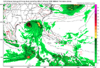
Last couple gfs runs are straight up into the northern gulf coast area.
Oooooof 11-12 makes me want to cry11-12, 01-02. I wouldn't be too excited about winter prospects in the SE right now
Yeah but 11-12 was a 2nd year Niña and was a big analog for this previous winter and it turned out nothing like 11-12.Oooooof 11-12 makes me want to cry
Brent
Member
Not as excited now.


Hardee's has a new fried egg and sausage biscuit... It's great.
accu35
Member
accu35
Member
Brent
Member
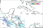
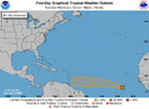
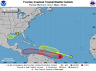
An area of low pressure is expected to develop by the middle part
of this week over the southwestern Caribbean Sea. Some slow
development of this system is possible while it drifts generally
northwestward off the coasts of Nicaragua and Honduras.
* Formation chance through 48 hours...near 0 percent.
* Formation chance through 5 days...20 percent.
of this week over the southwestern Caribbean Sea. Some slow
development of this system is possible while it drifts generally
northwestward off the coasts of Nicaragua and Honduras.
* Formation chance through 48 hours...near 0 percent.
* Formation chance through 5 days...20 percent.
accu35
Member
Last couple of gefs runs has this storm further north in the gulf. Something to watchAn area of low pressure is expected to develop by the middle part
of this week over the southwestern Caribbean Sea. Some slow
development of this system is possible while it drifts generally
northwestward off the coasts of Nicaragua and Honduras.
* Formation chance through 48 hours...near 0 percent.
* Formation chance through 5 days...20 percent.
Brent
Member
Last couple of gefs runs has this storm further north in the gulf. Something to watch
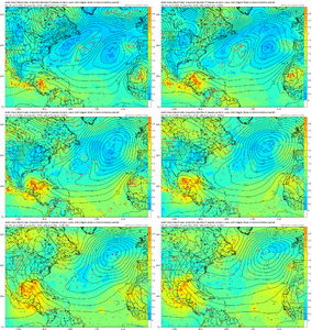
Probably gonna be hard to break the heat ridge if I had to guess but we'll see
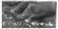
I know it's early to be looking at the Atlantic but what does the Sahara dust flow coming off Africa look like? It seems that in recent years it has put a cap on early development in the Atlantic.
Brent
Member
I know it's early to be looking at the Atlantic but what does the Sahara dust flow coming off Africa look like? It seems that in recent years it has put a cap on early development in the Atlantic.
There's some right now but that's very typical this time of year. It usually decreases towards August which ironically coincides with when the real season starts. You can still see development in between rounds though
Brent
Member
BHS1975
Member
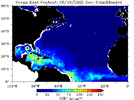
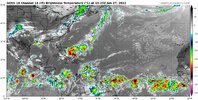
And with the early persistent heat wave the water will be boiling.That loop current in the Gulf is already sending off alarm bells. I think most of the season will probably be August September like usual but something in July definitely wouldn't surprise me View attachment 119323
Might be getting active in here soon
Brent
Member
Don't think they will make it across as climatology speaking its too early from that area, but who knows. How much SAL does everyone think they will erode?
Brent
Member
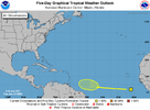
A tropical wave located over the eastern tropical Atlantic is
producing disorganized showers and thunderstorms. Environmental
conditions could become conducive for gradual development of this
system by early next week as the disturbance moves westward at
around 15 mph over the tropical Atlantic.
* Formation chance through 48 hours...low...near 0 percent.
* Formation chance through 5 days...low...20 percent.

Downeastnc
Member
Brent
Member
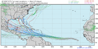
Holy ? at the Euro. It is pretty far south but the Euro also has a left bias but the strength alone is a ?


lexxnchloe
Member
If its going to be a hyperactive season thats the way to start it.Holy ? at the Euro. It is pretty far south but the Euro also has a left bias but the strength alone is a ?

weatherboyy
Member
this look like 2007 hurricane patterns .hmm
Brent
Member
NoSnowATL
Member
Stop teasing me Brent!
Brent
Member
weatherboyy
Member
we have 94L
accu35
Member
Whatever happens in the gulf, Texas to Florida P should get some nice rain chances.
Brent
Member
Tornadocane
Member
Brent
Member
There's like four or five tropical waves to keep an eye on.
View attachment 119533
If this is any sign of peak season it's gonna be ugly

