Gulf watch day 129.png")
Gulf watch day 129View attachment 121304
I'm all for easy baking the ATL latent heat transfer mechanism at this stage for Dec/Jan warmista cores, ECMWF indicates we could be pushing the later half of Sept, past peak, and at best a Gulf spin-up. I don't see anything on the radar or beyond, while not a full blown bust the envelope is closing. It's 9/7 after all, and we are still Day 10 +. It only takes 1, the likelihood of many is closing once we hit end of month.

We are past peak and the next 14 days look like poop. This season was and is a record bust. This is why you should never listen to predictions. Go ask Taxas AM about that!Where can I check out the current ACE?
And According to Wikipedia, where like tied for lowest record of Named activity.
View attachment 121365
I know it's only Sept. 12th, and we'll probably have another storm or two, but just highlighting how much the opposite this season has been so far compared to expectations.
There is no way we’ll reach 17 named storms. I won’t be surprised if we don’t get into the double digitsWhere can I check out the current ACE?
And According to Wikipedia, where like tied for lowest record of Named activity.
View attachment 121365
I know it's only Sept. 12th, and we'll probably have another storm or two, but just highlighting how much the opposite this season has been so far compared to expectations.


There is no way we’ll reach 17 named storms. I won’t be surprised if we don’t get into the double digits
1992………


Itshappening.exeTime to watch the gulf. ?
I've seen this before


This one is definitely the one to watchLooks like the wave around 10N 45W is what gets into the Caribbean and potentially the gulf. Outflow from fiona will be an issue early as well as interaction with South America potentially but once it's in the central/western Caribbean it'll have a decent environment to get going
Central Tropical Atlantic:
A tropical wave located several hundred miles east of the Windward
Islands is producing an area of disorganized showers and
thunderstorms. Some gradual development of this system is possible
during the next several days while the system approaches the
Windward Islands toward the end of the week and moves over the
eastern Caribbean sea over the weekend.
* Formation chance through 48 hours...low...near 0 percent.
* Formation chance through 5 days...low...20 percent.
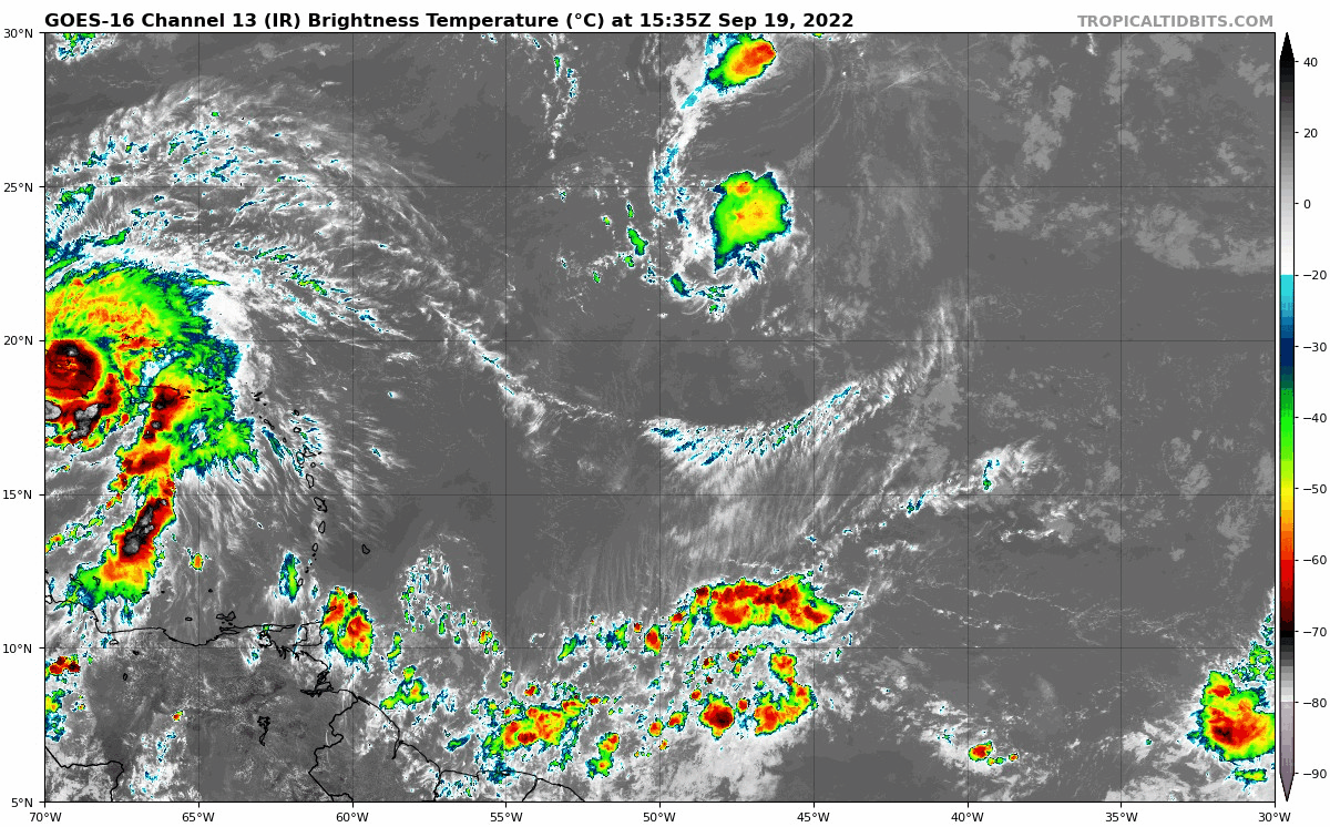

Yeap no way this goes ots being so far south.This one is definitely the one to watch

.png")

