Brent
Member
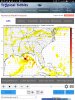
Texas bound

.png")


Here’s the GFS legacy hr234View attachment 21644
With that look, I could get some much needed rainfall!Here’s the GFS legacy hr234View attachment 21644View attachment 21646


Timing? Pressure? Comes up east coast or across?The UKMET has a TC hitting the NC VA at the end of its run fwiw
")
Forms just off the southern outer banks and hugs the coast as it moves north and look to finally make landfall around NC VA lineTiming? Pressure? Comes up east coast or across?

Poof.....there it goes in 12z GFS, both versions.
It would be short of funny if the Euro flips...Yep we'll have to wait for the ensembles to see if it was a fluke or if it really just doesn’t have the system
Ya never know it could always happen. I’ve seen it happen plenty of times.It would be short of funny if the Euro flips...
Yep we'll have to wait for the ensembles to see if it was a fluke or if it really just doesn’t have the system

At the end of its run, not likely but if it keeps showing it, it’s worth watching.This could be trouble. It's at the tail of 12z GPS. Dependent on the sequence of events before and if the ridge lets it in....
View attachment 21654
.png")
Yep euro stronger and eastInteresting previous runs there was nothing at the surface View attachment 21656

.png")
Euro tries but I think most try to do it off the SC NC coast.....here’s the euroSo what y'all think about the possible system models try and spin up this weekend off the FL GOM Coast?...


Agreed.....as well models consistently placing a wave in the middle of it. Prime conditions.....it will depend on the movement of the ridge in the endgame and how much tropical moisture it lets through the gate.Not a forecast, just an observation:
Gulf water temps are like hot tomato soup
Sheer in the upper Gulf is non-existent
A front is draping down and looks to hang, once it clears the Gulf coast
There's lots of unstable moisture along the Gulf
MJO is not good for ongoing in-close calm
Just stuff to consider and watch ...