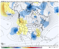
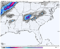
Not a good look at all. Starting to get bad for the mountainsView attachment 132610
Excellent
-
Hello, please take a minute to check out our awesome content, contributed by the wonderful members of our community. We hope you'll add your own thoughts and opinions by making a free account!
You are using an out of date browser. It may not display this or other websites correctly.
You should upgrade or use an alternative browser.
You should upgrade or use an alternative browser.
accu35
Member
? Arkansas?The Ozarks might be safe at this point
iGRXY
Member
Yep, the one thing we kept was the track even when the ULL amplified. Euro would’ve been an apps runner.Not a good look at all. Starting to get bad for the mountains
rburrel2
Member
I wouldn't say that. Upper low should be moving ENE from there since its already rounded off. Mountains would get crushed over the next few frames as the cold core comes through.Not a good look at all. Starting to get bad for the mountains
Huh?Not a good look at all. Starting to get bad for the mountains
rburrel2
Member
I'm not even sure it's more amped. Looks like it's just 3-4 hours slower to me.
It would keep with the theme of this winter. The Ozarks have had a bunch of snow going back into November.? Arkansas?
Who's got the euro 850 vort map that should settle this quick
NBAcentel
Member
That euro run was really bad, like really bad
iGRXY
Member
that was going to end ugly. We’ve been able to amplify the system without it cutting severely. That is a prime example of when amplifying goes bad. It’s a delicate balance between an amplified system that rides a positively tilted trough and a cutting monster.
Amped up is fine if it's not too soon, it's really not complicated
Stepping away from this insanity. Too much time until onset, and can just smell rain.. lots of it!!
iGRXY
Member
You’re fighting the delicate balance between a weaker wave that’s going to give you a really great track but weak precip and no ability for dynamic cooling and an amped wave that does exactly what the euro did which is not round the bend but come to a dead stop and cut NE. You need a blend of the GFS weaker and more southern solution and what the euro just spit out.
iGRXY
Member
iGRXY
Member
It’s slower but it was cutting hardI'm not even sure it's more amped. Looks like it's just 3-4 hours slower to me.
D
Deleted member 609
Guest
I'm just all in on GFS at this point
Don’t think it is so much an amplitude issue on the Euro as it is track. The wave is just detaching itself from the trough and floating slowly thru the ArkLaTex into MS. The slow trek opens up the door along the east coast for it to climb north as there is less of a height press then. It looks more like the (gulp) UKMet
Does anyone have a snow accumulation map for 18z Euro?
Flotown
Member
is off cycle euro to be taking seriousky?just used to 00 z and 12 z
olhausen
Member
ForsythSnow
Moderator
People are all doom because it didn't go well in the carolinas but I have to question if it made it better or worse for GA so I know if I should be with you hoping it to stop or hoping it stays like this.
Now that I see the above I hope it goes back
Now that I see the above I hope it goes back
"off cycle" runs are just as reliable as "on cycle" runs. The most accurate forecast is typically the most recent one. That goes for all models, not just ECMWF.is off cycle euro to be taking seriousky?just used to 00 z and 12 z
rburrel2
Member
Is the 18z GFS more accurate than the 12z Euro? I've always wondered this, but dunno if anyone tracks verification scores like that."off cycle" runs are just as reliable as "on cycle" runs. The most accurate forecast is typically the most recent one. That goes for all models, not just ECMWF.
You're welcomeSure do. This thing coming west so fast middle Tennessee will be to far east by tomorrow ?
View attachment 132618
Nomanslandva
Member
18z euro was amped and looked NW. 18z GFS was SE to the point rke was almost dry. Lots of work to do on this one.
iGRXY
Member
That wouldn’t have ended well for Georgia either. That was going to be a Nashville special.People are all doom because it didn't go well in the carolinas but I have to question if it made it better or worse for GA so I know if I should be with you hoping it to stop or hoping it stays like this.
Now that I see the above I hope it goes back
There’s no cold air to tap! How’s this possibleA view of the cold temperatures that the upper low is bringing with it aloft (from 12z Euro at 700mb)...

I've not seen statistics on this, but I imagine that the 18z GFS would be more accurate than the 12z ECMWF for closer range forecasts, and the 12z ECMWF would be more accurate in the longer range (>48hrs).Is the 18z GFS more accurate than the 12z Euro? I've always wondered this, but dunno if anyone tracks verification scores like that.
if you compress the troposphere, temperatures decrease dynamically. Pressure drops, air rises, temperatures drop.There’s no cold air to tap! How’s this possible
That’s what I am saying!!!Sure do. This thing coming west so fast middle Tennessee will be to far east by tomorrow ?
View attachment 132618
IDK. I would think that cole-core would slide ENE tucked in behind the developing coastal. I'll take my chances with that stout UUL moving northeastward from south central Ga.That wouldn’t have ended well for Georgia either. That was going to be a Nashville special.
Here in SC you could have every model on your side except one. And deep down you know that one, regardless of which one it is will be correct and all the others will cave to it. Goofus will still be Goofus for awhile. We'll get NAM'd and other short range models will offer hope. But I'd bet the farm they all look like the 18Z Euro just did once we get inside 24 hrs. I've been around too long to fall for it.
Yeah that Euro run was a little bit surprising that the track of the surface low stayed the same while the upper low shifted west. You would think that the upper low would follow in tandem with a deepening surface low on the coastIDK. I would think that cole-core would slide ENE tucked in behind the developing coastal. I'll take my chances with that stout UUL moving northeastward from south central Ga.
J1C1111
Member
Preach brother. I hate to hear it but your probably going to be right. I hope not but we haven't caught a break around here in a long time.Here in SC you could have every model on your side except one. And deep down you know that one, regardless of which one it is will be correct and all the others will cave to it. Goofus will still be Goofus for awhile. We'll get NAM'd and other short range models will offer hope. But I'd bet the farm they all look like the 18Z Euro just did once we get inside 24 hrs. I've been around too long to fall for it.
Tarheelwx
Member
Keep in mind the storm wasn’t complete when the 18z Euro ended. There was likely a lot more to happen on Sunday.
TW
TW
packfan98
Moderator
18z EPS will show the whole storm here in a few minutes.Keep in mind the storm wasn’t complete when the 18z Euro ended. There was likely a lot more to happen on Sunday.
TW
You must be in Beaufort or Charleston,Here in SC you could have every model on your side except one. And deep down you know that one, regardless of which one it is will be correct and all the others will cave to it. Goofus will still be Goofus for awhile. We'll get NAM'd and other short range models will offer hope. But I'd bet the farm they all look like the 18Z Euro just did once we get inside 24 hrs. I've been around too long to fall for it.
Maybe the midlands?
Upper level lows are crazy. I remember not having any snow expected in March of 2009 and then it came out of nowhere. I was a freshman in high school and was at the state basketball playoff games and came out to winter storm warnings about 24-36 hours before it started.
With these massive changes 84-96 hours out, there is no telling what this system will do. I’m still keeping an eye on it even for our area. I just hope someone on here gets smoked who hasn’t seen snow in awhile!
With these massive changes 84-96 hours out, there is no telling what this system will do. I’m still keeping an eye on it even for our area. I just hope someone on here gets smoked who hasn’t seen snow in awhile!


