severestorm
Member
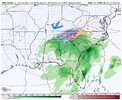
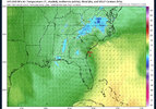
18z icon more amped.
How does it look over the top with the cold?ICON has the trough more positively tilted this run so far
It should be illegal to interfere with Happy Hour.Tropical tidbits will be down tomorrow from 3-7PM which is honestly just the best timing ever
You can pick up the ICON at weather.us and they have more maps available, too.Tropical tidbits will be down tomorrow from 3-7PM which is honestly just the best timing ever
Not there yet. It needs to go west some more. The euro definitely caught my attention with that last run and the snowfall shifting a lot more to the west. My house is in the red circle right where that red dot is. That said I’m really pulling for the North Carolina folks to get this one as y’all deserve it. I’ve had plenty the last few years so I’m more then willing to sit this one out if you all out east can score. I won’t complain though if it does make it’s way out here ?Lol congrats @olhausen View attachment 132570

I wouldn’t call it a day with one ICON run lol. Long way to go folks. Lots of changes in the next 48-72 hrsIcon has me at 38 to 39 degrees around 5 am on Sunday with 850's near -1C. Sooooo close. Heavy precip rates, too. Just too warm in the boundary layer. Coldest rain of the season inbound!
How do we get rid of boundary layer issues. Is there any hope?Icon would be an epic crush job for the upstate if it didn't have boundary layer issues. Still a good hit as depicted.
FWIW, we've seen the Icon get some setups correct, but it's not known for being stellar with temperatures.Icon has me at 38 to 39 degrees around 5 am on Sunday with 850's near -1C. Sooooo close. Heavy precip rates, too. Just too warm in the boundary layer. Coldest rain of the season inbound!
Wait for Hi-Res models to pick up on on dynamic cooling. (That's the hope) NAM doesn't have any boundary layer issues.How do we get rid of boundary layer issues. Is there any hope?
“Soundings across the Upstate show all snow, except for a shallow (100-200 ft) warm layer, so can certainly envision snow falling thru mid morning Sun, yet mostly melting as it falls.”Afternoon discussion from GSP.
LONG TERM /SATURDAY NIGHT THROUGH WEDNESDAY/...
As of 215 PM Wednesday...An active ext range is in store as a stout
closed upper low transits the southeast states and instigates sfc
cyclogenesis along the Carolina coast. The models are coming into
better agreement with this feature, however, the 12z GFS is still a
bit of an outlier with it/s faster and more eastern track thru Sun.
This low will interact with an existing and moist sfc bndry and it
will also generate it`s own moisture due to good dyno lift/cooling.
So, PoPs will be advertised in the likely range thru Sat night
across the entire FA then drop below 50 percent during the afternoon
Sun. This system still looks to remain mostly a rain/snow event with
some possibility of -fzra Sun morning across the NC escarpment when
a little higher llvl thicknesses get wrapped in off the coast.
Otherwise, the wintry weather will be snow. The best chance for
heavier accumulating snow still looks to occur across the higher
elevations of the NC mtns, while areas east of the mtns could see
low-end snow accums, especially across the I-40 corridor. The
biggest fly in the ointment as far as accum snow east of the mtns
will be sfc temps. Right now, dry and wetbulb temps too high for
much of a direct accum potential, however, any enhancement by elCAPE
and CSI could create snowfall rates high enuf for modest snow
accums. Soundings across the Upstate show all snow, except for a
shallow (100-200 ft) warm layer, so can certainly envision snow
falling thru mid morning Sun, yet mostly melting as it falls. This
system is still a day 4 event and as such will begin an HWO mention
this afternoon, with likely higher-end messaging as the the pattern
and details become more clear over the next couple days. Still
expect Sun/s max temps around normal across the sw/rn zones due to
earlier thickness rises, while maxes are held about 10 degrees below
normal across the NW NC Piedmont. A srn stream high builds in Mon
and helps bring temps back abv normal thru Tue.


The track was awesome though.Another deep southerly track from the GFS, but it looked like it wasn't quite as strong / deep with the upper low, so the column wasn't as cold on a widespread basis

Statesboro Slammer. Not far from @GaWx now ? And a couple ticks from a Hogtown HammerClasses cancelled at Georgia Southern on Monday

It really was. Just need it to go gangbusters on the strength scale to get the coolingThe track was awesome though.
I don't know. GFS was first to sniff this out and ensembles were further east.I think we can safely toss this run. Still the only model with that far south and east evolution of the 5h low.
View attachment 132582
With that NW trend I'm sitting pretty ?
Yeah GFS is the outlier, but if I'm you, I'd want the outlier being south like that. One other thing is that both the EPS and CMCE bumped south at 12z
All else being equal, I like where our area is sitting. NW trend rarely doesn't happen. Marginal as heck, but it beats looking at 10MB charts for an SSWE unicorn with my AM coffee for a month.With that NW trend I'm sitting pretty ?
Of course what's more likely to happen is?
Considering Augusta’s the bullseye this far out one could consider that points NW will be sitting pretty with this look, if BL temps can cooperate, but if what GFS is saying is true and if I’m interpreting correctly what I’m seeing here so far, rate driven is (as stated before) obviously key since surface temps are not great to begin with?All else being equal, I like where our area is sitting. NW trend rarely doesn't happen. Marginal as heck, but it beats looking at 10MB charts for an SSWE unicorn with my AM coffee for a month.
