iGRXY
Member
I have some bad news lolHopefully it keeps shifting south and Charleston can get in the game lol
I have some bad news lolHopefully it keeps shifting south and Charleston can get in the game lol
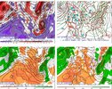
WOW! that is an old school image. People really have no idea how hard it used to be to do this hobby.Here is the Day 7 forecast from the Euro for March 2009. It looks like the current GFS lol. I know the UL track ticked NW close to go time (shocker)

The lack of an Arctic airmass close by is really why I doubt we’ll see a snow footprint outside the mountains as expansive as what the GFS was showing… even if it’s exactly correct on the track. IMO I think there will be an area of accumulating snow outside of the mountains, but I think it will most likely be in a band 60-80 miles wide or less… only were you see the best dynamic cooling. The March 2009 storm had a great fresh cold air mass to the north and a significant shot coming In behind the front… areas that got snow cover east of the mountains saw highs stay in the 30s for two days after. Now if that SE Canada does keep trending further south, that could definitely change.It would be nice if arctic air was in place or trailing close enough to be advected in. Marginal cool may be enough for areas to win but you have a thin area where you can capitalize on enough dynamics to band up precip and cool down from 875 to sfc. For you guys still in the game I would be watching the 925->850 tracks and wind vectors as much if not more than the 500 or sfc lows. Additionally I'd be watching the likely mid level dry punch that's going to happen.
Its ok I know I'm use to it lol.I have some bad news lol
You caved a little...earlier you said just mountains...now it's mountains and foothills. CLT to GSO have a chance.

I scored pretty darn good with that storm here with about 6" of paste. My Dad's house ten miles east got close to 10".Don't even mention that storm. The most frustrating storm in my life. We had thundersnow off and on all day and it accumulated to maybe 1/2" in West Georgia.
That’s good to hear. I miss him doing those videos just about daily. He has a wealth of knowledge, especially for all the regional microclimates we have in the CarolinasEast’s videos from back then are still available on his YouTube page, last I checked, FYI. He started making them sporadically again, and I know he made a few around our Christmas cold snap.
I think most of the precip had ended where I lived by the time late afternoon arrived, probably why it didnt accumulate much.I scored pretty darn good with that storm here with about 6" of paste. My Dad's house ten miles east got close to 10".
I'm convinced had the storm occurred at night, a foot or more would have accumulated here. 34-35 degrees throughout, with tater chips so big I could spot them as they left the cloud base yet they struggled to accumulate until late afternoon when the March sun angle lost its punch.
yeah we need it in SC
I was going to mention that November 2014 system. Also take a look at the 2/12/1999 system I mentioned earlier. I’m not sure on the H5 set up on that. I was going to look on your site, but it’s not up there… you have the map for a different storm that happened about a week later.Most of the really upper low events around here (including aforementioned Mar 2009 by another poster) don't fully cut off from the mean flow like this, where a ridge comes over the top & completely seals off cold air transport altogether. There's usually at least some modest interaction w/ the polar branch of the jet that continually feeds some cold air into the base of the upper low & it's all we usually need to change rain to heavy wet snow in the piedmont + coastal plain. Maybe a slightly stronger 50-50 low will help us out there as I've noticed the EPS + GEFS are trending in that direction, but we risk getting more ice than snow in such a case (bleh).
I'd love to see an event like this weekend actually pan out beyond the mountains, because of the thousands of storms I've looked at/analyzed, I can't think of or remember any upper low cases that did really well outside the mtns when there wasn't a little additional help coming from somewhere in the northern branch of the jet. It's just too warm most times to get a good snow from a totally cut off upper trough underneath a Rex Block. Those kind of setups even struggle big time out here in New Mexico, and I have an additional 4,000-5,000 feet of elevation to work with.
View attachment 132552
Famous last words, but I'll be a little more cautiously optimistic here than I'd like to be & I'll just assume that a storm like this at this time of the year isn't near-impossible, but rather it just hasn't been observed yet. The 4"+ snowfall from a cut off upper low near Columbia, SC on Nov 1, 2014 is reassuring proof of that.
It ticked 15-20 miles north in the last 24 hours before go time b/c I remember it took me from being outside the deform band to being squarely in the middle of it... and I was bouncing off the walls with excitement over the last minute shift.WOW! that is an old school image. People really have no idea how hard it used to be to do this hobby.
I think it drifted 75-100 miles N in the end but honestly, it wasn’t that dramatic
100 miles east of Charlestonyeah we need it in SC
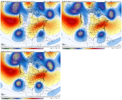
12z GFS Ens / CMC Ens / Euro Ens Comparison for when the wave is running thru the Palmetto State

Looks like the gfs has the strongest ridging over top, and thus the furthest south track. Man, I just wish it was right for once.
All in all, to me, the heaviest snow footprint today continues to be along the mountains areas, except the gfs op. Until we see the ensembles expand a good bit east showing the snow is less confined there, im afraid the Piedmont is just getting teased with noise. There's just not enough cold air.
I got 6 or 7 inches here with that storm in March 09.It ticked 15-20 miles north in the last 24 hours before go time b/c I remember it took me from being outside the deform band to being squarely in the middle of it... and I was bouncing off the walls with excitement over the last minute shift.
More shifts like what we been seeing and Columbia could definitely get in the game.I have some bad news lol
The best out for folks in the piedmont have is get a deeper/slower 50-50 low, another day or so for that to trend favorably and allow for a little more cold air transport at least initially, but it still wouldn't be great. Imagine if we had a 50-50 that was even a third as strong as the one that triggered the massive cold outbreak in New England last week ?.


Well dam, that's the 2nd time today I've posted the wrong model run. Clearly I need happy hour more than the GFS does

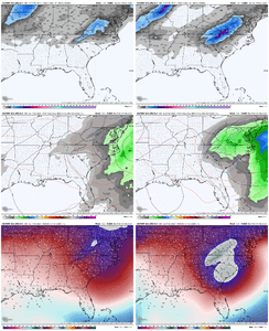
We tryin with that SE Canada low View attachment 132563View attachment 132564
Here's another image from that stormWOW! that is an old school image. People really have no idea how hard it used to be to do this hobby.
I think it drifted 75-100 miles N in the end but honestly, it wasn’t that dramatic

Congrats @ForsythSnow !acceptable. Was abt to drop a foot on me lol.
I have a spare bedroom. Bidding starts at $1000.
View attachment 132565
Feb 15/16 or Feb 26/27??The only case I can recall where we had a full-on Rex Block that actually worked out was Feb 2004. That case the 50-50 low was stronger and the center of the ridge anomaly was to the north, both more favorable indicators for injecting cold into a setup like this, that we don't seem to have atm.
I’m sure that it also helped that we had a reasonably deep cold airmass in place for that storm to help set up the overrunning snowfall that we had for the first part of it.The only case I can recall where we had a full-on Rex Block that actually worked out was Feb 2004. That case the 50-50 low was stronger and the center of the ridge anomaly was to the north, both more favorable indicators for injecting cold into a setup like this, that we don't seem to have atm.
Yup, temps much improved....NAM basically has no boundary layer issues or Western Piedmont regions.... just waiting for 750-850mb layers to crash at hour 84
View attachment 132569 .

It definitely was fixing to flip to at least sleetI fully believe the 18z NAM was about to obliterate NE GA and upstate SC after looking over soundings. Even Atlanta might have been in the game.
I mean... Concord and clt not so much... central NC nsm... upstate and N.GA hells yeah! (God I hope I am somewhat correct cause I have no idea what y'all are saying 90% of the time)
