tjed73
Member
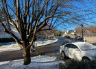
The best kind have the Storm day, Then everything gone after 2 days. then don't see another one for 3yrsThe big bad sun has unshaded asphalt covered areas nearly melted off already.
Would be nice if we had one of these where we didn’t get to 45 the next day.


My thoughts exactly. I've noticed I am generally a 2-3 degrees cooler here in midtown then the airport, esp in the fall/winter. Spring/summer its not as noticeable but usually a degree or so cooler sometimes. Looks like the airport is 33.4, I am at 31.8 right now.i mean I would imagine all the aircraft activity probably produces more latent heat near the surface and generally warms up the airport moreso than the surrounding areas. Just a theory though.
I’m a snowcover weenie, so I like when it sticks around, LOL.The best kind have the Storm day, Then everything gone after 2 days. then don't see another one for 3yrs
I do seem to remember that in the January 2011 storm, the airport reported 3” while pretty much every report in town was in the 5-8” range.The airport is generally warmer though than the city. The entire time they were reporting 34 I was at 31. I think it skews snow totals down there imo. No proof to this though LOL.
The big bad sun has unshaded asphalt covered areas nearly melted off already.
Would be nice if we had one of these where we didn’t get to 45 the next day.
Well we had a dam ChihuahuaSo, it was a surprise Great Dane for some and a little Yorkie to others in the end lol

That's awesome for Georgia.
Sent from my iPhone using Tapatalk
Dang, NE GA had it rough.
Sent from my iPhone using Tapatalk
It was a Yorkie with a Great Dane bark up hereSo, it was a surprise Great Dane for some and a little Yorkie to others in the end lol

This looks a lot more accurate to me
Sent from my iPhone using Tapatalk
This looks a lot more accurate to me
I can't help but laugh because in the days leading up to it ffc and local Atlanta TV Mets kept saying north of a line from Acworth to Gainesville to toccoa would be mostly snow/get the most...then to make it worse they lowered amounts to less than an inch I believe the night before. I HATED that graphic..the orientation/axis of precip amounts/types did not match model output or cad climo at all. Every time brad nitz on channel 2 or David chadley on 5..who should know better...showed it i was yelling at the TV lol.
Sent from my iPhone using Tapatalk
I can't help but laugh because in the days leading up to it ffc and local Atlanta TV Mets kept saying north of a line from Acworth to Gainesville to toccoa would be mostly snow/get the most...then to make it worse they lowered amounts to less than an inch I believe the night before. I HATED that graphic..the orientation/axis of precip amounts/types did not match model output or cad climo at all. Every time brad nitz on channel 2 or David chadley on 5..who should know better...showed it i was yelling at the TV lol.
I think that's just KATL. I saw a photo of someone in Virginia Highlands have around 4.3 inches when they measured with a ruler. I don't know why they use the airport for official measurements.
According to WSB-TV, Downtown Atlanta measured 3.5 inches of snow. That’s about what I got as well, I don’t live too far from the downtown area.That’s the airport reporting station south of town, too, right? So I’d assume downtown got a bit more.
