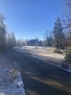
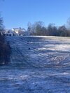
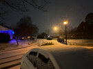
I do love the staying power of sleet. We’ve been above freezing for almost 20 hours and it still is holding strong even on the bridges and shady road areas. Cold ground helps too.
-
Hello, please take a minute to check out our awesome content, contributed by the wonderful members of our community. We hope you'll add your own thoughts and opinions by making a free account!
You are using an out of date browser. It may not display this or other websites correctly.
You should upgrade or use an alternative browser.
You should upgrade or use an alternative browser.
Wintry 1/9-12 Winter Potential Great Dane or Yorkie
- Thread starter SD
- Start date
Snowflowxxl
Member
‘Twas a great storm. The city still hasn’t gotten over 3 inches since 2011.
Was expecting sunshine and melting but very cloudy and snow is picking up in the mountains. 5”. totals vary in the county 3 to 6” with the heaviest near Purlear.
LukeBarrette
im north of 90% of people on here so yeah
Meteorology Student
Member
2024 Supporter
2017-2023 Supporter
King Street Boone, NC getting hammered currently on the live cam. 23 degrees. Would recommend the drive. 421 Wilkes is doable if know how to drive.
Good ol Roxboro
rburrel2
Member
LovingGulfLows
Member
- Joined
- Jan 5, 2017
- Messages
- 1,499
- Reaction score
- 4,100
‘Twas a great storm. The city still hasn’t gotten over 3 inches since 2011.
I think that's just KATL. I saw a photo of someone in Virginia Highlands have around 4.3 inches when they measured with a ruler. I don't know why they use the airport for official measurements.
Good ol Roxboro
Great stuff, so 1-1.5” here and ~0.1” ZR jives with about what I estimated with the ole mark 1 eyeball. The Wake County snow gradient lives.
‘Twas a great storm. The city still hasn’t gotten over 3 inches since 2011.
That’s the airport reporting station south of town, too, right? So I’d assume downtown got a bit more.
LovingGulfLows
Member
- Joined
- Jan 5, 2017
- Messages
- 1,499
- Reaction score
- 4,100
Drizzle Snizzle
Member
One person on here in Atlanta claimed they had 5-6" ?I think that's just KATL. I saw a photo of someone in Virginia Highlands have around 4.3 inches when they measured with a ruler. I don't know why they use the airport for official measurements.
rburrel2
Member
Yes. They like to cook the books any way they can. They should take a certain radius and get official measurements within that area to make their call on totals. It’s like me measuring every one of my snowfalls from the same spot in my yard year after year only now I have a big tree growing over that spot but I take the readings there anyway because I can’t use common senseI think that's just KATL. I saw a photo of someone in Virginia Highlands have around 4.3 inches when they measured with a ruler. I don't know why they use the airport for official measurements.
LovingGulfLows
Member
- Joined
- Jan 5, 2017
- Messages
- 1,499
- Reaction score
- 4,100
One person on here in Atlanta claimed they had 5-6" ?
I know Ryan Maue on twitter claimed he got 5 inches…its not out of the realm some isolated area did. I personally got around 4.2 inches of snow/sleet as well.
How did the GRAF model perform in NC, GA, and Upstate?
rburrel2
Member
Not good here on qpf out ahead of the warm nose. That was the difference between 3-5 and 1-2 for us. That fronto band did wind up stalling in ga and taking away qpf from the upstate Friday morning.How did the GRAF model perform in NC, GA, and Upstate?
LHow did the GRAF model perform in NC, GA, and Upstate?
Bad. Here's the final snow map from Jan. 9.How did the GRAF model perform in NC, GA, and Upstate?
I am in midtown. I did a measurement on our rooftop (31st floor) and we had 3.4" of snow. So, I am guessing 3" in the city or so, I don't know why they use the airport, which really isn't even near downtown honestly.One person on here in Atlanta claimed they had 5-6" ?
Okay cool. The GRAF did well in my area keeping us the right Ptype.. too bad it sucked elsewhere... Thought we had a new model to use
Drizzle Snizzle
Member
I wonder if there was more snow on the 31st floor than there was at ground level ?I am in midtown. I did a measurement on our rooftop (31st floor) and we had 3.4" of snow. So, I am guessing 3" in the city or so, I don't know why they use the airport, which really isn't even near downtown honestly.
That’s the thing about models often they are right for some and wrong for many. I’m sure euro AI did great for someone but it was poor for the Carolinas. Same for rgem. NAM did great for Carolina it seems as wellOkay cool. The GRAF did well in my area keeping us the right Ptype.. too bad it sucked elsewhere... Thought we had a new model to use
Drizzle Snizzle
Member
I think NYC does their measurements at Central Park. Maybe Atlanta could do theirs at Piedmont Park.
LovingGulfLows
Member
- Joined
- Jan 5, 2017
- Messages
- 1,499
- Reaction score
- 4,100
I think NYC does their measurements at Central Park. Maybe Atlanta could do theirs at Piedmont Park.
That would make too much sense though. This makes me question all of the historic measurements for Atlanta now. KATL's biggest snow is only around 8.3 inches back in 1940, but it wouldn't shock me if the city itself recorded over a foot.
Nailed the footprint really good, probably to far south with transition line ,espeacilly 2cnd part storm as it got all the way up toward MT airy briefly. Those AI models locked on an never waivered. Physics models bounce every which way as they zero in till last second.How did the GRAF model perform in NC, GA, and Upstate?
Drizzle Snizzle
Member
The Atlanta airport is only 10 miles south of downtown so I’m not sure why that would make a big difference in snow totals, but i guess in the south every mile matters.That would make too much sense though. This makes me question all of the historic measurements for Atlanta now. KATL's biggest snow is only around 8.3 inches back in 1940, but it wouldn't shock me if the city itself recorded over a foot.
Yes Atlanta airport is quite a bit SW of the city.
It did't seem like it tbh, I just wanted the best spot where no one had trampled it yet LOL. I doubt it made that much difference.I wonder if there was more snow on the 31st floor than there was at ground level ?
The airport is generally warmer though than the city. The entire time they were reporting 34 I was at 31. I think it skews snow totals down there imo. No proof to this though LOL.The Atlanta airport is only 10 miles south of downtown so I’m not sure why that would make a big difference in snow totals, but i guess in the south every mile matters.
How old/depth? Maybe it can be saved if the Taproot is okay
I think it made a big difference in 1993, and in some other storms. But not always.The Atlanta airport is only 10 miles south of downtown so I’m not sure why that would make a big difference in snow totals, but i guess in the south every mile matters.
ITUSETOSNOW
Member
Yes, it was me, and we did. 5.5 inches. Take it or leave it. It's still covered this morning.I know Ryan Maue on twitter claimed he got 5 inches…its not out of the realm some isolated area did. I personally got around 4.2 inches of snow/sleet as well.
rburrel2
Member
The euro ai did very good. Those snow maps posted from storm vista include ice/sleet. We don’t have sounding data from the euro ai(that I’m aware of), but it very well may have shown the 750-825mb warmnose.That’s the thing about models often they are right for some and wrong for many. I’m sure euro AI did great for someone but it was poor for the Carolinas. Same for rgem. NAM did great for Carolina it seems as well
It’s 850/700mb temp maps weren’t very far off, maybe a little too cool at 700mb. But it’s prob not a model you should be using to refine short range details anwways. It did phenomenal with the 4-7 day lead time. Like crazy good, blew every other model out of the water, imo.
ITUSETOSNOW
Member
The 1993 total was an utter joke.I think it made a big difference in 1993, and in some other storms. But not always.
Drizzle Snizzle
Member
You are the big winner in Georgia. Congrats.Yes, it was me, and we did. 5.5 inches. Take it or leave it. It's still covered this morning.
LovingGulfLows
Member
- Joined
- Jan 5, 2017
- Messages
- 1,499
- Reaction score
- 4,100
The airport is generally warmer though than the city. The entire time they were reporting 34 I was at 31. I think it skews snow totals down there imo. No proof to this though LOL.
i mean I would imagine all the aircraft activity probably produces more latent heat near the surface and generally warms up the airport moreso than the surrounding areas. Just a theory though.
The big bad sun has unshaded asphalt covered areas nearly melted off already. 
Would be nice if we had one of these where we didn’t get to 45 the next day.
Would be nice if we had one of these where we didn’t get to 45 the next day.


