Snowflowxxl
Member
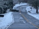
A little bit of melting taking place today but still solid white in most places. Main roads are in solid shape but back roads still a bit messy.
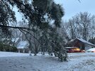
Temps here have not hit freezing yet and all the white is pure ice here. It's going to take a bit for this to melt. Roads are slowly drying and melting but trees remain iced.A little bit of melting taking place today but still solid white in most places. Main roads are in solid shape but back roads still a bit messy.
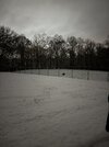
That’s what my yard looked like lmao
Temps here have not hit freezing yet and all the white is pure ice here. It's going to take a bit for this to melt. Roads are slowly drying and melting but trees remain iced.
Some of yall gotta move to the mountains this is too much fun. And I got my car unstuck, what a day.
Yep lol...they probably just copied and pasted it from their climo folder.That had been the TV met line since I was a kid. Grated it’s climo favored but still
Sent from my iPhone using Tapatalk
I somehow didn't see that post. I was about to say I was really surprised the far north didn't do better.This looks a lot more accurate to me
36 here. It's been mostly sunny here and all the ice on the trees is gone as well as most of the snow oustide of shady spots. It sucks being in the center of downslope hell.Yep even down here in Paulding it just now hit 33 imby. Out trees are still coated. The teens tonight are going to suck bigly.
31-34 seems pretty common across north ga atm
The sun this morning killed it here in the places that were sun facing. It’s since become cloudy and melting has subsided dramatically. You must’ve got a decent bit more than here, though (you probably got IP when we were ZR).Haven’t lost a whole lot of snow cover - I’m sure the ground being frozen is helping that.
we ended up with just a bit more than 2” of snow and sleet combinedThe sun this morning killed it here in the places that were sun facing. It’s since become cloudy and melting has subsided dramatically. You must’ve got a decent bit more than here, though (you probably got IP when we were ZR).
Ratchet strap that thing back upright and stake it up!
I think schools will remain closed on Monday in many areas.Still a winter wonderland here with 2 inches or so in most spots. Slush still on roads, and ice and snow are still on the trees. Temps have held steady at barely above freezing for a few hours. I expect some of the stuff in the sheltered spots might last until Monday or Tuesday. The snowmen will last a while anyway!
Ended up with 3 inches exactly in White House. I think 3-5 with a few 6 inch totals were about what most people got in the area. This was one of the rare storms where places south of me got more snow. That warm nose nudged the temps above freezing for about 3 hours and was the difference in a big dog 6 plus inches. Snow fell all day but only accumulated a few hours in the morning and early evening.Are there any official snow total maps coming out of middle Tennessee? About 4.5-5" here in the Bluff.


 View attachment IMG_1769.jpeg
And that is exactly where I live in the 5.9 spot..Thanks for all the negativity.
Sent from my iPhone using Tapatalk
My area is still covered,,,Roads are a mess...Ice still in trees,,Gray dark overcast all day,,,30.9Well every bit of the frozen is gone. You wouldn't have thought a winter storm came through here yesterday.
For now….It’s nice to have my normal days back and not having to schedule my life around when the next set of models comes out
Still a winter wonderland here with 2 inches or so in most spots. Slush still on roads, and ice and snow are still on the trees. Temps have held steady at barely above freezing for a few hours. I expect some of the stuff in the sheltered spots might last until Monday or Tuesday. The snowmen will last a while anyway!
 www.earthcam.com
Till TomorrowIt’s nice to have my normal days back and not having to schedule my life around when the next set of models comes out
with sunshine and temps in the 40s tomorrow most of it will be goneEven DT ATL is still pretty much covered...

Centennial Olympic Park Cam
Watch Atlanta live from the College Football Hall of Fame with EarthCam. See downtown skyline and Centennial Olympic Park events 24/7.www.earthcam.com
Definitely in the sunny areas, I face North with 0 solar radiation, my yard will take days to melt.with sunshine and temps in the 40s tomorrow most of it will be gone
OK, when’s the next one? Lol… I’m greedy like that.with sunshine and temps in the 40s tomorrow most of it will be gone
Beautiful picture...3.5” in North Buckhead near Chastain Park
View attachment 162852
heads up tonight
The ICON was the only model which for several of its last runs showed the light snowfall in SE Ga.
Winter Storm Cora Time Lapse. Finished with about 4.5-5". Hopin' those east of the Apps who haven't scored in a while can cash in on something similar before the winter is over. The TN Valley crew over on AmericanWx is rootin' for you guys!
