• Hello, please take a minute to check out our awesome content, contributed by the wonderful members of our community. We hope you'll add your own thoughts and opinions by making a free account!

Wintry 1/7/17-1/10/17 Winter Storm

Webberweather53 link said:
[quote author=modelwatcher link=topic=80.msg7248#msg7248 date=1483381468]
The GFS says winter storm warning and the other models say a winter weather advisory. LOL

Im honestly just happy that both model camps have wintry weather in some way, shape, or form, it's usually akin to picking teeth to get them to agree on that alone
[/quote]very good point. 5 days out, we will take it
 
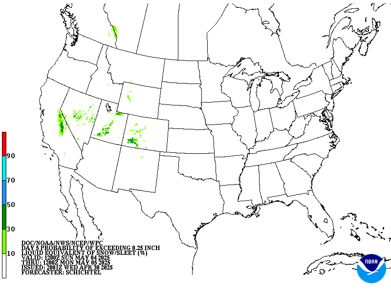
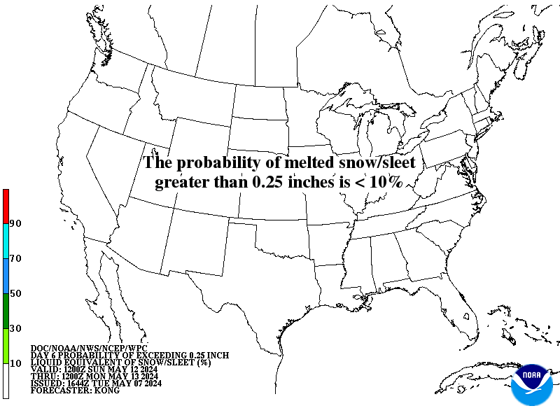
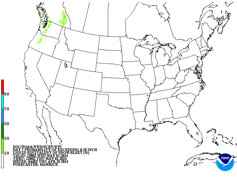
WPC is really stretching the boundaries now.
prbww_sn25_DAY5.gif

prbww_sn25_DAY6.gif

prbww_sn25_DAY7.gif
 
I don't think some realize just how little it would take for the Euro/CMC to look like the 12z GFS here and vis versa. A few minor details out west wrt stream separation and shortwave amplitude initialization will make all the difference in the world between nothing and a monster, the non-linearity here is pretty ridiculous. Even still, it's too far out to speculate on this or which scenario is more correct until we get some decent upper air data into these systems in ~ 36 hours...
 
So CMC has .5 or so for bham, gfs 2-3, Euro .5. At least all them have something. Maybe euro and cmc will trend snowier, but I'm not too upset with the position of anybody in or around central Alabama. Obviously northern folks may get heavier totals, but maybe we can get a nice 1-3 inch event for many. Still so much to happen with this one. But great trends the last 24 hours on most all models. Maybe EPS will be similar to GEFS
 
Per Allan Huffman.... 

Allan Huffman
‏@RaleighWx
Looks like the 12z ECMWF will look similar to the 00z run and the 12z GGEM. Which is a light wintry event for the SE Fri/Fri night.
 
Webberweather53 link said:
I don't think some realize just how little it would take for the Euro/CMC to look like the 12z GFS here and vis versa. A few minor details out west wrt stream separation and shortwave amplitude initialization will make all the difference in the world between nothing and a monster, the non-linearity here is pretty ridiculous. Even still, it's too far out to speculate on this or which scenario is more correct until we get some decent upper air data into these systems in ~ 36 hours...
+100000

Sent from my SM-G928V using Tapatalk
 
in regards to which model caves first, the euro isn't called "king" for no reason
 
Webberweather53 link said:
I don't think some realize just how little it would take for the Euro/CMC to look like the 12z GFS here and vis versa. A few minor details out west wrt stream separation and shortwave amplitude initialization will make all the difference in the world between nothing and a monster, the non-linearity here is pretty ridiculous. Even still, it's too far out to speculate on this or which scenario is more correct until we get some decent upper air data into these systems in ~ 36 hours...

Glory or failure having this type of setup and potential to track is great....  and so far every single scenario gives us NC folks something, so I like our chances
 
Shawn link said:
[quote author=FLO link=topic=80.msg7250#msg7250 date=1483381558]
Oh well....it was fun while it lasted. For a few hours.  :eyeroll:

Lol, you still get snow though.  It's just not a massive, crippling, ridiculous sleet and ice storm per Euro.

A middle ground of the GFS & Euro as of now.. would me our area very happy.  Idk about Chris though.. it'd prob be ZR either way, will have to see.
[/quote]

LOL  Relax, FLO.  We're in the game, as I stated previously.  That's all you can ask for at the moment.  The scenarios doesn't look bad at all, either.
 
Shawn link said:
[quote author=FLO link=topic=80.msg7250#msg7250 date=1483381558]
Oh well....it was fun while it lasted. For a few hours.  :eyeroll:

Lol, you still get snow though.  It's just not a massive, crippling, ridiculous sleet and ice storm per Euro.

A middle ground of the GFS & Euro as of now.. would me our area very happy.  Idk about Chris though.. it'd prob be ZR either way, will have to see.
[/quote]
Looks ok to me... Still 4 to 5 days out...


Sent from my iPhone using Tapatalk
 
Crazy how far apart the Euro and GFS are. But even the smallest detail can make all the difference.
 
Thundersnow89 link said:
in regards to which model caves first, the euro isn't called "king" for no reason
But it seems like recently it has been fighting more for its position as best. It hasn't been doing well in some cases within the past few weeks, but we will see.
 
I'm not at home atm, when I get home this afternoon I'll have some thoughts on the CMC and Euro.

Sent from my SM-J700T1 using Tapatalk
 
It's normal to get different models showing different solution and how strong the storm will be. The plus sign is that there will be wintry weather for those who's been wanting it, that a plus.
 
Well, we have 2 camps now....EURO would be a little light snow on the NW fringes, but verbatim its too warm for most.  EURO doesn't build in a high...We CANT have the energy come flying through like that IMHO.....There is no cold push and its moisture being chased by cold.  Is it right??  IDK  Honestly, it won't take much for either solution to verify...I wish we had more of a SFC high out in front like the GFS does.  We shall see, either way, I like the direction we are going right now.
 
97 Guests are viewing this boardMost Online Today: 258. Most Online Ever: 258 (Today at 12:33:22 PM) 8) :snowflake:


Guest we urge you to register. If this winter event is still looking good in a few more days they will have to limit the amount of info going out to the guest.  :snowflake: :snowflake: :snowflake:


Allan Huffman
‏@RaleighWx
So GFS/GEFS vs ECMWF/CMC/CMC ENS, EPS comes in later. Right now it would seem a blend of 12z GEFS/CMC ENS, 12z EC/CMC makes most sense
 
SD link said:
[quote author=Webberweather53 link=topic=80.msg7265#msg7265 date=1483381921]
I don't think some realize just how little it would take for the Euro/CMC to look like the 12z GFS here and vis versa. A few minor details out west wrt stream separation and shortwave amplitude initialization will make all the difference in the world between nothing and a monster, the non-linearity here is pretty ridiculous. Even still, it's too far out to speculate on this or which scenario is more correct until we get some decent upper air data into these systems in ~ 36 hours...
+100000

Sent from my SM-G928V using Tapatalk


[/quote]

I would gladly take a blend of the Euro and GFS and take half of what the GFS showed.
 
Webberweather53 link said:
That was a close one... A little more amped & further NW and the Euro looks like the 12z GFS

ecmwf_z500_mslp_us_6.png

Agreed...if we allow the northern branch to swing through and build the high in...its $$$$$$$$$$$$$$$$
 
Deltadog03 link said:
[quote author=Webberweather53 link=topic=80.msg7249#msg7249 date=1483381505]
That was a close one... A little more amped & further NW and the Euro looks like the 12z GFS

ecmwf_z500_mslp_us_6.png

Agreed...if we allow the northern branch to swing through and build the high in...its $$$$$$$$$$$$$$$$
[/quote]


money in the bank- love that
 
These differences always make me nervous but it's always a thread the needle scenario for us in the Deep South. Is EPS at 2?
 
12Z GFS gives an even 1 FOOT at Muscle Shoals, Al.
170107/0900Z 117  11008KT  29.9F  SNOW  11:1| 0.9|| 0.00|| 0.00|| 0.077  11:1|  0.9|| 0.00|| 0.00|| 0.08  100|  0|  0
170107/1200Z 120  08010KT  31.5F  SNOW  13:1| 3.4|| 0.00|| 0.00|| 0.259  13:1|  4.2|| 0.00|| 0.00|| 0.34  100|  0|  0
----------------------------------------------+----++-----+-------------++--------------++-------------++-----------+---+---
170107/1500Z 123  07008KT  31.9F  SNOW    9:1| 1.2|| 0.00|| 0.00|| 0.130  12:1|  5.4|| 0.00|| 0.00|| 0.47  100|  0|  0
170107/1800Z 126  03009KT  31.9F  SNOW  11:1| 2.7|| 0.00|| 0.00|| 0.240  12:1|  8.1|| 0.00|| 0.00|| 0.71  100|  0|  0
170107/2100Z 129  02010KT  31.5F  SNOW  17:1| 3.2|| 0.00|| 0.00|| 0.193  13:1| 11.4|| 0.00|| 0.00|| 0.90  100|  0|  0
170108/0000Z 132  36009KT  30.1F  SNOW    7:1| 0.6|| 0.00|| 0.00|| 0.088  12:1| [glow=red,2,300]12.0[/glow]|| 0.00|| 0.00|| 0.99  100|  0|  0
 
Sure would like to see that low crossing further south, else that will have to be a mighty cad to keep it from cold rain down here.  Further away from that heat pump the better.  This far out it's screaming iffy..but hey, that's the south, and if we ain't got iffy down here, we ain't got much, lol.  Remarkable Goofy has held on all this long a while, and plenty of time for a southward trend and sleet for Tony :)  I haven't had a good sled in 11 years.  It's time I saw another 4 inches of sleet with some snow on top.  Meanwhile, I just poured out 2.4 inches of the anti drought.  Over 70 days of nothing and now over 8 inches of liquid gold since the abrupt cessation of the Nothing.  Amazing weather we are having.
 
Deltadog03 link said:
[quote author=Webberweather53 link=topic=80.msg7249#msg7249 date=1483381505]
That was a close one... A little more amped & further NW and the Euro looks like the 12z GFS

ecmwf_z500_mslp_us_6.png

Agreed...if we allow the northern branch to swing through and build the high in...its $$$$$$$$$$$$$$$$
[/quote]
A high should build in behind a low...good weather follows bad weather.

Sent from my SM-J700T1 using Tapatalk
 
The Euro ensembles will tell us if there truly is a model battle or not. I fully expect there to be some GFS-like members in there.
 
metwannabe link said:
[quote author=Webberweather53 link=topic=80.msg7265#msg7265 date=1483381921]
I don't think some realize just how little it would take for the Euro/CMC to look like the 12z GFS here and vis versa. A few minor details out west wrt stream separation and shortwave amplitude initialization will make all the difference in the world between nothing and a monster, the non-linearity here is pretty ridiculous. Even still, it's too far out to speculate on this or which scenario is more correct until we get some decent upper air data into these systems in ~ 36 hours...

Glory or failure having this type of setup and potential to track is great....  and so far every single scenario gives us NC folks something, so I like our chances
[/quote]

Exactly. More than half of the battle is trying to get any wintry precipitation to begin with... The fact these models have such large discrepancies wrt timing, amplitude, antecedent airmass, low pressure track, etc. which still lead to snow/ice in NC is pretty telling
 
Dsaur link said:
Sure would like to see that low crossing further south, else that will have to be a mighty cad to keep it from cold rain down here.  Further away from that heat pump the better.  This far out it's screaming iffy..but hey, that's the south, and if we ain't got iffy down here, we ain't got much, lol.  Remarkable Goofy has held on all this long a while, and plenty of time for a southward trend and sleet for Tony :)  I haven't had a good sled in 11 years.  It's time I saw another 4 inches of sleet with some snow on top.  Meanwhile, I just poured out 2.4 inches of the anti drought.  Over 70 days of nothing and now over 8 inches of liquid gold since the abrupt cessation of the Nothing.  Amazing weather we are having.
I love the EURO track...haha
 
Stormlover link said:
12Z GFS gives an even 1 FOOT at Muscle Shoals, Al.
170107/0900Z 117  11008KT  29.9F  SNOW  11:1| 0.9|| 0.00|| 0.00|| 0.077  11:1|  0.9|| 0.00|| 0.00|| 0.08  100|  0|  0
170107/1200Z 120  08010KT  31.5F  SNOW  13:1| 3.4|| 0.00|| 0.00|| 0.259  13:1|  4.2|| 0.00|| 0.00|| 0.34  100|  0|  0
----------------------------------------------+----++-----+-------------++--------------++-------------++-----------+---+---
170107/1500Z 123  07008KT  31.9F  SNOW    9:1| 1.2|| 0.00|| 0.00|| 0.130  12:1|  5.4|| 0.00|| 0.00|| 0.47  100|  0|  0
170107/1800Z 126  03009KT  31.9F  SNOW  11:1| 2.7|| 0.00|| 0.00|| 0.240  12:1|  8.1|| 0.00|| 0.00|| 0.71  100|  0|  0
170107/2100Z 129  02010KT  31.5F  SNOW  17:1| 3.2|| 0.00|| 0.00|| 0.193  13:1| 11.4|| 0.00|| 0.00|| 0.90  100|  0|  0
170108/0000Z 132  36009KT  30.1F  SNOW    7:1| 0.6|| 0.00|| 0.00|| 0.088  12:1| [glow=red,2,300]12.0[/glow]|| 0.00|| 0.00|| 0.99  100|  0|  0
High snow rates indeed!

Sent from my SM-J700T1 using Tapatalk
 
SnowFlowXXL link said:
Honestly thought it was a good run. Keeps hope alive
We are all feeling pretty confident that there will be some type of winter weather event, but to what extent is still being figured out in the modeling. Could go either way
 
Stormlover link said:
12Z GFS gives an even 1 FOOT at Muscle Shoals, Al.
170107/0900Z 117  11008KT  29.9F  SNOW  11:1| 0.9|| 0.00|| 0.00|| 0.077  11:1|  0.9|| 0.00|| 0.00|| 0.08  100|  0|  0
170107/1200Z 120  08010KT  31.5F  SNOW  13:1| 3.4|| 0.00|| 0.00|| 0.259  13:1|  4.2|| 0.00|| 0.00|| 0.34  100|  0|  0
----------------------------------------------+----++-----+-------------++--------------++-------------++-----------+---+---
170107/1500Z 123  07008KT  31.9F  SNOW    9:1| 1.2|| 0.00|| 0.00|| 0.130  12:1|  5.4|| 0.00|| 0.00|| 0.47  100|  0|  0
170107/1800Z 126  03009KT  31.9F  SNOW  11:1| 2.7|| 0.00|| 0.00|| 0.240  12:1|  8.1|| 0.00|| 0.00|| 0.71  100|  0|  0
170107/2100Z 129  02010KT  31.5F  SNOW  17:1| 3.2|| 0.00|| 0.00|| 0.193  13:1| 11.4|| 0.00|| 0.00|| 0.90  100|  0|  0
170108/0000Z 132  36009KT  30.1F  SNOW    7:1| 0.6|| 0.00|| 0.00|| 0.088  12:1| [glow=red,2,300]12.0[/glow]|| 0.00|| 0.00|| 0.99  100|  0|  0
might as well post the cmc and euro totals for comparison

Sent from my SM-G900V using Tapatalk
 
Webberweather53 link said:
[quote author=metwannabe link=topic=80.msg7270#msg7270 date=1483382203]
[quote author=Webberweather53 link=topic=80.msg7265#msg7265 date=1483381921]
I don't think some realize just how little it would take for the Euro/CMC to look like the 12z GFS here and vis versa. A few minor details out west wrt stream separation and shortwave amplitude initialization will make all the difference in the world between nothing and a monster, the non-linearity here is pretty ridiculous. Even still, it's too far out to speculate on this or which scenario is more correct until we get some decent upper air data into these systems in ~ 36 hours...

Glory or failure having this type of setup and potential to track is great....  and so far every single scenario gives us NC folks something, so I like our chances
[/quote]

Exactly. More than half of the battle is trying to get any wintry precipitation to begin with... The fact these models have such large discrepancies wrt timing, amplitude, antecedent airmass, low pressure track, etc. which still lead to snow/ice in NC is pretty telling
[/quote]
Maola milk and bunny bread are excited to hear this lol

Sent from my SM-G928V using Tapatalk
 
Who else remembers this bad boy on this date back in January 2002? I was a lil' munchkin back then and have a very vague memory of the event...

accum.20020102.gif
 
Shawn link said:
Definitely not comparing this low with the blizzard of 1993...atm. The placements of the highs are similar...kinda

Sent from my SM-J700T1 using Tapatalk
 
Back
Top