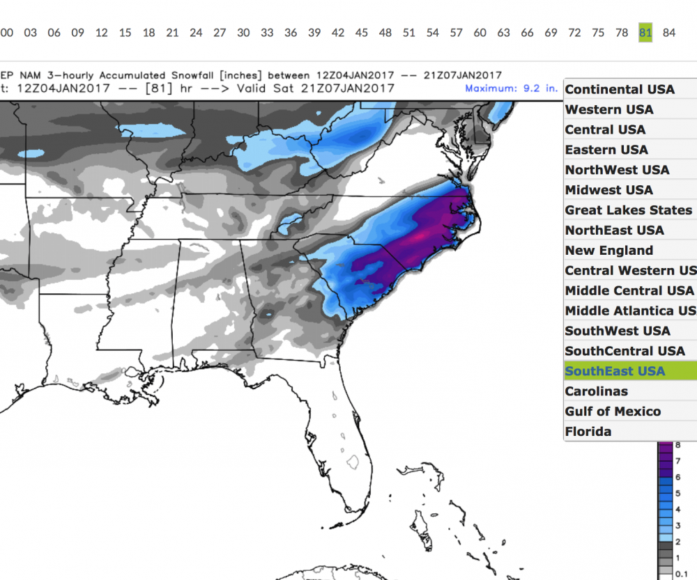
Look at the NAM snowfall output. The most snow comes in during the night hrs, less warming. When the sun comes up Sat. morning there won't be much warming...plus the cold air continues to be filtered in.ATLWxFan said:NorthGAWinterWx said:I think the models are overdoing the warm temps. Some places will have good snow amounts on the ground. There won't be much temp moderation.
Sent from my SM-J700T1 using Tapatalk
Based on what? Not being facetious. I genuinely want to know.
Sent from my iPhone using Tapatalk
Sent from my SM-J700T1 using Tapatalk


 :cry:
:cry: