WilkesboroDude
Member
Stormlover link said:IN case this hasn't been posted:

Those maps are created differently on weekdays vs weekends....weekdays have human input while weekend are model generated. I expect them to get worse soon.
Stormlover link said:IN case this hasn't been posted:

Nice to see model agreement at this range!Storm5 link said:12z para heads the wrong direction as well. pretty good model agreement from the 12z set
Sent from my SM-G900V using Tapatalk
Storm5 link said:12z para heads the wrong direction as well. pretty good model agreement from the 12z set
Sent from my SM-G900V using Tapatalk
yeah. i think were in troubleStorm5 link said:12z para heads the wrong direction as well. pretty good model agreement from the 12z set
Sent from my SM-G900V using Tapatalk
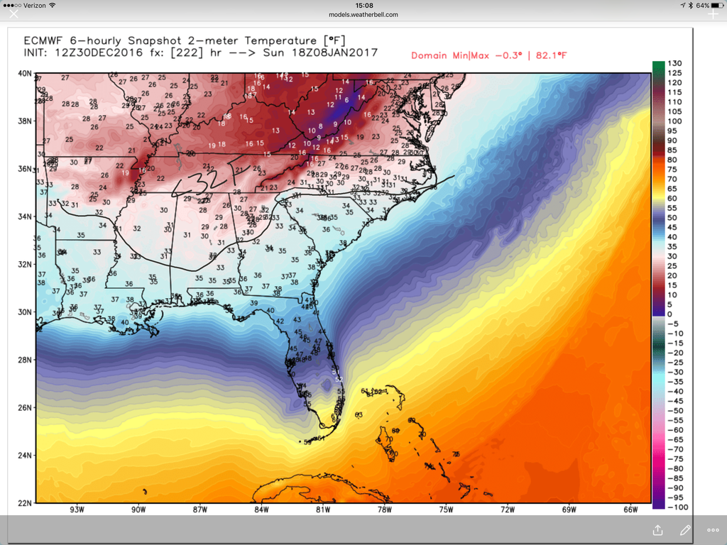
modelwatcher link said:Even if we do not score with wintry precip next weekend, the 12Z EURO has highs next Sunday at or below 32F for a lot of us. Looking very cold as of now.

Stormlover link said:IN case this hasn't been posted:

you guys usually get more than we doUsmeagle2005 link said:I had a feeling, I told my wife about it..... kids of death in my area. ? In Tupelo, Ms
you guys usually get more than we doJLL1973 link said:[quote author=Usmeagle2005 link=topic=80.msg5026#msg5026 date=1483135014]
I had a feeling, I told my wife about it..... kids of death in my area. ? In Tupelo, Ms
NorthGaWinter link said:Lock this thread and let's get the mojo going back in the January discussion
wow, unbelievable ??? ??? ??? ???NorthGaWinter link said:Lock this thread and let's get the mojo going back in the January discussion
I think we shouldn't just take two runs and jump the cliff. We should wait until tomorrow's 18Z, and if things keep getting worse, and trending NW, then we can all jump.NorthGaWinter link said:Lock this thread and let's get the mojo going back in the January discussion
I think we shouldn't just take two runs and jump the cliff. We should wait until tomorrow's 18Z, and if things keep getting worse, and trending NW, then we can all jump.ForsythSnow link said:[quote author=NorthGaWinter link=topic=80.msg5046#msg5046 date=1483136429]
Lock this thread and let's get the mojo going back in the January discussion
man, take a break....get away from it for a while..seriously.NorthGaWinter link said:1/7-1/10 drought buster thread. Change the name
man, take a break....get away from it for a while..seriously.Stormlover link said:[quote author=NorthGaWinter link=topic=80.msg5057#msg5057 date=1483136840]
1/7-1/10 drought buster thread. Change the name

Shawn link said:this was a slight step to a better result with the second wave. i'd check out the ensembles with this in a bit. al/ms/tn look a bit more Wintry this go around.
edit: also the whole second deal is slower vs 12
snow trying to make it into N. central/N. eastern NC. not horrible.
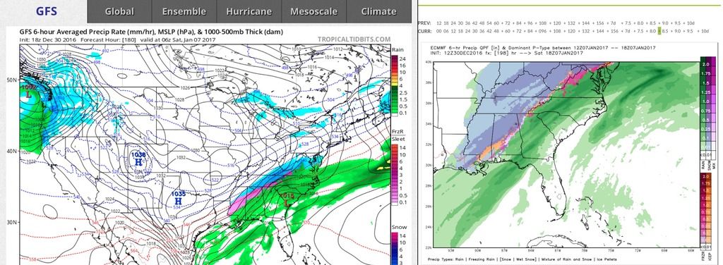
modelwatcher link said:Actually, the GFS and EURO are not too far off on the chances of some back end winter precip for some parts of the SE with the second wave...
