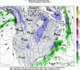
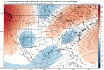
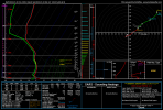
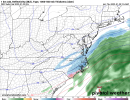
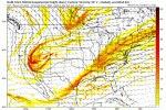
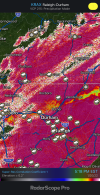
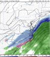
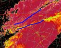
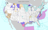
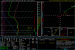
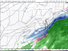
18z GFS pretty consistent with past runs. Still provides hope for a general 3-6” event across the eastern half of NC.
-
Hello, please take a minute to check out our awesome content, contributed by the wonderful members of our community. We hope you'll add your own thoughts and opinions by making a free account!
You are using an out of date browser. It may not display this or other websites correctly.
You should upgrade or use an alternative browser.
You should upgrade or use an alternative browser.
Wintry 1/20 - 1/23 Winter Storm
- Thread starter packfan98
- Start date
NBAcentel
Member
Lighter, likely related to the less tilt that was already noted. Honestly, I was expecting worse. I think it shows a reasonable outcome, more north and west coverage than other models but not dried out like the NAMRates looked lighter on that run
I haven’t looked into it too much tbh, but I had noticed that in the past. Could be a sneaky way that surprises a lot of people tomorrow and makes the roads impassable if that happens. A lot of people let their guards down when we were just given a WWA, but I think if we do get a couple inches this has the potential to be more impactful than a lot of warned storms given how cold it is. The roads will be a mess with even an inch or two. And if you throw freezing drizzle into that…@superjames1992 @metwannabe @FallsLake have y’all noticed the freezing drizzle present on the RAP soundings tomorrow morning? Gonna be a big ticket item for the northern triangle and border counties if it’s real.
18z GGEM looks pretty durn good, too.
Last edited:
This may belong in the banter forum but: This is going to hand down go down as one of the most exhausting storms that we've had to track in a while. So much disappointment and so much excitement at the same time. I really appreciate everyone's insight and play-by-play. I wish you all luck. Hopefully, we can all be pleasantly surprised come tomorrow. Now, it's literally nowcasting time.
18zs were a minor step down but in the same way that like Justin Herbert is a minor step down from Aaron Rodgers (that analogy is for scale only, not comparing this event to Aaron Rodgers).
Seemed like a retreat on the northern shortwave was mediated by a little better southern stream interaction. Unclear if there’s anything there or a little deck chair shuffling on the titanic. 00z is our last crack to see if we can get some favorable adjustments
Seemed like a retreat on the northern shortwave was mediated by a little better southern stream interaction. Unclear if there’s anything there or a little deck chair shuffling on the titanic. 00z is our last crack to see if we can get some favorable adjustments
ForsythSnow
Moderator
Hey maybe I'll be able to get in on some flake action now too, looks far better than last several runs but still got that dry pocketThat’s a trend View attachment 108865

2 runs ago

norcarolinian
Member
NBAcentel
Member
Any idea why no winter weather advisories for all this rain and temps being in the 20s all day tomorrow? Esp north of Charlotte dang. Statesville City Schools are gonna try a 3 hour delay I see.
I still think models are underestimating the power of all that lift on NW side of storm. It’s definitely slowing down a little also which helps.Little surprised GFS wasn’t better. NS trough digging more pumping heights out ahead. I guess to little to late.
View attachment 108870
Last edited:
Splitting hairs at this point, but I am noticing a “bit” more gulf moisture tap across the FL Panhandle, indicative of more stream interaction. Upper end is really set, seasonal average + for the Coastal Plain. Years when we blank, going to enjoy regardless of what ends up on the snow board or melt in the sensor.

Yeah and I've noticed with these types of setups, with spotty precipitation, there's always low level moisture/precip (drizzle) that models and nowcast radar don't show. It'll be interesting overnight.I haven’t looked into it too much tbh, but I had noticed that in the past. Could be a sneaky way that surprises a lot of people tomorrow and makes the roads impassable if that happens. A lot of people let their guards down when we were just given a WWA, but I think if we do get a couple inches this has the potential to be more impactful than a lot of warned storms given how cold it is. The roads will be a mess with even an inch or two. And if you throw freezing drizzle into that…
18z GGEM looks pretty durn good, too.
Down to 39. If I'm reading the NexRad radar correctly the transition is only 10 miles away from me. Problem, is it hasn't moved much in the past hour: https://weather.cod.edu/satrad/nexrad/index.php?parms=RAX-N0C-0-6-100-usa-rad
Very much agreed… I’m gonna say 1-2” from west to east across CLT metro, dusting to 1” north and west of there. I just have to believe the H5 looks we’re seeing along with that 700mb jet is going to give us at least a few hours of light to moderate snow that should be able to efficiently accumulateI’m sorry but I’m almost convinced there will be more on the NW side with a sounding like that and a northern stream wave digging in with strong dcvaView attachment 108872View attachment 108873
blueheronNC
Member
snowlover91
Member
brendan123
Member
34/34, all snow and sleet now
Not that it really matters, but the 12z NAVGEM looks pretty solid, similar to the GFS I’d say. Notable only because I tend to think it has a suppression bias? It’s not a good model, regardless, but at least we have the JMA and NAVGEM on our side. Killer combo!!! modernweenie
- Joined
- Jan 23, 2021
- Messages
- 4,602
- Reaction score
- 15,197
- Location
- Lebanon Township, Durham County NC
Roxboro hasn’t switched as of its last obs so my guess is it’s somewhere between Yanceyville and DanvilleWhich is the transition Line?
View attachment 108878
It's a step. At the very least, it looks like there will be some light snow around tomorrow evening. And it won't be the kind that you have to worry about melting before you get outside to look at it. It will be snowing and frigid. If we're lucky enough to pick up and inch or two, and if that hangs around through the day on Saturday, then we should be able to get to see the snow under a pretty bright moon Saturday night. That's one of the prettiest and most peaceful weather scenes you will experience.Well 21z RAP picking up on those backside bands and filling them in. Sort of like the RGEM but lighter. View attachment 108877
Good thing it should be a fairly efficient snowfall accumulation wise because it's going to be a quick hitter

The snow map from weathernerds using 'Dynamic Ratio' (below) was less in comparison to Kuchera
Here is just part of the write-up on the weathernerds site for how snowfall is calculated: ..."The algorithm uses model forecast snowfall liquid equivalent, along with temperature, relative humidity, and vertical velocity at 50 mb increments from 950 to 400 mb. The algorithm starts with the basic 10:1 ratio and then scales upward (or downward, see sections below on 2-meter temperature analysis and sleet/freezing rain) based on the number of 50 mb intervals in which saturated lift is detected within the dendritic growth zone (DGZ: defined in the code as -18° C ≤ T ≤ -12° C). If no saturated lift is detected in the DGZ, the 10:1 ratio is used. If 5 or more 50 mb intervals contain saturated lift within the DGZ, a 25:1 ratio is used. When between 0 and 5 intervals are detected, a quadratic function is applied"
So the soundings are showing snow, but the low and mid-level warm advection contributing to ascent is modest. On the flip side, this keeps the warm nose at bay. The strongest forcing for this storm is higher aloft associated with the incoming 500mb wave and upper level jet divergence (generally above the DGZ) - you can see that with the pink line on the left side of the sounding below for Raleigh. The low and mid level forcing is better as you work east toward the coast.
Bottom line: the main source region of the storm (northern stream) and the cold sounding profiles support higher snow ratios, but efficient dendrite formation is still needed in order for higher ratios to be realized. Admittedly, the GFS being a global model isn't going to pick up on banded, heavier lift as the higher resolution models will....but, it's not going to be way off in concept either


NBAcentel
Member
NCWeatherhound
Member
We got a smart aleck down around Autryville ...


^ You can see when comparing the GFS Kuchera and weathernerds snowfall map how they are more similar along the coast as the weathernerds map is picking up on the better mid level rising motion compared to farther inland
NBAcentel
Member
Sctvman
Member
CHS pretty much shut down tomorrow even though most of the frozen precip won’t get here till sunset. All schools virtual.
Christian T Murray
Member
We got a smart aleck down around Autryville ...holly springs also ?
- Joined
- Jan 23, 2021
- Messages
- 4,602
- Reaction score
- 15,197
- Location
- Lebanon Township, Durham County NC
Henderson-Oxford airport down to 32 along with South Hill.
Christian T Murray
Member
snowing in henderson, nc now
Ron Burgundy
Member
Don’t think it’s a coincidence that FFC’s site is down. They probably gave up and went home when they saw that run.That’s a trend View attachment 108865
Pretty looking heavy flakes around Winston Salem Forsyth county
Is that some kind of dry slot nw of the Triangle?Oh wow, cod shows it better but those soundings to me look good for light-moderate snow as far back as GSO/CLT, you can even see the nice lift in the DGZView attachment 108883View attachment 108885
Tokenfreak
Member
CHS pretty much shut down tomorrow even though most of the frozen precip won’t get here till sunset. All schools virtual.
I noticed that as I live in the Charleston area. Maybe they think it could be worst then they forecasted?
Sent from my iPhone using Tapatalk
Statesville down to 36 and dropping with growing radar returns.
BelmontWX79
Member
Possible at beam height it's changed to snow but low level temperatures aren't quite supportive of it reaching the ground.Roxboro hasn’t switched as of its last obs so my guess is it’s somewhere between Yanceyville and Danville

