It dropped a couple of inches in Raleigh? That is all it showed at 12Z. Oh, now I know what you mean.?Not a big dog or anything, but definitely a tick in the right direction. Drops a couple inches in Raleigh, bigger totals east of there and especially NE NC/SE VA.
-
Hello, please take a minute to check out our awesome content, contributed by the wonderful members of our community. We hope you'll add your own thoughts and opinions by making a free account!
You are using an out of date browser. It may not display this or other websites correctly.
You should upgrade or use an alternative browser.
You should upgrade or use an alternative browser.
Wintry 1/20 - 1/23 Winter Storm
- Thread starter packfan98
- Start date
SouthSideYankee
Member
Snow definitely mixing in here in Durham.
Cary_Snow95
Member
Who’s got the 18z snow map
18z euro actually went down here lol
Mostly sn/ip now, light amounts but deck and vehicles have a light coating. Would appears radar does not look as robust as HRRR advertised, a dusting maybe if lucky but I think the HRRR was too aggressive with amounts
Mostly sn/ip now, light amounts but deck and vehicles have a light coating. Would appears radar does not look as robust as HRRR advertised, a dusting maybe if lucky but I think the HRRR was too aggressive with amounts
Snowing on my work webcams. Tank Farm Gboro for point of reference.
Ill check outside here in a few northern Randolph county
Ill check outside here in a few northern Randolph county
Who’s got the 18z snow map

Light snow here at 34 degrees.
campamy
Member
Just arrived in Augusta GA, on my way up to Jacksonville NC. Should be ok driving before noon, correct? I plan to drive through Columbia, SC.
- Joined
- Jan 23, 2021
- Messages
- 4,604
- Reaction score
- 15,203
- Location
- Lebanon Township, Durham County NC
It’s possible it could get dicey on the highways in Columbia. There’s several elevated interchanges in town. I expect it to get worse toward Florence and Darlington.Just arrived in Augusta GA, on my way up to Jacksonville NC. Should be ok driving before noon, correct? I plan to drive through Columbia, SC.
- Joined
- Jan 23, 2021
- Messages
- 4,604
- Reaction score
- 15,203
- Location
- Lebanon Township, Durham County NC
Light snow, 33 degrees.
Light snow Northern Randolph
Bannerdude
Member
Rain/snow mix now east of Durham
NBAcentel
Member
rain snow mix here
Temperature really starting to drop here… 38/34 down from 41/38 last hour
If I did a call map it would probably be a carbon copy of this NBM, maybe just a tick higher down east

iGRXY
Member
Not saying this is going to happen by means but the radar back in Texas is extremely healthy and north of most guidance to my knowledge. It honestly looks like the RGEM runs from a couple nights ago. Again not saying we get as much snow as that showed but that’s what the real returns back in Texas look like.
Christian T Murray
Member
If I did a call map it would probably be a carbon copy of this NBM, maybe just a tick higher down east
I honestly see this turning out like December 2004 event feel like precipitation will be more pronounced than currently being modeled.
NCWeatherhound
Member
38 in central Harnett .... that's a few hours ahead of schedule.
My first forecast call for downtown Raleigh for the main show:
0.2 liquid
15:1 snow to liquid ratio
3.0 inches snow
Best snow Friday 7pm to Midnight with temperatures in the mid-20's
Good luck!
0.2 liquid
15:1 snow to liquid ratio
3.0 inches snow
Best snow Friday 7pm to Midnight with temperatures in the mid-20's
Good luck!
36/34 RDU reported ice pellets briefly. Currently all drizzle here
D
Deleted member 609
Guest
Union county schools canceled
Downeastnc
Member
18Z GFS for PGV, good ratios and averaging .50" a hr rates just not enough QPF.....this gives us 4" of snow with just .29" of QPF, that's about as good as it ever gets here.....even another .25" of QPF would be good....frustrating......
220122/0100Z 31 02012KT 26.9F SNOW 7:1| 0.1|| 0.00|| 0.00|| 0.011 7:1| 0.1|| 0.00|| 0.00|| 0.01 100| 0| 0
220122/0200Z 32 01013KT 26.7F SNOW 17:1| 0.3|| 0.00|| 0.00|| 0.017 13:1| 0.4|| 0.00|| 0.00|| 0.03 100| 0| 0
220122/0300Z 33 01012KT 26.1F SNOW 15:1| 0.6|| 0.00|| 0.00|| 0.038 14:1| 0.9|| 0.00|| 0.00|| 0.07 100| 0| 0
220122/0400Z 34 36012KT 25.8F SNOW 13:1| 0.5|| 0.00|| 0.00|| 0.041 14:1| 1.5|| 0.00|| 0.00|| 0.11 100| 0| 0
220122/0500Z 35 36013KT 25.2F SNOW 11:1| 0.4|| 0.00|| 0.00|| 0.041 13:1| 1.9|| 0.00|| 0.00|| 0.15 100| 0| 0
220122/0600Z 36 36012KT 24.9F SNOW 10:1| 0.5|| 0.00|| 0.00|| 0.046 12:1| 2.4|| 0.00|| 0.00|| 0.19 100| 0| 0
----------------------------------------------+----++-----+-------------++--------------++-------------++-----------+---+---
220122/0700Z 37 36012KT 24.7F SNOW 13:1| 0.6|| 0.00|| 0.00|| 0.046 12:1| 3.0|| 0.00|| 0.00|| 0.24 100| 0| 0
220122/0800Z 38 36012KT 24.5F SNOW 16:1| 0.5|| 0.00|| 0.00|| 0.030 13:1| 3.4|| 0.00|| 0.00|| 0.27 100| 0| 0
220122/0900Z 39 36012KT 24.3F SNOW 19:1| 0.4|| 0.00|| 0.00|| 0.022 13:1| 3.9|| 0.00|| 0.00|| 0.29 100| 0| 0
I don’t know if anyone has mentioned this or not, but overnight tonight for the CLT area and even up into the NW Piedmont and in the foothills, I really think we may see a lot of lingering drizzle and mist after this first batch clears the area. It won’t get picked up on radar, but as temperatures fall below freezing it’ll prevent roads from drying out much and allow icy spots to start forming… with temperatures dropping into the 20s during the day tomorrow, there won’t be much improvement
Nice light snow falling. 33 degrees. Need that temp to drop below freezing for any hopes of (light) accumulations.
Light snow Myers Park, Charlotte, NC
Yadkin County Schools 2 hour delay. Surry County Schools 3 hour delay. Wilkes County Schools Closed. Everyone different but ice not going anywhere tomorrow folks temps will not hit freezing even! ?
Here's the 18z MMFS.
Experimental Winter Storm Impact Scale
Freezing Rain Accumulation
Snow Accumulation


Experimental Winter Storm Impact Scale
Freezing Rain Accumulation
Snow Accumulation
Last edited:
Agreed, with clouds in place and a NE wind, temperatures may actually fall slowly throughout the dayYadkin County Schools 2 hour delay. Surry County Schools 3 hour delay. Wilkes County Schools Closed. Everyone different but ice not going anywhere tomorrow folks temps will not hit freezing even! ?
accu35
Member
Radar back in TX/La seems north of what being modeled
Iceagewhereartthou
Member
I noticed this as well. Give me this look and I'll take it everytime!Not saying this is going to happen by means but the radar back in Texas is extremely healthy and north of most guidance to my knowledge. It honestly looks like the RGEM runs from a couple nights ago. Again not saying we get as much snow as that showed but that’s what the real returns back in Texas look like.

Just need that precip to track ENE and you'd think we'd be looking at a boardwide hit...
NBAcentel
Member
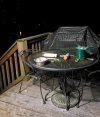
Deck is turning white and the snow has picked up some.
The precip in Texas sinks into the GOM per modeling regardless of how north it is now. The stalled boundary is where moisture will go (eastern NC). The track has been laid the question will always be how much it wiggles to the north/west out of South Carolina creating sharp gradients in snowfall amounts.
Still rain
While connected to the same moisture source, no. There is a stalled boundary that moisture will be riding. Our radar watching will blossom overhead if it does over-perform western Carolina’s. Not likely but non-zero.Is it possible for models and forecasts to be off so bad that the bottom moisture from texas ends up way west? cope
Same here, light to mod snow, temp 32.4 and starting to whiten up someDeck is turning white and the snow has picked up some.