I'm not guaranteeing anything, but having lived in Charlotte for 20 years the NW trends have been more reliable than any weather model. In my opinion the piedmont of NC will overperform. I have a Met degree but knowing previous experiences/tendencies in the upstate of SC and piedmont of NC are more valuable. It's nowcasting time. Good luck to all for an unexpected thump, and keep up the good work!!
-
Hello, please take a minute to check out our awesome content, contributed by the wonderful members of our community. We hope you'll add your own thoughts and opinions by making a free account!
You are using an out of date browser. It may not display this or other websites correctly.
You should upgrade or use an alternative browser.
You should upgrade or use an alternative browser.
Wintry 1/20 - 1/23 Winter Storm
- Thread starter packfan98
- Start date
Precip looks way better at 18 wow
I'm not guaranteeing anything, but having lived in Charlotte for 20 years the NW trends have been more reliable than any weather model. In my opinion the piedmont of NC will overperform. I have a Met degree but knowing previous experiences/tendencies in the upstate of SC and piedmont of NC are more valuable. It's nowcasting time. Good luck to all for an unexpected thump, and keep up the good work!!
If anyone reading has a met degree and doesn't have a tag indicating so under their username, message one of the staff with credentials so we can get that fixed.
iGRXY
Member
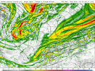
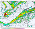
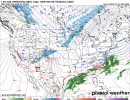
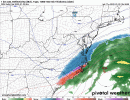
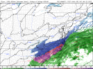
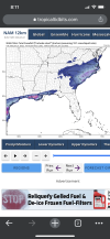
This NAM run is about to legitimately phase
NBAcentel
Member
We’re trending to a halfway version of January 17 2018 basically
iGRXY
Member
I'm going to start this off by saying that i love the NAM. I enjoy the NAM for what it is. The NAM and it's 3km brother have a lot of use. And nobody's takeaway from this event should be "the NAM is terrible".
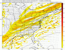
But this? This is poverty model stuff. This is a model currently run by Dan Snyder. Watch the wind barbs change in Illinois, Missouri, and Oklahoma. NAM just never got a good grip on this thing. We got routed by the Canadians.

But this? This is poverty model stuff. This is a model currently run by Dan Snyder. Watch the wind barbs change in Illinois, Missouri, and Oklahoma. NAM just never got a good grip on this thing. We got routed by the Canadians.
Probably still more along the lines of January 1-2 2018. I remember precip extending over the west in almost the exact same manner that most models didn’t catch onto.We’re trending to a halfway version of January 17 2018 basically
iGRXY
Member
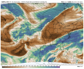
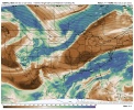
At 26 nam looks similar to the hrrr honestly. West
NBAcentel
Member
BOOM at 28!
L
Logan Is An Idiot 02
Guest
I’m sorry but if these trends continue throughout tomorrow we have to give the RGEM more respect.

Sent from my iPhone using Tapatalk

Sent from my iPhone using Tapatalk
iGRXY
Member
Is this our first legitimate BOOM in the last 3 days???BOOM at 28!
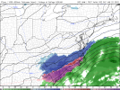
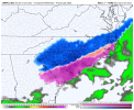
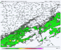
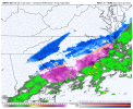
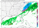
At hour 27 there's snow in NC from the foothills to the NE coast.
Mountain meteorology was never my strong suit but I wonder if the little band that develops near the mountains to kick things off is related to a little lee side cyclogenesis, seems to line up when the most forceful vorticity goes over the area
31.5, finally below freezing about .2 and still light to moderate snow
RGEM leading the way. Like usual
Underrated model.
Underrated model.
iGRXY
Member
What’s crazy is these runs are likely still too dry
Lee side trough, see it alot in the summerMountain meteorology was never my strong suit but I wonder if the little band that develops near the mountains to kick things off is related to a little lee side cyclogenesis, seems to line up when the most forceful vorticity goes over the area
We have such a love hate relationship with the NAM haha but it really is in line with latest HRRR and the RGEM. Legit solid trend, nice tilt with our energy and so close to boom boom
- Joined
- Jan 23, 2021
- Messages
- 4,602
- Reaction score
- 15,197
- Location
- Lebanon Township, Durham County NC
Mulch is whitening up. 31 degrees. Mod snow
NBAcentel
Member
We’re so close to repeating jan 2018 forget halfway
iGRXY
Member
If that phases even just 50 miles sooner and this thing turns back to a 6-12 snow back towards NE NC and a solid 2-4 type even even back towards the upstate and CLT
I’ve got some big snows from Lee side troughs. Once about 10’ish years ago. 3” of snow at 40 degrees in the middle of the day.Lee side trough, see it alot in the summer
NBAcentel
Member
packfan98
Moderator
3k looking good too.
- Joined
- Jan 23, 2021
- Messages
- 4,602
- Reaction score
- 15,197
- Location
- Lebanon Township, Durham County NC
Put some respeck on the RGEMs name
blueheronNC
Member
Hearing sleet / frozen pinging on my metal roof for the first time tonight here just north of NC State
iGRXY
Member
Hypsometric
Member
We right on scheduleWe’re so close to repeating jan 2018 forget halfway
Honestly it’s very similar to how the models began picking up on the mesolow that developed near the SC upstate during the January 2003 storm… if something like that does occur the short range models will start picking up on it over the next few hours.Mountain meteorology was never my strong suit but I wonder if the little band that develops near the mountains to kick things off is related to a little lee side cyclogenesis, seems to line up when the most forceful vorticity goes over the area
Very light snow over my way, but I have dropped to 32 (finally).Mulch is whitening up. 31 degrees. Mod snow
accu35
Member

