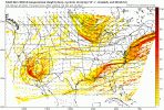
Houma Louisiana, the jackpot winner!View attachment 108957
Looking good towards my way
Hope it hits for my old hometown peeps!
Houma Louisiana, the jackpot winner!View attachment 108957
Looking good towards my way
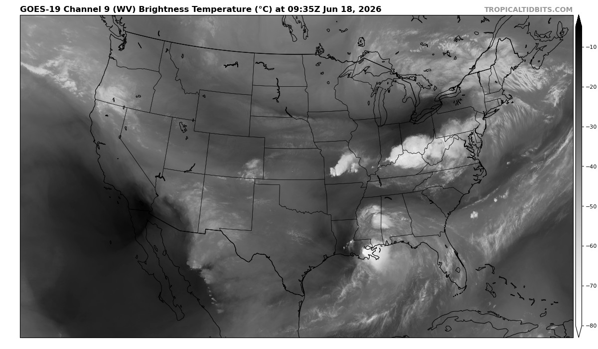
 www.tropicaltidbits.com

That’s my wife’s favorite neighborhood in charlotte. Nothing like Elizabeth or Myers Park in the snow.Decent sized flakes falling in Elizabeth, mixing with a few pingers.
This has the feel of Atlanta getting blindsided and looking like fools….again.Went into lurker mode on this thread..but my temp is 33.7 with a brisk NNE breeze & 97% humidity.
And then I looked at the NAM.
Yup...same here in Myers Park, CharlotteBig burst of snow !!!
only way we know how to do things, really.This has the feel of Atlanta getting blindsided and looking like fools….again.
Weird, I have very light rain near Lake Benson. Maybe the sleet will be here any moment.Sleet flying here
Same in Zebulon as Wilson , I’ll walk out in a second and check again.Getting sleet mixed in with rain here in Wilson, nc

Thought I heard sleet earlier on the window but it might have just been @LickwxPlenty of rain in SE Wake.
CAE is sleet to snowWoah. 00z RGEM with snow back to the Appalachians at hr 27, looks like it’s about to go boom with snow from Augusta up through NW SC into C/E NC! CAE looks icy!
Yep! It changed over the next frame!CAE is sleet to snow