-
Hello, please take a minute to check out our awesome content, contributed by the wonderful members of our community. We hope you'll add your own thoughts and opinions by making a free account!
You are using an out of date browser. It may not display this or other websites correctly.
You should upgrade or use an alternative browser.
You should upgrade or use an alternative browser.
Wintry 1/20 - 1/23 Winter Storm
- Thread starter packfan98
- Start date
LovingGulfLows
Member
- Joined
- Jan 5, 2017
- Messages
- 1,499
- Reaction score
- 4,100
Looking at the trends, there's probably a legit 50/50 chance I see some snowflakes fall tomorrow.
D
Deleted member 609
Guest
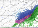
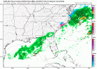
3 more ticksIm greedy...can we get one more shift by tomorrow afternoon...View attachment 108959
neelsamb
Member
This is just insane
NBAcentel
Member
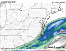
1012mb tightened up and back west on nam
packfan98
Moderator
3k looks better for RDU than 12k
iGRXY
Member
NAM dropped just 0.11 at Spartanburg and on a normal 10:1 ratio that’s 1.1”. These will be at least 15:1 so that’s almost 1.7”. If the NAM is even a little too dry and we get closer to 0.2” or QPF that’s 3” and we could be pushing even higher than that on the ratios. The bust potential on this for everyone is ridiculously high
- Joined
- Jan 2, 2017
- Messages
- 1,566
- Reaction score
- 4,279
Congrats ol buddy!Mulch is whitening up. 31 degrees. Mod snow
LMAO at the NAM. Unreal. What an insane turnaround. Gotta give credit as these models are trending towards the RGEM/GGEM and also the JMA and NAVGEM. ?
Now, I’m very interested if the NAM was just correcting back towards the other models or if the RGEM/GFS/etc. go even further NW tonight at 00z.
RAH WFO must be spinning in their chairs right now.
Now, I’m very interested if the NAM was just correcting back towards the other models or if the RGEM/GFS/etc. go even further NW tonight at 00z.
RAH WFO must be spinning in their chairs right now.
Is it drizzle is it snow ? .. I think it’s snow here in Raleigh by the PNC arena 33
I mean I want to be upset but I can't, not this time but if it happens again. Lol
Personally I don't think these shifts are done, the trend tonight with the energy slowing/tilting more favorable is definitely gonna pull more moisture N/NW imho
blueheronNC
Member
Is it drizzle is it snow ? .. I think it’s snow here in Raleigh by the PNC arena 33
Rain/snow line is taking forever to move south. About to drive north from Raleigh to see where it is.
Stephenb888
Member
Looks like maybe I can even get in on something. Was looking like 0 for a while.NAM dropped just 0.11 at Spartanburg and on a normal 10:1 ratio that’s 1.1”. These will be at least 15:1 so that’s almost 1.7”. If the NAM is even a little too dry and we get closer to 0.2” or QPF that’s 3” and we could be pushing even higher than that on the ratios. The bust potential on this for everyone is ridiculously high
So it looks like I'll just get a ZR/IP event in Jacksonville. Maybe there is a chance for flakes on the back end?
36/34 in Concord and some heavier returns heading this way?
NBAcentel
Member
The 01z hrrr even sharper with the northern stream
NAMs are always to stingy with precip gradients. Hopefully GFS and RGEM holdI mean I want to be upset but I can't, not this time but if it happens again. Lol
Personally I don't think these shifts are done, the trend tonight with the energy slowing/tilting more favorable is definitely gonna pull more moisture N/NW imho
I think most places, RAH included, kept up decent totals even when we hit the nadir yesterday. So I don't think they're spinning as much as they are getting ready to buy some victory cigars. Any shop that bit yesterday probably looks a little windshield wipery today. That being said they're probably a bit on edge because we've already proven that this is a high leverage situation, where small tweaks can have massive upstream effects, and they're likely doing a little back of the napkin math on what their high end is going to look like.RAH WFO must be spinning in their chairs right now.
It’s just drizzling here. Had a brief period of light snow earlier, though.
Iceagewhereartthou
Member
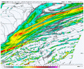
? Umm 250 mile jump in one run? How about another 100?View attachment 108964~*~ just NAM thingz ~*~
Actually an earlier stronger phase would be nice.
Actually, I just want to see this come to fruition, but keep my midland and ENC friends in the game too!

Stephenb888
Member
Is this a recent model run?? Umm 250 mile jump in one run? How about another 100?
Actually an earlier stronger phase would be nice.
Actually, I just want to see this come to fruition, but keep my midland and ENC friends in the game too!

It’s for a couple days ago.Is this a recent model run?
No look at the timestampIs this a recent model run?
Downeastnc
Member
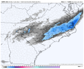
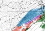
Slight difference for MBY on the 0Z 3k versus the 18Z


Init wed 1/19 0zIs this a recent model run?
NBAcentel
Member
Sigh. Got my hopes up for a spilt second.? Umm 250 mile jump in one run? How about another 100?
Actually an earlier stronger phase would be nice.
Actually, I just want to see this come to fruition, but keep my midland and ENC friends in the game too!

Yea, I was excited earlier when I saw some flakes while driving, but it's really slackened off since then. Can't tell if it's tiny flakes or drizzle, but either way it's not accumulating.It’s just drizzling here. Had a brief period of light snow earlier, though.
There's a decent chance we'll be subfreezing by morning. It's 34 where I am and 35 at the airport. Forecast low is 34 for both locations. *knock on wood* it's rare we get to bust on the cooler side of low temperatures especially w/ cloud cover. Ironically I think the NW winds are helping us steadily cool off.
- Joined
- Jan 2, 2017
- Messages
- 1,566
- Reaction score
- 4,279
Stop it...your drawing me in and I know better. But honestly in this set up, if I see some snow (dusting) then you and @Robert West are def getting snow and more than we were expecting. Weather Twitter World will be a happy place.The 01z hrrr even sharper with the northern stream
Yeah, same. I never had much hope for the frontal passage, anyways, so not too worried about it, though. In some ways, it might help us tomorrow as the cold push wasn’t as quick as modeled.Yea, I was excited earlier when I saw some flakes while driving, but it's really slackened off since then. Can't tell if it's tiny flakes or drizzle, but either way it's not accumulating.
You will be below freezing before midnight. My forecast low was 34F. It’s already 31.3F, and now I’m just waiting on the next 100 mile shift west.There's a decent chance we'll be subfreezing by morning. It's 34 where I am and 35 at the airport. Forecast low is 34 for both locations. *knock on wood* it's rare we get to bust on the cooler side of low temperatures especially w/ cloud cover. Ironically I think the NW winds are helping us steadily cool off.
jay.p
Member
Light sleet in SE Cary right now
SouthGarnerSleet
Member
Getting the ever coveted “Raleigh NWS issues WSW” tweet notification tomorrow is going to feel good.
iGRXY
Member

