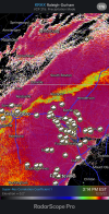
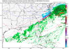
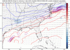
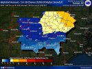
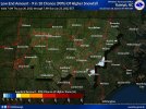
CAE's AFD hot off the press:
Area Forecast Discussion
National Weather Service Columbia SC
333 PM EST Thu Jan 20 2022
.NEAR TERM /UNTIL 3 AM FRIDAY MORNING/...
A band of light showers will continue to progress southeast
throughout the afternoon today with relatively high PoPs and
rainfall totals generally around 0.2". The cold front forcing
this line will follow quickly behind with southwest winds
quickly turning out of the north-northeast by 8pm tonight. PoPs
will remain likely across the coastal plain, chance elsewhere
even early into the overnight as some weak post-frontal
overrunning forces some showers. Strong low level cold advection
will ramp up after the frontal passage and continue overnight
dropping temps into the low 30`s by early Friday morning. The
front will stall offshore early Friday as the cold advection
continues at the lowest levels behind the front. After roughly
3am Friday is when the risk for wintry precip begins to
accelerate, first starting the northern tier counties and slowly
extended south by sunrise.
.SHORT TERM /3 AM FRIDAY MORNING THROUGH FRIDAY NIGHT/...
Overview: A Weather Weather Advisory remains in effect for
northern SC starting at 4am and central/southern SC starting at
1pm. This system that has been riddled with uncertainty from
its origin continues to do so. Low pressure will develop along
the stalled front Friday, with overrunning and a broad area of
lift developing along the coast. With cold low levels, most
precip that falls Friday will be frozen in some variety (snow,
sleet, or freezing rain). The northeast fa will likely mostly
sleet and snow, while the southern and central fa will generally
mix favoring sleet or freezing rain. While this continues to be
a tricky system, wintry precip exits by Saturday morning
regardless of how the precip types play out. Temps throughout
the day Friday will remain in the low-mid 30`s.
Discussion: Light frozen precip expected to begin along the back
edge of the front across our northern counties sometime around 4am
with all guidance indicating that this will remain light
throughout the early morning hours. Freezing rain and sleet is
possible with this batch of precip and is why the northern
county advisory is issued well ahead of the southern counties.
This initial wave of precip is consistently progged across all
guidance to be fairly light with a mix of light precip and
drizzle, with low total qpf amounts. There is fairly good
agreement that a general lull in any precip is likely from 12z
to 18z across much of the fa, but some patchy freezing
drizzle/light rain is possible particularly across the northern
fa. Ice and sleet totals should generally remain below 0.1"
during this early window.
Guidance throughout the morning has trended back towards
slightly more amped and less positively titled as the trough
axis crosses over TN Friday afternoon. This allows for some mild
interaction with the GoM shortwave, thus improving the synoptic
location and setup for the developing low along the coast. This
would throw substantially more precip back into the central and
eastern after 18z Friday. GFS operational and ensemble members
are currently the high end wintry precip solution, with the EC
the drier solution. While it is hard to pull much from a single
suite, that isn`t even uniformly consistent, this wetter
guidance trend appears to be a more physically realistic
solution but uncertainty remains. So in general a slightly
higher qpf solution is now favored, with slightly higher snow
totals late Friday evening into Saturday. The southern county
advisory goes into effect at 18z Friday with a freezing rain and
sleet dominate precip type until the 00z - 06z window where
some back edge snow is possible. This system remains a tricky
one with shallow cold air, a lack of intense warm advection
aloft, and a weakly developing low all adding to lack of
predictability.
The system should exit by 12z Saturday with strong cold advection
continuing behind the system. Morning lows Saturday will bottom out
in the mid 20`s.
Summary: Freezing rain and sleet possible across our northern
counties early Friday morning. Weakening precip likely throughout
the late morning Friday with some freezing drizzle around. A batch
of all precip types likely late Friday afternoon, lasting into early
Saturday morning. Ice accumulations expected between 0.1"-0.25"
across the eastern fa, less than 0.1" elsewhere. Snow/sleet
accumulations will be highest over the Lancaster and Chesterfield
counties with 1-2" possible.

