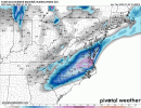
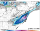
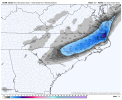
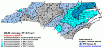
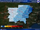
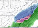
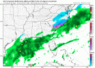
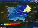
And it was yesterday when he posted itThat was yesterday's map
-
Hello, please take a minute to check out our awesome content, contributed by the wonderful members of our community. We hope you'll add your own thoughts and opinions by making a free account!
You are using an out of date browser. It may not display this or other websites correctly.
You should upgrade or use an alternative browser.
You should upgrade or use an alternative browser.
Wintry 1/20 - 1/23 Winter Storm
- Thread starter packfan98
- Start date
The 18z RGEM was a little lighter/east of the 12z run, I’ll say. Still pretty good, relatively speaking, though. Could be the beginning of a fold, but we shall see…
packfan98
Moderator
iGRXY
Member
Yeah starting to lose the best model we had but we still got 24 hours for this to come back W/NW a tick, let's see how the 0z models look tonight as Shane pointed out, all pieces of energy will be fully sampled at that point.The Northern Stream energy was a little weaker and more positively tilted on the 18z RGEM. It's still gives a good footprint of snow, but not as much as 12z.
View attachment 108854
Interesting how the Kuchera is picking up on the ratios for the RGEM, showing 5” versus 3-4” for Durham on the 10:1 maps.
NBAcentel
Member
Downeastnc
Member
Looks a little like January 2000. Late bloomer. modernweenie
Also nice to see Eric talking up a storm. He’s usually crushing weenies’ dreams.
I was thinking more like Dec 2000
Honestly though I am happy with my 3-5" forecast that's almost my annual average in one storm....and there is still enough model support for it.
How reliable is the RGEM when it's close to gametime?
NBAcentel
Member
Shaggy
Member
It may be wrong but man has it been consistent
It’s a pretty good model. Ryan Maue is a big fan IIRC. It certainly is on its own to some extent, though the GFS supports it pretty well at this point (we’ll see if that still holds true in 30 minutes at 18z). I wouldn’t discount it as a bad model, but it certainly is presenting a rather extreme scenario at this point that probably shouldn’t be a median forecast.How reliable is the RGEM when it's close to gametime?
How reliable is the RGEM when it's close to gametime?
It's been very good this winter at this range but it's kind of all alone with what it's showing so you do have to be skeptical.
Temps beginning to drop here in PGV with a bit of northerly wind, SE Wake and points ENE are in a pretty solid spot at this stage. Fixing to put the front end loader on my 1025R and pre-position for clearing the driveway, this will be a first, stoked. 
A wobble, hopefully, but that's 3 wobbles in a row in the wrong direction, in terms of amounts. At what point do we concede that a wobble is a trend?Both ICON and RGEM backing off last run totals a concern or maybe just a wobble? We're inside 36hrs now for most of the event.
Typically the models will kind of converge when they are different like this......as opposed to any one model being the sole winner. Let's see what the GFS says
RAH wrote a brief AFD for tonight's system but has yet to write it for tomorrow, they must be writing a novel
It’s been consistent and it probably did the best with Sunday’s storm.It may be wrong but man has it been consistent
You know my rule...take the model showing the least snow and slash that by 75% and you'll just about have it. Since we're not dealing with a warm nose this time, you can probably just take the model showing the least amount of snow and stop there.Typically the models will kind of converge when they are different like this......as opposed to any one model being the sole winner. Let's see what the GFS says
Downeastnc
Member
A wobble, hopefully, but that's 3 wobbles in a row in the wrong direction, in terms of amounts. At what point do we concede that a wobble is a trend?
I think at this point its all just noise,.....the map from Jan 2014 looks good to me, area wise at least, whether or not we hit those kind of totals is the real issue....I would assume models have underdone coverage as that is the default usually in these setups....but is it enough to really take it from 1-3 to 3-6" etc....we probably wont know that till Friday night when we are either freaking out over awesome radar trends or watching the west edge approach way to fast....
Cary_Snow95
Member
More stream interaction on 18z gfs but I don’t love the tilt
brendan123
Member
Heaviest sleet I’ve ever seen
GFS coming in


NBAcentel
Member
18z GFS


.SHORT TERM /FRIDAY THROUGH FRIDAY NIGHT/...
As of 430 PM Thursday...
Still expect flat low pressure to develop and track NE along the
offshore front, as cold air at all levels advects in from the N,
from strong and frigid high pressure centered over SE Ontario early
Fri. After the lull in precip over all but far SE sections through
at least Fri morning (although the brisk and gusty NNE winds will
make it feel quite raw), forcing for ascent will strengthen and
deepen as the potent shortwave trough approaches from the W. After
overnight forecasts that trended east and more offshore with most
precip, the more recent model runs have shifted a bit further back
westward. Confidence is still lower than usual with this particular
scenario, given the model variation, lack of a strong coastal low
that might better organize banded precip, and the reliance on the
incoming shortwave and subsequent lift to saturate the column and
prompt a westward expansion of precip. What we do have more
confidence in is the vertical thermal structure, supportive of more
icing than snow in areas SE of a Troy-to-Tarboro line, with the
potential for a tenth or two of glazing over S Sampson county. And
we also have confidence that the rest of the forecast area will be
cold enough through the column to be mostly snow. Precip should
start to ramp back up by mid to late afternoon, as the upper jet RRQ
and the mid level shortwave approach, and peak in the evening.
Amounts should be less than an inch over most of the Triad region
(where moisture will be more limited), an inch or two from Kerr Lake
to the Triangle and over much of the Sandhills, and 2-4" over our
far NE including Tarboro and Scotland Neck. Precip should end fairly
quickly W to E overnight, most likely as a short period of freezing
drizzle as we again lose ice aloft. Expect highs of 26-32, followed
by lows of 14-23. -GIH
Wow still looks good.
Good thing it should be a fairly efficient snowfall accumulation wise because it's going to be a quick hitter


If we want to split hairs, low is 1mb stronger and west of 12z
Downeastnc
Member
GFS coming in
Lowers totals area wide by a few inches.....just cant get it done with 6-8 hrs of snowfall, nothing to slow it down.....
Rates looked lighter on that runLowers totals area wide by a few inches.....just cant get it done with 6-8 hrs of snowfall, nothing to slow it down.....
- Joined
- Jan 23, 2021
- Messages
- 4,601
- Reaction score
- 15,196
- Location
- Lebanon Township, Durham County NC
@superjames1992 @metwannabe @FallsLake have y’all noticed the freezing drizzle present on the RAP soundings tomorrow morning? Gonna be a big ticket item for the northern triangle and border counties if it’s real.
I think we have a decent shot to verify on the high end of RAH's guidance, but I think for everybody not named metwannabe 4" is the most likely high endGood thing it should be a fairly efficient snowfall accumulation wise because it's going to be a quick hitter

On CC, current mixing line runs from GSO to the NE through Henderson/Soul City.

