iGRXY
Member
I don’t know that it’s really a matter of it not coming more WNW or more a matter of the low not quickly strengthening. The low can still move closer to the coastline but if it’s not getting wound up to quickly, it won’t drive the warm nose far to the west and northI hope I don't regret this statement later but one thing I like seeing is the slp isn't really coming too far W/NW, it's more the precip is expanding further W/NW, which hopefully will prevent too much WAA (the warm nose) from coming too far inland.

That’s a nice uptick from 00zUKMET - Note 10-1 ratios only. NW side should be higher.

We're looking at around 5" of snow if that run is realizedThat’s a nice uptick from 00z
Brutal cutoff here, but that’s a big shift NW from the past couple runs.UKMET - Note 10-1 ratios only. NW side should be higher.

I am starting to get convinced that even back this way we will see flakes flying with accumulation (oddly enough) SE of 85.gefs members
View attachment 108766
Me and You need a 25-45 mile adjustment. That LP would come on over to hatteras(inching closer) it would be jackpot.Brutal cutoff here, but that’s a big shift NW from the past couple runs.
I hope it makes it over to you. I'm in Greenwood, SC and that would definitely put me in it.This is slowly inching closer and closer to where I live in GA if it does one or two more slight westward trends


As quickly as this went downhill, it can come back uphill just as quick. At least wait till op runs come out before discrediting the potentional of this storm. Precipitation shield will shift some west. East of raleigh and north of greenville, nc will still see the biggest impacts in my opinion.
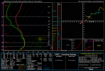
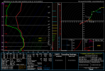
I've expected some silly ratios for the last few days. I just need the QPFHere are soundings from the RDPS and GFS for Raleigh at 10pm Friday. Both show snow and 24 degrees (very rare)
I agree with the idea that snow ratios will be good...some thoughts:
1. The main impetus for the storm is the wave in the northern stream (polar jet) which is bringing cold air with it...as opposed to a warm and juiced up system approaching from the southern stream / gulf.
2. The soundings show a nice cold profile, not approaching freezing aloft or at the surface, more typical of snowstorms that happen well north of us
3. No super heavy winds associated with a strong cyclone to fracture dendrite snowflakes
I like the idea of snow ratios in the 15:1 to 20:1 range in Raleigh.....closer to 20:1 where you get into a good snow band with dendrites being efficiently produced....otherwise closer to 15:1


Thanks for your thoughts on this. It does seem like a situation where ratios should be very good, I’ve just been burnt by that in the past, so I’m afraid to assume more than 10:1, haha. This could make a big difference for the Triangle and areas on the western side as even a “measly” 0.3” of liquid could translate into 4-5” of snow if ratios are 15:1. Definitely something that could lead to an outperformance.Here are soundings from the RDPS and GFS for Raleigh at 10pm Friday. Both show snow and 24 degrees (very rare)
I agree with the idea that snow ratios will be good...some thoughts:
1. The main impetus for the storm is the wave in the northern stream (polar jet) which is bringing cold air with it...as opposed to a warm and juiced up system approaching from the southern stream / gulf.
2. The soundings show a nice cold profile, not approaching freezing aloft or at the surface, more typical of snowstorms that happen well north of us
3. No super heavy winds associated with a strong cyclone to fracture dendrite snowflakes
I like the idea of snow ratios in the 15:1 to 20:1 range in Raleigh.....closer to 20:1 where you get into a good snow band with dendrites being efficiently produced....otherwise closer to 15:1


For a more questionable area back west (CLT), those RGEM soundings are a thing of beautyHere are soundings from the RDPS and GFS for Raleigh at 10pm Friday. Both show snow and 24 degrees (very rare)
I agree with the idea that snow ratios will be good...some thoughts:
1. The main impetus for the storm is the wave in the northern stream (polar jet) which is bringing cold air with it...as opposed to a warm and juiced up system approaching from the southern stream / gulf.
2. The soundings show a nice cold profile, not approaching freezing aloft or at the surface, more typical of snowstorms that happen well north of us
3. No super heavy winds associated with a strong cyclone to fracture dendrite snowflakes
I like the idea of snow ratios in the 15:1 to 20:1 range in Raleigh.....closer to 20:1 where you get into a good snow band with dendrites being efficiently produced....otherwise closer to 15:1


Yeah Im not really trusting this anafront is been busting back up north due to warmer temps and a further north baroclinic zone, that might be important tomorrowHRRR for the overnight....well starting at roughly 9-10pm in Raleigh. HRRR did great for last Sunday but it's burnt me in the past when relying on it.
View attachment 108777View attachment 108778
This is something that could cause some accumulation forecasts to end up too low. The NWS and local mets are going to lean towards climo on ratios.For a more questionable area back west (CLT), those RGEM soundings are a thing of beauty View attachment 108775View attachment 108776
A lot of the models are starting to "beef up" amounts with the actual front tonight, that's something different and I'm not sold on it just yet but there does appear to be some potential with it. I think roads will be a mess in morning regardless of amounts anyway then it will be nerve-racking watching the radar all day to see if/when precip starts to build back west lolHRRR for the overnight....well starting at roughly 9-10pm in Raleigh. HRRR did great for last Sunday but it's burnt me in the past when relying on it.
View attachment 108777View attachment 108778
I believe this came before the most recent models.I wonder what RAH means about this:
.NEAR TERM /TODAY/...
As of 925 AM Thursday...
No major changes this morning. The latest surface analysis shows the
cold front just pushing into the NC mountains, with mostly light
rain spreading NE into (and blossoming over) the NC Piedmont. This
trend should persist with the mostly solid rain band moving past the
Hwy 1 corridor by noon and easing slowly E, reaching our eastern
counties by sunset. The cold/dense air mass will have trouble
breaching the higher terrain but will instead pour through the
shallower terrain of the central Appalachians and spill into central
NC from the N starting late this afternoon. RAP partial thicknesses
suggest that the changeover to rain/snow will occur over the N
Piedmont around 19z-21z (give or take an hour), with steady column
cooling taking place through the evening, so current p-type trends
still look good. Expect late-morning to early-afternoon highs from
the lower 40s (meaning mostly steady temps in our NW this morning)
ranging to around 60 in our far SE (where precip will hold off until
late today). Taking a peek ahead to tonight through Fri night, many
of the 06z model runs have shifted precip E and SE of the Triad and
made it overall a bit lighter/patchier, although the 06z GFS still
draws considerable precip back W over all of central NC late Fri
through Fri night, and most ECMWF ensemble members depict at least a
couple of inches of snow at RDU. Stay tuned. -GIH
Even though it says updated at 9:25, it’s still early morning discussion… before the 6z models started coming inI wonder what RAH means about this:
.NEAR TERM /TODAY/...
As of 925 AM Thursday...
No major changes this morning. The latest surface analysis shows the
cold front just pushing into the NC mountains, with mostly light
rain spreading NE into (and blossoming over) the NC Piedmont. This
trend should persist with the mostly solid rain band moving past the
Hwy 1 corridor by noon and easing slowly E, reaching our eastern
counties by sunset. The cold/dense air mass will have trouble
breaching the higher terrain but will instead pour through the
shallower terrain of the central Appalachians and spill into central
NC from the N starting late this afternoon. RAP partial thicknesses
suggest that the changeover to rain/snow will occur over the N
Piedmont around 19z-21z (give or take an hour), with steady column
cooling taking place through the evening, so current p-type trends
still look good. Expect late-morning to early-afternoon highs from
the lower 40s (meaning mostly steady temps in our NW this morning)
ranging to around 60 in our far SE (where precip will hold off until
late today). Taking a peek ahead to tonight through Fri night, many
of the 06z model runs have shifted precip E and SE of the Triad and
made it overall a bit lighter/patchier, although the 06z GFS still
draws considerable precip back W over all of central NC late Fri
through Fri night, and most ECMWF ensemble members depict at least a
couple of inches of snow at RDU. Stay tuned. -GIH
Athens about to get in the game @farleydawg792 ?
I am beginning to wonder if indeed we do wake up tomorrow to upgrades from WWA to WSW in more western counties
What are we looking at?
This is quickly getting more interesting by the run for us further west.Hrrr is quickly trending towards the RGEM with that change… View attachment 108781View attachment 108782
