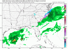
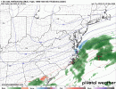
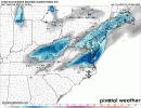
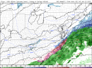
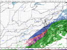
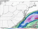
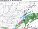
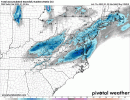
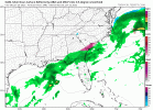
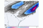
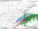
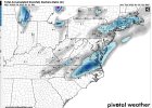
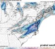
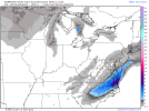
at 34 it is def further west w precip. it is trying hard.Hour 30 is a nice tick NW vs previous run. This is much better at 5h and precipitation and 7h is responding.
-
Hello, please take a minute to check out our awesome content, contributed by the wonderful members of our community. We hope you'll add your own thoughts and opinions by making a free account!
You are using an out of date browser. It may not display this or other websites correctly.
You should upgrade or use an alternative browser.
You should upgrade or use an alternative browser.
Wintry 1/20 - 1/23 Winter Storm
- Thread starter packfan98
- Start date
It's really that small good luck6z GFS v/s 12z NAM. This is the difference between a whiff and 3-4" for many in central/eastern NC
View attachment 108692
SimeonNC
Member
What does this mean?
Yep, it was just after that timeframe that the RDPS and GFS "exploded" with precip and the NAM is just now starting to develop more precip westward, might not get it done on this run but it is definitely an improvementWay to premature to say that View attachment 108693
spoke to soon. at 36 precip is back near florence where 06z had it over myrtle. much much better!
TigerSnow
Member
Gonna be tough around CLT unless we get a surprise.at 34 it is def further west w precip. it is trying hard.
agree. but i think the pee dee and cola up to rdu is still in a good spot if we keep seeing these west shifts today.Gonna be tough around CLT unless we get a surprise.
snow from darlington county up near rdu at 39 it looks like
It’s shocking to me how different the RGEM was compared to the NAM at 06z. For the Triangle, it was the different berween a 6-8” big dog (WOOF) and zilch. Makes for a hard forecast. Insane.
Notice the LP position. It moves further east actually for 12z. What looks to be happening is more amplification of the system throwing more moisture back to the west.If we were already on the line we'd be cliff diving and moving on with this shift, this is pretty big NW jump
View attachment 108696
edit: Again the LP position could just be more of a timing thing from last run. System moving faster?
Downeastnc
Member
If we were already on the line we'd be cliff diving and moving on with this shift, this is pretty big NW jump
View attachment 108696
Really its just coming back into the fold from lala land so to speak and getting back to were literally every single other model is more or less....
NBAcentel
Member
lexxnchloe
Member
One more shift like that and its a big ticket itemIf we were already on the line we'd be cliff diving and moving on with this shift, this is pretty big NW jump
View attachment 108696
NBAcentel
Member
RDUHeatIsland
Member
yea 3k looks much improved too.Big improvement on 3k as well. It was showing nothing for ENC 6z.View attachment 108704
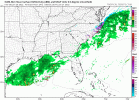
Just move that 0.5 precip line back west 2 counties to the Triangle and we are golden.
NBAcentel
Member
These changes on the modeling are wild this 12z suite
if we were on the snow line and saw this shift we would all be cliff diving 100%. if i am in the eastern carolinas i am loving these trends right now. not out of the game at all.
packfan98
Moderator
Yes. It's remarkable how those little changes in the northern stream make such a big difference at the surface. I guess now the question is will the northern stream dig a little more in the west? How much energy will be there? Will there be more ridging off the coast to prolong the event?These changes on the modeling are wild
It appears the models are now pretty much at a consensus. How much will they change from here?
It's not a good model sorry if that offends anyone. Useful? Yes. Good? Mehthis model.
View attachment 108705
I need a complete RGEM coup of the models .. did amazing with last storm imo and was the only one harping steady sleet over freezing rain here in the triangle .. while the nam had .4 inches of freezing rain the day of the storm ..
NBAcentel
Member
- Joined
- Jan 23, 2021
- Messages
- 4,602
- Reaction score
- 15,197
- Location
- Lebanon Township, Durham County NC
That one has really perked up on the modelling today12z RAP .. this is purely with the frontal stuff today .. still kind of going a bit at the end .. storm not in view yet View attachment 108711
Downeastnc
Member
if we were on the snow line and saw this shift we would all be cliff diving 100%. if i am in the eastern carolinas i am loving these trends right now. not out of the game at all.
The models are just picking up the bigger extent of the NW side precip field in overrunning events, something we know they underdo especially in mid range but always seem to forget when faced with these systems lol....need this to hang out for 3-6 more hrs ( at least )....the ratios get insanely good even on the NAM its 15:1 for several hrs just light QPF.....
The WRF sisters are outdoing themselves right now ?
1km fv3 jumps west too.The models are just picking up the bigger extent of the NW side precip field in overrunning events, something we know they underdo especially in mid range but always seem to forget when faced with these systems lol....need this to hang out for 3-6 more hrs ( at least )....the ratios get insanely good even on the NAM its 15:1 for several hrs just light QPF.....
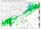
Agreed. Honestly given what we’re seeing even CLT, especially east of I-77 is not out of the game for a bigger hit… that NAM run put the 1” about 20 miles to my east. If the snow/mix line was 20 miles to my east 18 hours out or so, I would be convinced that I would end up mixing a lot. Another thing is that from checking out the Bukfit data, there is some evidence that higher ratios may actually play out in the scenario. I always kinda dismiss ever seeing anything over 10-12:1 around here, but this certainly looks like it could be an exception and it could have an impact on accumulation forecasts… I remember reading that one of the reasons that the January 2003 storm busted with so much higher amounts than forecasted was not giving credence to the prospect of high ratiosif we were on the snow line and saw this shift we would all be cliff diving 100%. if i am in the eastern carolinas i am loving these trends right now. not out of the game at all.
Another example of poor ratio modeling was January 2009, models were showing an inch or two, and Raleigh received over 6 inches of powder.Agreed. Honestly given what we’re seeing even CLT, especially east of I-77 is not out of the game for a bigger hit… that NAM run put the 1” about 20 miles to my east. If the snow/mix line was 20 miles to my east 18 hours out or so, I would be convinced that I would end up mixing a lot. Another thing is that from checking out the Bukfit data, there is some evidence that higher ratios may actually play out in the scenario. I always kinda dismiss ever seeing anything over 10-12:1 around here, but this certainly looks like it could be an exception and it could have an impact on accumulation forecasts… I remember reading that one of the reasons that the January 2003 storm busted with so much higher amounts than forecasted was not giving credence to the prospect of high ratios
packfan98
Moderator
12z RGEM - Northern Stream energy looks a little less diggy. My guess is that it will back off a little and line up with other models. Hold on a minute. It runs fast!
wow.


