• Hello, please take a minute to check out our awesome content, contributed by the wonderful members of our community. We hope you'll add your own thoughts and opinions by making a free account!

Wintry 1/20 - 1/23 Winter Storm

The problem is you cant trust the models on any given run at this point, it just as liable to go back to a whiff next run, the only trend is there is no clear cut trend....we use to call this wind shield wiping runs where there are too many moving pieces and the models just cant get a handle on all the little nuances that impact this.....which is why this is liable to frustrate the hell out of us all the way up to game time.....

What I would love to see is by 12Z tomorrow is some solid agreement in the hi res stuff.....preferably into a monster central and eastern NC hit....
 
It wasn't always phase dependent. The northern stream could have done this all on it's own if it were sharper, slower, and dug. The phase idea was kinda a "glory" thing if everything lined up perfectly. We started to lose the idea of the northern stream getting it done on it's own, so then the phase became the needed ingredient as we get closer to verification time.
 
The problem is you cant trust the models on any given run at this point, it just as liable to go back to a whiff next run, the only trend is there is no clear cut trend....we use to call this wind shield wiping runs where there are too many moving pieces and the models just cant get a handle on all the little nuances that impact this.....which is why this is liable to frustrate the hell out of us all the way up to game time.....

What I would love to see is by 12Z tomorrow is some solid agreement in the hi res stuff.....preferably into a monster central and eastern NC hit....
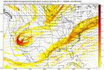
You sure you dont want 85 and sunny tomorrow? lol
 
Idk guys, just look for more atlantic ridging to slow the northern stream down a bit.. cause it to dig a bit and tilt better than looking like a positively tilted trainwreck.

there's still room for all of that, by the way.... it's not like we need 100% changes here.. frank is right about this situation.
 
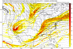
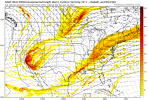
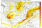
The reason why the ICON looked is this. N/S was further west.icon_z500_vort_us_fh51_trend.gif
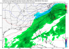
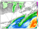
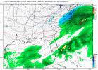
icon_mslp_pcpn_frzn_us_16.png
 
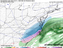
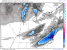
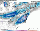
Rgem wasn't far off from a massive precipitation field in my quick overview. deeper with the northern stream and more energetic getting the southern wave involved.

nice thing about the RGEM idea of the northern stream being deeper = more cold... but FINE LINE boys... don't want too much WAA for our friends in Eastern sections
 
I want this to happen for everyone from Alabama thru Carolinas so we all can sit back and laugh about how God awful the models have been at this point not for love of winter weather just to embrace the craziness of it all
 
Idk guys, just look for more atlantic ridging to slow the northern stream down a bit.. cause it to dig a bit and tilt better than looking like a positively tilted trainwreck.

there's still room for all of that, by the way.... it's not like we need 100% changes here.. frank is right about this situation.
sorry this is absolutely banter but for the record you can just call me ross or ilmross (even though i haven't lived there in 9 years), i made that username when i intended this to be a burner and i was really going through it ?

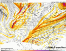
to make this post actually useful I think the little feature i'm seeing the models key in on tonight is that secondary piece that dives in through the dakotas, just seems to give our shortwave a better tilt. a new groove
 
Rgem wasn't far off from a massive precipitation field in my quick overview. deeper with the northern stream and more energetic getting the southern wave involved.

nice thing about the RGEM idea of the northern stream being deeper = more cold... but FINE LINE boys... don't want too much WAA

This X 1000, we would much rather do it with just the northern stream sharping up....the real question is how good of a handle do the models have on the cold...we can get it colder by even 3-4C it helps with ratios etc....also pushes the IP and ZR areas smaller limiting the area impacted by bigtime ice.
 
sorry this is absolutely banter but for the record you can just call me ross or ilmross (even though i haven't lived there in 9 years), i made that username when i intended this to be a burner and i was really going through it ?

to make this post actually useful I think the little feature i'm seeing the models key in on tonight is that secondary piece that dives in through the dakotas, just seems to give our shortwave a better tilt. a new groove
It’s funny you say that. I think it was @SD who literally said he had his eye on that piece this morning
 
Last edited:
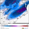
Brad P new video out. Trace to 1” Charlotte. Now nothing foothills. Says trending dryer. 11pm snow map early release on his video by accident..before the newscast.
 
Back
Top