Have to wonder if the recent global model chaos is due to the volcanic eruption late last week. Model scores have plummeted, esp the GFS. They’re highly dependent on aerosol calculations, cloud condensation nuclei, etc.
-
Hello, please take a minute to check out our awesome content, contributed by the wonderful members of our community. We hope you'll add your own thoughts and opinions by making a free account!
You are using an out of date browser. It may not display this or other websites correctly.
You should upgrade or use an alternative browser.
You should upgrade or use an alternative browser.
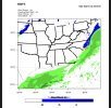
Wintry 1/20 - 1/23 Winter Storm
- Thread starter packfan98
- Start date
brendan123
Member
Why did the Euro have to suck me in again smh... at least on par with 6Z and arguably best run since last night's 0z it looks like
NBAcentel
Member

Cary_Snow95
Member


Someone with better maps fill us in... This is a pretty big difference at 72 hours
lexxnchloe
Member
Euro much better. Overall i would say the trend has been good at 18Z as i was saying earlier.
That seems to still be a wild card… the HRRR has been hinting at it all day. We don’t typically get cold pushes coming in from that direction during precip, but when we do they always have very quick drops in temperatureLol euro has a decent 1-2 inch snow across the north Charlotte area with the Arctic front itself so far
Cary_Snow95
Member
One more trend like that and we are looking MUCH better. WAR flexed just enough to slow down the NS and allow the SS to catch up just a little.
NBAcentel
Member
It’s crazy 1 more war trend like that and we get a big event for more areas but 2-3 more war trends like that, this thing is screwing us with a warm nose, very sensitive systemOne more trend like that and we are looking MUCH better. WAR flexed just enough to slow down the NS and allow the SS to catch up just a little.


iGRXY
Member
Euro will keep me interested long enough to see the NAM. Hopefully we can start a nice NW trend
That’s an interesting point. Also there have been a lot of commercial flights getting canceled lately… first due to the Covid spike and now the 5G concerns. These commercial flights are also gathering atmospheric info that goes to weather agencies around the world and is used to input data in computer models. When the pandemic started in 2020, models were volatile and had lower accuracy scores… there much fewer planes in the air at that time as wellHave to wonder if the recent global model chaos is due to the volcanic eruption late last week. Model scores have plummeted, esp the GFS. They’re highly dependent on aerosol calculations, cloud condensation nuclei, etc.
accu35
Member
Is there anything at the gulf coast as in freezing rain? Counties under me are now in a WWA

This post made me laugh so hard. Not because it's not a valid point; it is. It's just that I immediately thought of it this way: We've gotten so desperate with this system that we are digging in the geological event bucket to find hope!Have to wonder if the recent global model chaos is due to the volcanic eruption late last week. Model scores have plummeted, esp the GFS. They’re highly dependent on aerosol calculations, cloud condensation nuclei, etc.
If there's some merit to that idea, I hope it's contributory to model error now and not 36 hours ago when things looked great lol
Oddly enough back before the 2/12/2010 storm, the JMA was one the first models to pick up on the NW trend and more expansive precip to the NW that gave all of SC and most of NC a significant snowfall
Y’all be careful rooting for this northwest trend that monkeys paw is going to curl hard and fast
Nick Petro at the NWS RAH voices the concern of the NAM. He says they are not ready to pull the totals yet, but will if the trend continues.
This follows the 12z eps pretty well it looks like .. new eps should be interesting
wake4est
Member
- Joined
- Jan 3, 2017
- Messages
- 52
- Reaction score
- 138
Nick Petro at the NWS RAH voices the concern of the NAM. He says they are not ready to pull the totals yet, but will if the trend continues.
I feel like the NWS should be getting better model output than tropical tidbits….
Downeastnc
Member
Y’all be careful rooting for this northwest trend that monkeys paw is going to curl hard and fast
What we needed was for it to have been able to really phase and get captured and go nuts well offshore so it can throw plenty of moisture back east but be strong enough to crash 850's so there is no warm nose problem....
NBAcentel
Member
Sleet > nothing at this point in the gameY’all be careful rooting for this northwest trend that monkeys paw is going to curl hard and fast
Yeah, now we just need a solar minimum cycle and a weaker Gulf Stream current, combined with another lockdown to cut down on carbon output.This post made me laugh so hard. Not because it's not a valid point; it is. It's just that I immediately thought of it this way: We've gotten so desperate with this system that we are digging in the geological event bucket to find hope!
If there's some merit to that idea, I hope it's contributory to model error now and not 36 hours ago when things looked great lol
The point was never that the models are struggling now with this system & are going to somehow adjust to a weenie output as a result of that atmospheric stimuli.. we’ve seen unusually high amounts of model variability over the past 60 hours with this system. It’s not just this system that’s been affected though. Look globally & you’ll see similar variability with other systems across the globe. The butterfly effect is absolutely real when it comes to atmospheric modeling.. and a massive volcano eruption is a very intense stimuli that atmospheric models don’t consider.This post made me laugh so hard. Not because it's not a valid point; it is. It's just that I immediately thought of it this way: We've gotten so desperate with this system that we are digging in the geological event bucket to find hope!
If there's some merit to that idea, I hope it's contributory to model error now and not 36 hours ago when things looked great lol
Well, they said that they in-house stuff, but aren't allowed to show it.I feel like the NWS should be getting better model output than tropical tidbits….
He said that's he's using TT because it's available publicly. He also said he's restricted from showing the in house modeling suites they use. Which I'm sure are a lot better then anything he can show using TT.I feel like the NWS should be getting better model output than tropical tidbits….
Ukmet, euro,icon at 18z heading back the right way. Hopefully American guidance will at 0z
I think the main reason is that tropical tidbits displays looks better than AWIPS displays. I know FFC uses pivotal for briefings but also use it for viewing model outputs tor forecasting. Some forecasters just have different preferences. Some don’t like AWIPSWell, they said that they in-house stuff, but aren't allowed to show it.
I hear you. It's a good point that I hadn't considered. I was just making a little joke. But everything you said makes sense.The point was never that the models are struggling now with this system & are going to somehow adjust to a weenie output as a result of that atmospheric stimuli.. we’ve seen unusually high amounts of model variability over the past 60 hours with this system. It’s not just this system that’s been affected though. Look globally & you’ll see similar variability with other systems across the globe. The butterfly effect is absolutely real when it comes to atmospheric modeling.. and a massive volcano eruption is a very intense stimuli that atmospheric models don’t consider.
Awips 2 / a version is available to the public, but you're on your own finding a datafeed. It's their data they don't wanna show I guess.
Hmm 23z HRRR vs. 18z HRRR same time 

NBAcentel
Member
don’t be surprised the see a overall worse HRRR run for wave 2, it typically follows the RAP since they are the most similar, however I can’t say the same for the 06z
NBAcentel
Member


NBAcentel
Member


Cary_Snow95
Member
You have 12z to compare
Was curious about Atlantic ridging and sure enough... GFS still reliable for something at least. check out the northward expansion and increase in intensity on the jet north of the greater antilles on 18z GFS hour 12. Don't know if it will translate to better results our way but thought it was a fun tidbit from the topics

L
Logan Is An Idiot 02
Guest
Were these an improvement from 12z?
Sent from my iPhone using Tapatalk
Yes by a good bitWere these an improvement from 12z?
Sent from my iPhone using Tapatalk
NBAcentel
Member
It appears as if the chances of a lighter snow went up


Now the 18z eps is something I feel like I can put some stock in .. that should have more credibility than an 18z run of the NAM