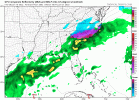
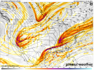
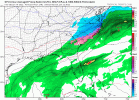
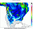
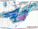
Here's RAH's discussion. They are the experts:
.SHORT TERM /THURSDAY THROUGH FRIDAY NIGHT/...
As of 410 PM Wednesday...
...
Winter storm still expected Fri/Fri night...
The evolution and impacts of this upcoming event are becoming
clearer, although differences in the details at this range persist.
Still appears that the most wintry precip will fall Fri/Fri night.
We`ve seen a slight colder trend in the models and slightly lower
QPF,
esp on the western edge, but overall the areas of highest
impact are roughly unchanged, with the most snowfall expected from
the Triangle to the ENE toward Roanoke Rapids/Tarboro, and the
greatest ice accumulation in our SE, south and east of Wadesboro-to-
Tarboro line. Will maintain the winter storm
watch for now, given
that these greatest impacts will be beyond 36 hours.
Thu/Thu night: Round one of this event looks like a fairly low
impact, although some advisory-worthy wintry precip is expected
after nightfall Thu. The phasing of the polar and subtropical
streams into an expansive
trough from N Que through the Upper
Midwest down to NW Mexico will result in a fast and perturbed SW mid
level
flow from TX through the Mid Atlantic region, as an Arctic
front approaches, dropping SSE through the area during the
afternoon. Will stay with
likely to
categorical pops as a stream of
nearly 1"
PW advects in from the SW. Expect the rain to transition
to a brief wintry mix before becoming mostly snow starting late
afternoon from N to S, as the column cools below freezing throughout
the low and mid levels. As the
front settles just to our S and E Thu
night with frigid low level air pouring in and the upper
jet core
just to our N and W, the stage will be set for multiple rounds of
initially weak/flat surface lows tracking along the
front, with
forcing for ascent focused on the equatorward side of the upper
jet
core. Precip through much of Thu night shouldn`t be especially
heavy, given the more broad mid-upper-level-sourced lift and
initially weak/flat
advection pattern, in addition to the expected
period of drying aloft (including in the mixed phase region) which
should give us a relative lull in precip late Thu night into Fri
morning. Expect light (under an inch) snow amounts across the N and
W
CWA, and very light
icing across the SE through Thu night. After
highs Thu in the mid 40s NW to upper 50s SE, afternoon temps should
tumble into the 30s and lower NW to SE starting mid afternoon. Lows
in the upper teens to upper 20s.
Fri/Fri night: We await the arrival of the sharpening, but still
positively tilted,
shortwave trough from the St Lawrence Valley down
through the Ohio Valley/Mid South on Fri. While the bulk of the
wintry precip should fall in this window, with the arrival of peak
DPVA and upper
divergence within the
RRQ of the strengthening upper
jet, questions remain,
esp regarding how far inland the warm nose
penetrates and how quick and amplified the
trough becomes. It does
still appear that the primary surface low that forms and strengthens
along the
front offshore will be sufficiently flat, with a muted
advection pattern and passing N of our
latitude, which should
somewhat limit the degree of wrap-around precip back into VA/
NC Fri
night. This also favors broader corridors of mixed p-type. Our
latest storm totals depict a light glazing mainly S and E of the
Triangle, with the highest in the far SE sections S and E of a
Laurinburg-to-Goldsboro line, which should see a tenth to third of
an inch of ice accrual. Snowfall should be highest in our NE,
ranging across central
NC from just an inch or two in the Triad to 3-
5 inches from the Triangle to the ENE to Rocky Mount, Tarboro, and
Scotland Neck. If the offshore low strengthens more than expected
and tracks closer to the coast, we could see more banding and
greater totals near the VA border and in our far NE. Precip and
clouds will hold temps way down Fri, with Arctic air in place, so
still expect highs in the 20s to lower 30s. Precip,
likely ending as
light snow and then a little freezing drizzle as we dry out aloft,
should be exiting NE sections during the early
Sat morning predawn
hours. Lows Fri night in the teens to lower 20s. -GIH
&&

