-
Hello, please take a minute to check out our awesome content, contributed by the wonderful members of our community. We hope you'll add your own thoughts and opinions by making a free account!
You are using an out of date browser. It may not display this or other websites correctly.
You should upgrade or use an alternative browser.
You should upgrade or use an alternative browser.
Wintry 1/20 - 1/23 Winter Storm
- Thread starter packfan98
- Start date
The ol south east trend not even Nostradamus could’ve seen that coming!
alfoman
Member
Absolutely crazy to see the WAR recede further and further each run, like the exact OPPOSITE of what we've expierenced a million times. Of course this comes during the one time we do not need it to.
iGRXY
Member
iGRXY
Member
Only hope is that the WAR is being undermodeled like usual to help slow down the N/S. The SW in the southwest actually trended better but the N/S is progressing too far east too fast.
Looking like the second wave might be a complete whiff out to hr 51. Not good, LOL. Surprising after the 15z SREF.
Cary_Snow95
Member
I’m really beginning to think this is gonna be a frontal passage with a little cold chasing moisture
I mean I have never seen this model dry up that much over this few runs ever.
iGRXY
Member
snowlover91
Member
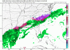
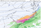
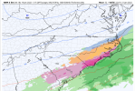
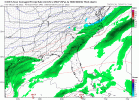
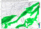
The 3km is better than 12km nam with some ice and snow in extreme eastern nc, but worse than its 12z run.
iGRXY
Member
All the NAM has is a dried up Frontal passage as it crosses the Apps and that's it. Just cold and dry.I’m really beginning to think this is gonna be a frontal passage with a little cold chasing moisture
It really surprising to see this after that HRRR and Sref… I wasn’t expecting it to come back to last night’s dream solution, but I thought it might be a little improvedView attachment 1083793K has more precip further north but it's really a mute point as none of it is snow and it's really restricted to SE NC and along and south of 20.
The 18z NAM is legit like a 200 mile shift east in sensible weather. Unreal. I’m definitely concerned now.
iGRXY
Member
I mean seriously has any shift like that every occurred with the NAM in such a short amount of time?? I don’t remember it.The 18z NAM is legit like a 200 mile shift east in sensible weather. Unreal. I’m definitely concerned now.
snowlover91
Member
January 2017. It shifted the Triangle plus Charlotte right out of the picture in last 36hrs. That was a NW trend though.I mean seriously has any shift like that every occurred with the NAM in such a short amount of time?? I don’t remember it.
There is no storm without a robust wave or a combination of the two waves. Right now we have a front with a couple of weak jabroni waves that miss each other. Good lesson: NEVER expect the SREF to lead the way on anything. 102 pages for clouds.
iGRXY
Member
Only thing from the the 3K is it is one badass Ice storm along and east of 95 in SC and SE NC. Looking at the soundings, It's definitely all ZR and it's falling into temps in the upper 20's.
NBAcentel
Member
this was last nights run. just unreal how quick this went to **** in 3 runs.

today:


today:

MichaelJ
Member
If this was a Tropical Storm, it would be downgraded to an Easterly Wave by now or even an "area of thunderstorms". Where is Neil Frank when you need him??? ?
iGRXY
Member
Christian T Murray
Member
As quickly as this went downhill, it can come back uphill just as quick. At least wait till op runs come out before discrediting the potentional of this storm. Precipitation shield will shift some west. East of raleigh and north of greenville, nc will still see the biggest impacts in my opinion.
Yeah but even that was more of trend based on thermals. CLT still had close to the forecasted QPF, just more of it come down as rain and official the airport still 2” of snow/sleet. What the NAM has done the last 3 runs is just crazy. What really gives me pause is comparing to the HRRR… in this run the NAM even basically dried up the frontal passage and first wave as well, while the HRRR has been trending wetter on that all day. Yes it’s the long range HRRR, but it’s really done very well with these set ups in the Carolinas which is why I give it some weight. Both models are ran off the same data, so it certainly gives you reason for pauseJanuary 2017. It shifted the Triangle plus Charlotte right out of the picture in last 36hrs. That was a NW trend though.
Well, 3KM would have one believe that the event is far from "done" for the coastal regions with some pretty bad ice.
iGRXY
Member
FGEN and overrunning is going to happen causing more precip than what the models are showing as we have stated multiple times. Problem is the main precip shield on the models is going so far SE that even the additional NW coverage that they aren't picking up on is starting to look like it might go as far west as 95 but is trending to maybe only the immediate coast even getting any precip.Yeah but even that was more of s trend based on thermals. CLT still had close to the forecasted QPF, just more of it come down as rain and official the airport still 2” of snow/sleet. What the NAM has done the last 3 runs is just crazy. What really gives me pause is comparing to the HRRR… in this run the NAM even basically dried up the frontal passage and first wave as well, while the HRRR has been trending wetter on that all day. Yes it’s the long range HRRR, but it’s really done very well with these set ups in the Carolinas which is why I give it some weight. Both models are ran off the same data, so it certainly gives you reason for pause
Downeastnc
Member
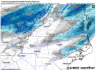
View attachment 108394
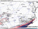
View attachment 108395
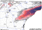
View attachment 108396
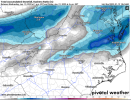
And it's still going with the Ice at the end of the run. That is a true ice storm. Soundings are ZR all the way and accrual would be a lot as the precip really isn't heavy and temps hold around 27-30 degrees with the CAD reinforcing the cold.
Thats the most snow the NAM has given me yet
WEATHERBOYROY
Member
I'm not a big fan of the SREF, It usually is the last place you can find hope in a storm. But, Jan 28 2014, it was the only model that gave the precip a chance to hit the ground in central Al......I guess even a blind pig does find an acorn sometimes ?There is no storm without a robust wave or a combination of the two waves. Right now we have a front with a couple of weak jabroni waves that miss each other. Good lesson: NEVER expect the SREF to lead the way on anything. 102 pages for clouds.
Downeastnc
Member
Downeastnc
Member
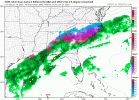
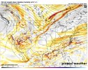
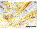
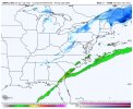
Hmm, I think the 18z ICON might be coming in west of the 12z run.
Isn't that early hour Icon stuff part of the initial frontal passage? Nothing to do with the big dog that had been progged on the back?
Edit: I can see something going on in the gulf over texas; guess we'll see.
Edit: I can see something going on in the gulf over texas; guess we'll see.
Yeah I get that with the 2nd wave, but like I said the NAM just basically dried up the frontal passage and the wave that’s coming through at that time..: the HRRR has been showing more moisture with itFGEN and overrunning is going to happen causing more precip than what the models are showing as we have stated multiple times. Problem is the main precip shield on the models is going so far SE that even the additional NW coverage that they aren't picking up on is starting to look like it might go as far west as 95 but is trending to maybe only the immediate coast even getting any precip.
Downeastnc
Member
Isn't that early hour Icon stuff part of the initial frontal passage? Nothing to do with the big dog that had been progged on the back?
yeah it didnt have the second piece till hr 63 last run
Yeah, it is, but the alignment looks a bit better to me, as a result, for the second part. Of course, famous last words and all that…Isn't that early hour Icon stuff part of the initial frontal passage? Nothing to do with the big dog that had been progged on the back?
Edit: I can see something going on in the gulf over texas; guess we'll see.

