• Hello, please take a minute to check out our awesome content, contributed by the wonderful members of our community. We hope you'll add your own thoughts and opinions by making a free account!

Wintry 1/20 - 1/23 Winter Storm

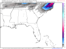
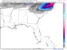
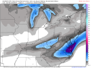
I am assuming this is the IBM GRAF model that many news stations use as their short range “futurecast”


Couple interesting things on that run. First it’s really wanting to push the cold in faster with that first wave and switches most of the NC Piedmont to frozen precip by late evening tomorrow. The other thing is this model typically has a dry bias… especially when dealing with low level Arctic airmasses… but here it’s showing quite a bit more precip than what some of the models have been showing this morning
 
We are used to boom/bust set ups around here and this one is no exception. Right now the trend is definitely towards more separation of the streams allowing a suppression of the system and sending many of us to go find ledges. We may well just be looking at a suppressed system with more of a coastal influence. Yet crazily, it would not take much for this to be a much bigger and widespread system. Last night's trends showed a bit more interaction b/w the 2 streams, specifically due to a better press by the northern stream. It would not take very much for that to actually happen. Remember, a relatively small variable change often has significant down stream effects. We don't know how this will end up, but I think there are still lots of possibilities out there, even some for the more western areas. FWIW, I think the Triangle is in a great spot to see the best potential in the Carolinas, as you already have a good setup, but also room for error. Stay tuned, we could still see a lot of waffling or trends coming down the wire; when do we not?
 
On the radio, WFMY 2 just said a chance of rain for the Triad Thursday night
Yeah, that’s from the cold front that moves out ahead of the storm. It could easily start out as rain before changing over to snow. Any precip on Friday will likely be frozen due to how cold the surface is (likely upper teens for the Triad).
 
Last edited:
We are used to boom/bust set ups around here and this one is no exception. Right now the trend is definitely towards more separation of the streams allowing a suppression of the system and sending many of us to go find ledges. We may well just be looking at a suppressed system with more of a coastal influence. Yet crazily, it would not take much for this to be a much bigger and widespread system. Last night's trends showed a bit more interaction b/w the 2 streams, specifically due to a better press by the northern stream. It would not take very much for that to actually happen. Remember, a relatively small variable change often has significant down stream effects. We don't know how this will end up, but I think there are still lots of possibilities out there, even some for the more western areas. FWIW, I think the Triangle is in a great spot to see the best potential in the Carolinas, as you already have a good setup, but also room for error. Stay tuned, we could still see a lot of waffling or trends coming down the wire; when do we not?
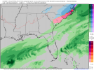
What’s odd is that models have been kinda waffling back and forth the last several days between more suppression and more amping. Like I said the other day, this just a set up where mets are gonna have to rely on “old fashioned” meteorology… paying close attention to current charts and upstream obs
 
I got to say with the initial rain and waves of moisture/clouds coming and going I feel like a possible bust will be the Ptype the NWS thinks it’s snow when it could be confined much further west. I could see sleet or mix bagged for most on here. It’s a very messy strung out system that’s gonna wreak havoc on sleet vs snow vs rain mix vs rain vs dry. I wonder if models will see clearer once the front actually crosses
 
Brad P still honking on social media. Idk, but whenever he honks, I listen because he is by far one of the most conservative Mets in the region. His latest being- "Snow could start as soon as 4-7am Friday morning but the main show is in the afternoon and the evening. I don't like to make decisions for people but everyone leaving work & school in the middle of the day at the same time has been a disaster in the past. #snOMG #cltwx"
 
Brad P still honking on social media. Idk, but whenever he honks, I listen because he is by far one of the most conservative Mets in the region. His latest being- "Snow could start as soon as 4-7am Friday morning but the main show is in the afternoon and the evening. I don't like to make decisions for people but everyone leaving work & school in the middle of the day at the same time has been a disaster in the past. #snOMG #cltwx"
Eh, I would agree but I'm guessing all of this was put out before he looked through 12z models.
 
What sucks is that a lot of us are now hoping for a SW shift in the precip. Barely any precip for the Midlands of SC and points west now. Precipitation ends very early for most areas on the Euro. Even sooner than most models. What's worse is that 850s are actually pretty good for the Midlands of SC for a lot of the "event" in the Afternoon hours and beyond,but it's very dry. Well the positive thing is that there won't that many areas if any that would suffer a significant ice storm based on todays trends.
 
Yeah things will have to begin moving further NW by 0Z tonight if it’s going to happen. There will be more precip on the NW side but the way this is trending, that may struggle to get back to Charlotte at this point.
Agreed… what’s frustrating about watching this is that I honestly don’t see anything in the looks that would stop this from shifting NW or push int further east… yet here we are for the last 12 hours seeing miss wide right
 
I would hate to be Raleigh DOT right now, rain storm before a winter storm means ouch. Same for most of eastern NC. How do you treat the roads?
 
The globals were "meh" during the last event at this time. The HRRR was on point when we got into game time. with the initial band and the ULL keeping precip going when literally every other model showed it drying up in N GA. Hope is beginning to dwindle a bit, but it's certainly far from over.
 
The globals were "meh" during the last event at this time. The HRRR was on point when we got into game time. with the initial band and the ULL keeping precip going when literally every other model showed it drying up in N GA. Hope is beginning to dwindle a bit, but it's certainly far from over.
The HRRR was too cold and wet here. Busted badly
 
Suppression trends are actually preferred at this stage, one does not want to see Roxboro getting more SN than Raleigh for the 29th time this century. Fully expecting a slight NW trend inside 48 with a bit more amplification than the 12Z suite suggested. Watch...
 
Suppression trends are actually preferred at this stage, one does not want to see Roxboro getting more SN than Raleigh for the 29th time this century. Fully expecting a slight NW trend inside 48 with a bit more amplification than the 12Z suite suggested. Watch...
This isn't going to help Upstate or the Midlands of South Carolina. There was barely any precip in South Carolina at all on the Euro. This is quickly trending towards just a cold front for people outside of the NE North Carolina and SE Virgina.
 
Carolinas under the gun losing it to mysterious suppression which shouldn't be the case and all parts of West SE are out of the game at moment. The 18z and 0z runs today are probably the last hurrah for alot of people if no large jogs westward with this system we are out of it. Now if it comes back you just have to throw your hands up with these models and ask what they heck is it with these things
 
I know most people in here hate mentions of Jan 2017, but I think it's somewhat comparable to this system as it was another late blooming snow setup like what we're likely looking at now. I do remember that the bullseye for snow was around Elizabeth City/the OBX for a little while, but then things shifted about 30 miles northwest and those areas saw mostly sleet while areas to the NW saw close to a foot. 15843926_1230813730299216_5075019528950211097_o.jpg
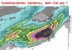
Here's what the Euro looked like 3-4 days out... so a shorter window than we had then. I doubt any NW trend will be that severe, if there is a NW trend at all. But if you're in SE Virginia or Central NC, I wouldn't give up hope just yet.
 
I know most people in here hate mentions of Jan 2017, but I think it's somewhat comparable to this system as it was another late blooming snow setup like what we're likely looking at now. I do remember that the bullseye for snow was around Elizabeth City/the OBX for a little while, but then things shifted about 30 miles northwest and those areas saw mostly sleet while areas to the NW saw close to a foot. View attachment 108347
Here's what the Euro looked like 3-4 days out... so a shorter window than we had then. I doubt any NW trend will be that severe, if there is a NW trend at all. But if you're in SE Virginia or Central NC, I wouldn't give up hope just yet.
That map is exactly the right amount imby, I got 10-12
 
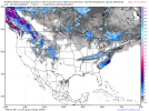
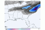
The GFS and Euro seem intent on keeping this a coastal system but the NAM starts making things interesting for ATL/North GA around hour 69. Does anyone think the mesoscale models could be picking up on something as the forecast range moves closer into their wheelhouse and we could start seeing more of the northwest trend?

ref1km_ptype.us_se.png
 
The GFS and Euro seem intent on keeping this a coastal system but the NAM starts making things interesting for ATL/North GA around hour 69. Does anyone think the mesoscle models could be picking up on something as the forecast range moves closer into their wheelhouse and we could

The GFS and Euro seem intent on keeping this a coastal system but the NAM starts making things interesting for ATL/North GA around hour 69. Does anyone think the mesoscale models could be picking up on something as the forecast range moves closer into their wheelhouse and we could start seeing more of the northwest trend?

ref1km_ptype.us_se.png
There have been 2 runs of NAM since the 0Z run you show. They look nothing like that
 
Back
Top