-
Hello, please take a minute to check out our awesome content, contributed by the wonderful members of our community. We hope you'll add your own thoughts and opinions by making a free account!
You are using an out of date browser. It may not display this or other websites correctly.
You should upgrade or use an alternative browser.
You should upgrade or use an alternative browser.
Wintry 1/20 - 1/23 Winter Storm
- Thread starter packfan98
- Start date
Iceagewhereartthou
Member
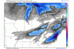
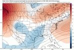
Noticeably less of a SW dig by the Northern Stream energy here on this run, thus too much separation b/w the two streams. There's a disturbance over NE Canada that looks noticeably weaker this run, not sure if that is causing less of a press on our Northern stream in this case or not, but without a better dig this will not work for the western folks.Last night 12 z Great Run

This 12z today: To pos leaning

So too much separation causes a weaker more suppressed system but actually allows more frozen precip with the arctic front but if the N/S stream digs and interacts with southern energy then you have less with the front but a much better event with the 2nd?
We are only 36-60 hrs out and models still having difficulty zoning in on how this plays out, fun
We are only 36-60 hrs out and models still having difficulty zoning in on how this plays out, fun
I trust the RGEM did well with last system .. so I’ll watch the 12z run of that .. don’t see why NAM would just go completely 180 like that other than it’s the NAM .. we’ve seen it fold on many things when it’s past 60 hours so let’s see until we get some more 12z stuff in
Downeastnc
Member
Winds gusting well into the 20-30 mph range would not go well with .50-1" of ice that would be possible in coastal SC/NC.....
brendan123
Member
3km Nam looked more suppressed with less qpf than the 12km
packfan98
Moderator
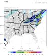
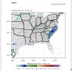
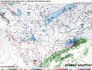
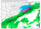
12z RGEM looks to follow the trend of less Northern Stream digging and being further east.
Snowflowxxl
Member
This thing has gone downhill in a hurry this morning it appears. RGEM will be good but def not as good as it was
Downeastnc
Member
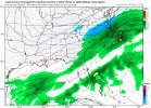
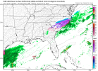
ICON

packfan98
Moderator
RGEM


iGRXY
Member
It's honestly getting less impressive even in the eastern carolinas compared to what it was showing outside of extreme NE NC and SE Virginia.
I know we have all talked about it for awhile now, but if you are not in the Carolina's then this is quickly not becoming your storm. sad face sad face. I know....I am bummed out as well.
MichaelJ
Member
Don't really think there will be movement N/W with the LP but an expansion slightly NW with the precip is possible
Then to top it off, Eric Webb says that RDU still may be sleet.
We down to hoping for some flurries! lolDon't really think there will be movement N/W with the LP but an expansion slightly NW with the precip is possible
Downeastnc
Member
RGEM


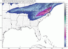
Snow map seems off though, I look to snow almost the whole time on that run ( solid 12 hrs ) and it has me at 1" of QPF and 4-5" of snow....even at 8:1 that does not work....especially over the I 95 corridor were they never have mixing issues on the soundings
Edit: actually it does give .3-5" before my column crashes with the front good but back west should have had higher totals

Avalanche
Member
Folks this is not a NC storm at the moment, it is an eastern NC storm. There are just as many unhappy NC members as anywhere else right now. We have this afternoon and evening to resolve things. Prayers for the best.
Then to top it off, Eric Webb says that RDU still may be sleet.
If the low had developed as other models have had it .. that process would drive in more cold air aloft to make snow happen for a lot
packfan98
Moderator
Looks like you get .6" of rain on the frontal passage you need to subtract.Snow map seems off though, I look to snow almost the whole time on that run ( solid 12 hrs ) and it has me at 1" of QPF and 4-5" of snow....even at 8:1 that does not work....especially over the I 95 corridor were they never have mixing issues on the soundings
Edit: actually it does give .3-5" before my column crashes with the front good but back west should have had higher totals

D
Deleted member 609
Guest
This is what was 'bothering' me yesterday with that 18z GFS run. It produced a good snow in the end...but going about more solely with the northern stream wave, and with a farther north NS wave to boot, is a risky play storm / precip wise. It does benefit the Greenville, NC area etc. temps wise, but that evolution increases risk of a weaker system overall. The 06z Euro is so much differentStill moderate differences between GFS/Euro...normally I would say Euro is probably more right but it's really sucked lately. This is just over 2 days away.
View attachment 108219
- Joined
- Jan 23, 2021
- Messages
- 4,602
- Reaction score
- 15,197
- Location
- Lebanon Township, Durham County NC
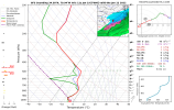
12z NAM BUFKIT numbers came in with two different waves but ended up at 5.3" total.
RGEM still doesnt get a clean handoff/connection like last nights 0z run. This is the same thing that just happened on the NAM. Only the Nam had more speration. Bottom line to max out our opportunity here, we need NS to dig down more and connect/gel with the SS energy.


Ron Burgundy
Member
Glad to see the ZR totals down to non-disaster levels!RGEM


Loganville Winter
Member
So we have the exact opposite problem that we thought we had 48 hours ago. That sounds about right.Look at the trend of that atlantic ridge on the NAM...the irony. We've been undone by the WAR so many times and now we just need a little to help out.
View attachment 108273
packfan98
Moderator
Too much banter in this thread folks.
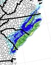
Also more sleet is being mixed in for areas closer to the coast as well on the 12Z Rgem, which is helping to prevent severe icing issues,along with less precipitation. Also the 1-2 inches of snow for the midlands of SC and getting closer to the CSRA as well. 4-6 inches of snow for Raleigh and Fayetteville. Still a hevay snowstorm for NE North Carolina and far SE Virigina. Overall,I see today trends as a net positive.Glad to see the ZR totals down to non-disaster levels!
well at 57 gfs is a little better w precip than 06z fwiw and a little colder into northern sc
Even with what we’ve seen the last few hours, it still looks to me like there should be a more expansive precip shield to the north and west. Maybe not warning criteria stuff, but maybe some advisory level. Do you think so?This is what was 'bothering' me yesterday with that 18z GFS run. It produced a good snow in the end...but going about more solely with the northern stream wave, and with a farther north NS wave to boot, is a risky play storm / precip wise. It does benefit the Greenville, NC area etc. temps wise, but that evolution increases risk of a weaker system overall. The 06z Euro is so much different
- Joined
- Jan 23, 2021
- Messages
- 4,602
- Reaction score
- 15,197
- Location
- Lebanon Township, Durham County NC
I think the highest bust potential with this whole storm comes with the anafront snow on Thursday Evening. The HRRR, which has nailed precip timing this entire winter, has snow falling as soon as 21z tomorrow.
good news with these trends is if you're in the pee dee region in sc more snow than ice now. gfs continues the east trend with the 06z and 12z suite.
Looks like 12z GFS has better upper level cold support for snow for eastern NC.

