-
Hello, please take a minute to check out our awesome content, contributed by the wonderful members of our community. We hope you'll add your own thoughts and opinions by making a free account!
You are using an out of date browser. It may not display this or other websites correctly.
You should upgrade or use an alternative browser.
You should upgrade or use an alternative browser.
Wintry 1/20 - 1/23 Winter Storm
- Thread starter packfan98
- Start date
iGRXY
Member
NBAcentel
Member
iGRXY
Member
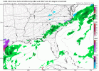
Precip shield down in TX and Mexico looks better as well at 45.
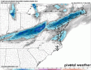
I think everyone agrees that NE NC and SE VA will probably be the jackpot zone for this storm as those areas will likely be able to take the most advantage of this storm quickly intensifying off shore. However that doesn’t mean this will not turn into a significant event with high impacts for western areas in NC as well. Everything about this set screams a much more expansive area of snow on the west and northwest side of the storm… strong FGEN forcing and great jet dynamics are all at play here. I still think we’re headed toward a set up very similar to the January 2002 stormWell, the beautiful NAM and RGEM runs from last night backed off, so that's sad. It's been very clear this is going to be an eastern nc storm, for a while now. However I'm still hoping for a few more digs of the northern stream, and a few more NW ticks to get some heavier precipitation into the western piedmont.
NBAcentel
Member
That looks all WAA driven on nam with first wave something to watch
GeorgiaGirl
Member
I’m surrounded by watches and weather statements, not sure what’s going on with that can someone chime in please. My weather is showing 33 with rain tomorrow night is that possible?
Main show is later on Friday if this area isn’t too far west.
That’s happening at a time that temperatures in CLT metro should be dropping into the upper 20s and staying well below freezing for the next 36 hours or so. Rainfall on Thursday is gonna prevent any pretreatment of the roads from having any effect, so it’s quite possible we may be dealing with a flash freeze in that time as wellThat looks all WAA driven on nam with first wave something to watch
iGRXY
Member
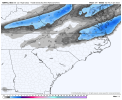
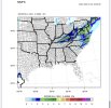
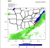
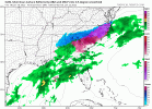
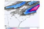
NAM looks like it's really slowing down
Really holding back no expansion of moisture at 18z FridayNAM looks like it's really slowing down
at 57 looks suppressed. further east w precip
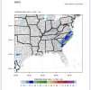
Yeah and it continues to increase totals probably not done increasing either. Regardless with very cold temps Friday morning travel looking tricky, remote learning day I guess
Gonna be a nod to the GFS? It looked good with the first wave and was very suppressed with the 2nd, NAM looking like that too now hmm
packfan98
Moderator
I'm not sure what happened with the surface reflection. Kind of hard to believe it totally fizzled with this.


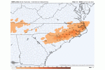
Last night 12 z Great Run

This 12z today: To pos leaning


This 12z today: To pos leaning

Here we go maybeI'm not sure what happened with the surface reflection. Kind of hard to believe it totally fizzled.

Oh good we haven’t used our 1 NAM toss token… redeeming that now .. in all seriousness though has more WAA stuff on Thursday night Friday screwed up our main system on the NAM?
Last edited:
Gonna be a nod to the GFS? It looked good with the first wave and was very suppressed with the 2nd, NAM looking like that too now hmm
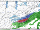
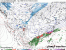
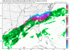
Meh...it's the 60+ hour NAM. It was awful for Sunday's event. If the RGEM shifts east like this....?
iGRXY
Member
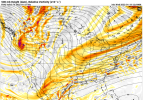
Was just about to say H5 looked way better than the surface reflection. There was more southern stream interaction that run.I'm not sure what happened with the surface reflection. Kind of hard to believe it totally fizzled with this.

Downeastnc
Member
NBAcentel
Member
iGRXY
Member
I know it has been said that the NAM has been drier in the extended only to show more precip the closer we get. Is that bias at this range I wonder?Meh...it's the 60+ hour NAM. It was awful for Sunday's event. If the RGEM shifts east like this....?
packfan98
Moderator
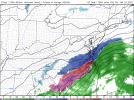
The Northern Stream really needs to dig further west and be stronger for this to work for more people. This Nam was a dud!
It was less. Look at the 2 comparisons I posted; Needs to dig down moreWas just about to say H5 looked way better than the surface reflection. There was more southern stream interaction that run.
East she blows! Srry guys, gonna stick with my first call map for now.
iGRXY
Member
Yeah when it went for consolidation it started stretching the SW instead.It was less. Look at the 2 comparisons I posted
A few of us still love this but yeah I really don't want to play around with too much suppression but we all know it will tick back NW a bit so giving us some wiggle room


Might be a make or break day for the Atlanta folks if we’re going to see any impacts more than a dusting. Not a great start with the NAM. Hopefully the RGEM holds.
Z
Zander98al
Guest
Looks like Birmingham might get NAM'd  . Hopefully a eastward trend with precip and a bit more colder temps drain in. 3km nam hinted at moisture being all the way up to the Tennessee Alabama state line.

