• Hello, please take a minute to check out our awesome content, contributed by the wonderful members of our community. We hope you'll add your own thoughts and opinions by making a free account!

Wintry 1/20 - 1/23 Winter Storm

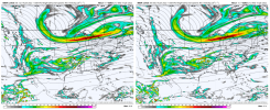
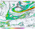
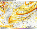
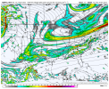
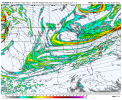
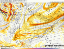
The northern stream digging more is just such a fantastic trend. I think that if you're scratching your head about this (hey, I thought a stronger, more amplified shortwave would be warmer!" it's completely understandable because that's how most of our events work. Last weeks system was a pretty good example of this- we're pretty used to amplification of our shortwaves causing more warm air advection and the system to achieve negative tilt sooner. However, the location matters- last week's amplification trend took place around arklatex- so yeah, it makes sense as that trough got stronger, the ridging ahead would also get stronger.

For this system, as the northern stream gets stronger, it's digging much further south, and generally depressing heights for the wholesale region because of how much more it is digging. I think that's why snow totals have actually ticked SE over the last cycle. Sure, as this feature gets stronger, the processes like WAA get stronger as well. The southward shift is doing a good enough job to shunt these forces southward a well. The northern stream shortwave as it turns out did detach from a much colder longwave trough, so it makes sense that as it digs southward, that chilly arctic air hangs on a little longer.

(BTW, in case anyone is wondering why an account with like 20 posts over 4 years is now writing a dissertation on phasing, I've lurked here for a while. I originally got on here to troll a friend of mind who now happens to be banned. But I still stay on because I enjoy the expert GIF makers on here and the pay graphics that get posted. I'm typically more active on American under the name "ILMRoss")
yoooo welcome aboard bud
 
Truth be told most of us go and look at both forums. We are all-weather weenies and we all enjoy expert opinions. We hobbyists THINK we know the weather.... until you have a knowledgeable and educated pro chime in. We all want to learn and get a big ass storm board wide. Thanks for coming over!
The northern stream digging more is just such a fantastic trend. I think that if you're scratching your head about this (hey, I thought a stronger, more amplified shortwave would be warmer!" it's completely understandable because that's how most of our events work. Last weeks system was a pretty good example of this- we're pretty used to amplification of our shortwaves causing more warm air advection and the system to achieve negative tilt sooner. However, the location matters- last week's amplification trend took place around arklatex- so yeah, it makes sense as that trough got stronger, the ridging ahead would also get stronger.

For this system, as the northern stream gets stronger, it's digging much further south, and generally depressing heights for the wholesale region because of how much more it is digging. I think that's why snow totals have actually ticked SE over the last cycle. Sure, as this feature gets stronger, the processes like WAA get stronger as well. The southward shift is doing a good enough job to shunt these forces southward a well. The northern stream shortwave as it turns out did detach from a much colder longwave trough, so it makes sense that as it digs southward, that chilly arctic air hangs on a little longer.

(BTW, in case anyone is wondering why an account with like 20 posts over 4 years is now writing a dissertation on phasing, I've lurked here for a while. I originally got on here to troll a friend of mind who now happens to be banned. But I still stay on because I enjoy the expert GIF makers on here and the pay graphics that get posted. I'm typically more active on American under the name "ILMRoss")
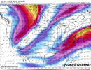
Fabulous explanation and I agree 100% with why the previous system was warmer and this one is trending colder.
 
The northern stream digging more is just such a fantastic trend. I think that if you're scratching your head about this (hey, I thought a stronger, more amplified shortwave would be warmer!" it's completely understandable because that's how most of our events work. Last weeks system was a pretty good example of this- we're pretty used to amplification of our shortwaves causing more warm air advection and the system to achieve negative tilt sooner. However, the location matters- last week's amplification trend took place around arklatex- so yeah, it makes sense as that trough got stronger, the ridging ahead would also get stronger.

For this system, as the northern stream gets stronger, it's digging much further south, and generally depressing heights for the wholesale region because of how much more it is digging. I think that's why snow totals have actually ticked SE over the last cycle. Sure, as this feature gets stronger, the processes like WAA get stronger as well. The southward shift is doing a good enough job to shunt these forces southward a well. The northern stream shortwave as it turns out did detach from a much colder longwave trough, so it makes sense that as it digs southward, that chilly arctic air hangs on a little longer.

(BTW, in case anyone is wondering why an account with like 20 posts over 4 years is now writing a dissertation on phasing, I've lurked here for a while. I originally got on here to troll a friend of mind who now happens to be banned. But I still stay on because I enjoy the expert GIF makers on here and the pay graphics that get posted. I'm typically more active on American under the name "ILMRoss")
So great having you here. I enjoy reading your posts. We've added a "Meteorologist" tag to your profile. Good luck with the storm. Looking forward to more of your great analysis!
 
What worries me about some of the ice maps coming out; is the surface cold air is cold enough for a lot of areas to be well below 32F. We can go all into latent heating and that jazz, but in this scenario, some place (maybe the interior coastal sc/nc) may see some of these totals come to fruition with the raw duration of the event.

It's easy to say the maps never happen verbatim, but occasionally they do. A lot of factors come into play. I think in Feb of 2014, areas to my South did see even more than the ZR maps were printing out because of the duration and the cold air feed from the North.
 
NBM took a hit with that 6z suite. I'm not sure what models are included with that. Hopefully, the next couple of cycles can expand that axis of snow.
snowfall_acc.us_ma.png

framexp_acc.us_ma.png
 
What worries me about some of the ice maps coming out; is the surface cold air is cold enough for a lot of areas to be well below 32F. We can go all into latent heating and that jazz, but in this scenario, some place (maybe the interior coastal sc/nc) may see some of these totals come to fruition with the raw duration of the event.

It's easy to say the maps never happen verbatim, but occasionally they do. A lot of factors come into play. I think in Feb of 2014, areas to my South did see even more than the ZR maps were printing out because of the duration and the cold air feed from the North.
yep. last storm i switched from sleet to frz rain around 29-30 degrees and i was shocked at how quickly it accrued. trees went from no glaze to covered shockingly fast.
 
Truth be told most of us go and look at both forums. We are all-weather weenies and we all enjoy expert opinions. We hobbyists THINK we know the weather.... until you have a knowledgeable and educated pro chime in. We all want to learn and get a big ass storm board wide. Thanks for coming over!
Yeah I have both tabs open usually. It's a bit disorientating to see names here that I recognize when I was refreshing american on my iphone 5 in high school during lunch. But cool to see nonetheless. My chips are all on the table here, I'm moving in two weeks to Richmond so if I don't see Raleigh doused in 8 inches of pixie dust Saturday morning I probably never will lol. I'm still absolutely terrified of sleet- to paraphrase jurassic park, sleet, uh, finds a way. A 12z suite holding its ground or even shifting more would do a lot to assuage that nagging feeling.
 
Well, the beautiful NAM and RGEM runs from last night backed off, so that's sad. It's been very clear this is going to be an eastern nc storm, for a while now. However I'm still hoping for a few more digs of the northern stream, and a few more NW ticks to get some heavier precipitation into the western piedmont.
 
I’m surrounded by watches and weather statements, not sure what’s going on with that can someone chime in please. My weather is showing 33 with rain tomorrow night is that possible?
 
That extra little dig on the northern stream helps to turn up the trough axis a bit on the East Coast. That could help slow it down and give the Low pressure more time to develop resulting in better precip on the NW edge and possible a deform band like we saw hints of on the Euro.
 
Intresting ... Light precip, but training over the same area with sub freezing temps will lead to some accumulations Aka for example January 2014. Birmingham snowmageddon. Very interested. A precip shield/train is still plausible for Alabama. View attachment 108224View attachment 108225
I recall the storm well, the Mets had said the precip shield would stay south of us in the Bham area, however there was a big weather weenie/model output consensus of a distinct possibility we would get a push into the area. We had lower 20s locked in that morning with thick cloud cover so the temp was going to stay put and all that we needed was the precip push.

Early that morning it was obvious that was exactly what was going down and yet the on air Mets still wouldn’t hardly acknowledge the possibility, much less the probability at that point, of what was unfolding until it was doing its thing really. It caught the public off guard but not the weather weenie populace here. That was an absolute mess getting folks home.

Hopefully we don’t see that again anytime soon but it makes me ill when the local Mets on air, tasked with getting the word of this type stuff out, don’t even mention the substantial possibility of potential scenarios hanging around even though they feel those are outliers. They would do the public a service to mention researching the latest trends and not relying totally on their official forecasts.
 
Last edited:
at 42 precip is further inland. no worries eastern nc folks, no real changes in temps. just better precip shield.
Lol you're right and seeing the increased precip early on is good, gonna be a long duration event. I do believe another legit NAMming is in the works
 
I’m surrounded by watches and weather statements, not sure what’s going on with that can someone chime in please. My weather is showing 33 with rain tomorrow night is that possible?

Yeah you are way south on the edge of the shallow cold dome.


Sent from my iPhone using Tapatalk
 
Back
Top