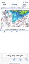
wow
Member
Yep, RGEM checked out my crude sketch it seems. Wouldn't be surprise to continue to trend and dig deeper toward S MS/AL/GA.
Short range trending with more digging of the energy which has been the trend in the short range this year. Much more expansive precip shield as well.
We should all do what @wow asks us to do.
RGEM is only cold biased at the surface and is in line with other model guidance on surface temps. RGEM and NAM are still in the same camp and depict a more robust precip shield on the NW side which is likely to take shape.In my opinion NAM didn't look nearly as good as the RGEM. Plus, we all know about its cold bias as well. We've got some work to do I think in western NC to get a warning criteria event. Hopefully models trends toward the GEFS axis where we can all get in on the fun.
Not sure what drives this. Maybe the less amped solutions coming in today.RAH has lowered winter wx chances from 70% to 60% for Raleigh and Durham.
View attachment 107922So we ride the NAM…

Wave looks faster and the N/S looks slightly further south
Kind of yes, but the RDPS has the ticket for many (not all) with phasing the 2 waves late. GFS is keeping the 2 waves separate, with the northern stream wave tracking too far north into the Ohio Valley, and the southern stream wave coming out late and weaker. RDPS is much better for manyI think the money wave is the 2nd wave. I wouldn't expect many people to get much off the initial front coming though. The winter storm that we need to be more focused on is the 2nd wave forming and the end of the gulf.


Thanks @GaWx. ATL city and south metro are right on that line as well. Lotta folks (including me) gonna be white-knuckling it given the qpf.A large portion of this snow on the 18Z NAM clown is from ZR and some from sleet based on how far north the 850 0C line is, including the far south TX stuff. This image shows about as far south as it got on the 18Z NAM:
View attachment 107938
Actually took a small step in the wrong direction for a phase

Good graphic for now for sure.
Perhaps, though I’m always nervous to predict above 10:1 ratios around our region. It hardly ever happens, even when the conditions look promising.RGEM ratios would be ridiculous with temps at the surface in the mid 20's and 850's and 925's roughly -3 to -5C
Kind of shocked it produced that much precip with the wave running so far north, but hey, that works
Kind of shocked it produced that much precip with the wave running so far north, but hey, that works
